
Kuala Sungai Baru
Kuala Sungai Baru | |
|---|---|
 | |
| Country | Malaysia |
| State | Malacca |
| District | Alor Gajah |


Kuala Sungai Baru is a mukim and town in Alor Gajah District, Malacca, Malaysia, with fishing as main economic activity. It is situated midway between Kuala Linggi and Pengkalan Balak and is approximately 15 kilometers from Masjid Tanah.[1]
Education[edit]
| Image | Name | Description |
|---|---|---|
 |
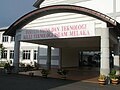
Universiti Melaka (UniMEL) | The state government's private college which focused on Islamic Science, Psychology and Technology disciplines. It was established in 1996 as Melaka International Islamic Technology College (Malay: Kolej Teknologi Islam Antarabangsa Melaka, KTIAM) under the Act of Private Higher Educational Institutions 1996, upgraded by the Ministry of Higher Education to University College of Islam Melaka (Malay: Kolej Universiti Islam Melaka, KUIM) in 2009 and upgraded again to a fully fledged University on 8 April 2021.[2] |
 |
Malaysian Maritime Academy (Malay: Akademi Laut Malaysia, MMA or ALAM) | A maritime training academy in Malaysia wholly owned by MISC Berhad with a 30 hectares campus in the town, which provides training for seagoing personnel.[3] |
Infrastructures[edit]
| Image | Name | Description |
|---|---|---|
 |
Port of Kuala Sungai Linggi | Commercially known as Linggi International Floating Transshipment & Trading HUB (LIFT-HUB), it is a transshipment area for liquid bulk transshipments and break-bulking located offshore of Linggi River in the Strait of Malacca.[4][5] |
Tourist attractions[edit]
| Image | Name | Description |
|---|---|---|
| Konet Island (Malay: Pulau Konet) | An islet located 100 metres off the shores of Telok Gong, it is connected to the mainland by a tombolo and is accessible by foot at low tide.[6] | |
 |
Kuala Linggi Mangrove Recreational Forest (Malay: Hutan Rekreasi Paya Laut Kuala Linggi) | Mangrove recreational forest at the mouth of the Linggi River, near the border between Negeri Sembilan and Malacca.[7] |
| Kuala Linggi Fort (Malay: Kota Kuala Linggi) | A fort that was built at Kampung Kuala Linggi and atop the Bukit Supai (Sepoy’s Hill). It was erected by the Dutch and Bugis soldiers as a sign of friendship after a war which took place from 1756 until 1757, strategically located in an area capable of monitoring the incoming and outgoing river traffic in the past. Besides being known as "Supai Fort", it was also known as Fort Filiphina, after the name of the Dutch Governor’s daughter at that time. According to local history, the agreement between the Dutch and Bugis soldiers took place on 1 January 1758. This agreement empowered the Dutch control over the Linggi area and the tin trading. The square shaped fort was erected from an arrangement of laterite stones. For defense, a semi circle was made at each corner of the fort where cannons were placed.[8] | |
 |
Cape Rachado Lighthouse | A lighthouse located in Tanjung Tuan, believed to be the oldest in the country, with its history allegedly dating back to Portuguese rule of Malacca during the 16th century.[9][10] |
Gallery[edit]
-
 Kim Chong grocery shop is famous within the Kuala Sungai Baru people
 -
 Boatpark
 -
 Faculty of Science and Technology is one of the university college's faculties


See also[edit]
References[edit]
- ^ SUFFIAN ABU BAKAR. "Tender Empangan Air Sungai Jernih dibuka". Utusan Online.
- ^ "University College of Islam Melaka".
- ^ "Malaysia Maritime Academy".
- ^ GAC Logistics "Linggi International Floating Transshipment HUB", 26 April 2007 Archived 12 August 2014 at the Wayback Machine
- ^ Utusan Malaysia "Kuala Linggi New Maritime HUB in Malacca Straits", 05 April 2012 Archived 13 April 2012 at the Wayback Machine
- ^ "Hanky-panky island for lovers". Archived from the original on 22 October 2019.
- ^ "Taman Eko Rimba Paya Laut Tinggi" [Paya Laut Linggi Jungle Eco Park]. Jabatan Perhutanan Semenanjung Malaysia (in Malay). Retrieved 28 May 2021.
- ^ "Kuala Linggi Fort".
- ^ Rowlett, Russ. "Lighthouses of West Malayasia East Coast". The Lighthouse Directory. University of North Carolina at Chapel Hill. Retrieved 24 May 2008.
- ^ "Rumah Api Cape Rachado". Marine Department of Malaysia. Archived from the original on 28 April 2009. Retrieved 28 May 2008.
Capital: Malacca City, Administrative capital: Ayer Keroh | |||||||||||||||
| Topics | |||||||||||||||
| Society | |||||||||||||||
| Administrative divisions |
| ||||||||||||||
2°21′N 102°02′E / 2.350°N 102.033°E
This Malacca location article is a stub. You can help Wikipedia by expanding it. |