
Lamel Hill
.jpg)
53°57′04″N 1°03′55″W / 53.951014°N 1.065226°W


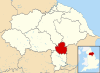

Lamel Hill is a scheduled monument about 1 mile (1.6 km) south-east of the centre of York, England.[1] It is on the grounds of The Retreat and the northern part of Walmgate Stray, and in some medieval documents it is referred to as Siward's Mill Hill, or Siward's How Mill, in reference to its previous use as the base of a windmill. However it should not be confused with another site known as Siward's Howe which is about 220 yards (200 m) further east.[2] The hill isn't visible in the picture as it lies inside the wall on the left.
Lamel Hill is best known for having been the location of a Parliamentary gun-emplacement aimed at Walmgate Bar in the City Walls during the Siege of York in 1644.[3] It was the site of York's first formal archaeological excavation in 1849, when traces of an Anglo-Saxon cemetery were found.[4] Lamel Hill is part of a conservation area which was designated in 1975.
References[edit]
- ^ Historic England. "Lamel Hill (Anglo-Saxon tumulus) (1004886)". National Heritage List for England. Retrieved 21 December 2016.
- ^ "POST-EXCAVATION ASSESSMENT: HESLINGTON HILL, HESLINGTON, SITE CODE: YHS02, NGR: SE 6235 5085, REPORT: June 2003" (PDF). FIELD ARCHAEOLOGY SPECIALISTS. Retrieved 21 December 2016.
- ^ "The Walls vs The Civil War". York Archaeological Trust. Retrieved 21 December 2016.
- ^ Thurman, John (1849). "Tumular Cemetery at Lamel Hill, York" (PDF). The Archaeological Journal. 6: 27–39, 129–136. Retrieved 21 December 2016 – via Archaeological Data Service.
External links[edit]
- Clegg, Kester. "The Retreat / Heslington Road". Low Moor Allotments Association. Archived from the original on 27 April 2003.
- "Post-Roman York: Lamel Hill cemetery". Carla Nayland Historical Fiction. 12 July 2012. Retrieved 21 December 2016.
This York location article is a stub. You can help Wikipedia by expanding it. |