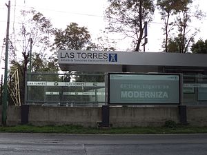
Las Torres light rail station
The topic of this article may not meet Wikipedia's general notability guideline. (March 2024) |
| STE light rail | |||||||||||
 Station | |||||||||||
| General information | |||||||||||
| Location | Calzada de Tlalpan, Cerro de las Torres y Miguel Ángel de Quevedo.
Col. Atlántida Mexico City Mexico | ||||||||||
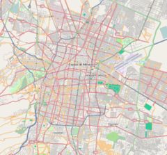
| Coordinates | 19°20′27″N 99°08′36″W / 19.340833°N 99.143433°W | ||||||||||
| Line(s) | Xochimilco Light Rail | ||||||||||
| Platforms | 1 | ||||||||||
| Tracks | 2 | ||||||||||
| Construction | |||||||||||
| Structure type | At grade | ||||||||||
| History | |||||||||||
| Opened | 1 August 1986 | ||||||||||
| Services | |||||||||||
| |||||||||||
| |||||||||||
Las Torres light rail station is one of the stations on the Xochimilco Light Rail in Mexico City. Managed by the Servicio de Transportes Eléctricos, it is located between Tasqueña and Ciudad Jardín stations.[1]
It was inaugurated on August 1, 1986.[2] It is named after the nearby Avenida de Las Torres, itself named after the high-voltage towers on that street (hence why the station's logo features a high-voltage tower). It serves the Atlántida neighborhood, located in Coyoacán.
See also[edit]
References[edit]
- ^ "Tren Ligero". Servicio de Transportes Eléctricos de la Ciudad de México (in Spanish). Retrieved 25 February 2024.
- ^ "LRT Developments in Mexico". Mass Transit magazine, June 1989, pp. 20–21. Cygnus Publishing. ISSN 0364-3484.
External links[edit]
Wikimedia Commons has media related to Las Torres (station).
- «Servicio de Transportes Eléctricos de la Ciudad de México» (in Spanish)
- «Alcaldía Coyoacán» (in Spanish)
- «CDMX - Trámites y Servicios» (in Spanish)


