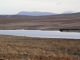
Loch Achnamoine
| Loch Achnamoine | |
|---|---|
 Loch Achnamoine, from the road on its northern shore | |
| Location | Scottish Highlands |
| Coordinates | 58°15′40″N 4°01′21″W / 58.26111°N 4.02250°W |
| Primary outflows | River Helmsdale |
| Basin countries | Scotland, United Kingdom |
| Max. length | 1.38 km (0.86 mi) |
| Max. width | 397 m (1,302 ft) |
| Surface elevation | 114.1 m (374 ft) |
Loch Achnamoine is a small mountain loch, situated on the River Helmsdale in the Highland council area of Scotland. The nearest settlement to it is Kinbrace, a small village 2.5 miles (4 km) east, along a small country road.
The name derives from the Scottish Gaelic elements "achadh" and "mòine", meaning "Lake of the Peat-field".[1]
Loch Achnamoine is a drift dam, formed from the last glacial period in Scotland.[2] The loch was the site of several biological surveys in the 1990s, identifying several species of xanthidium in its waters[3]
References[edit]
- ^ "The Gaelic origins of place names in Britain". OS GetOutside. Retrieved 9 November 2020.
- ^ Memoirs of the Geological Society of Great Britain: Explanation of Sheet. Scotland. H.M. Stationery Office. 1931.
- ^ Archiv Für Hydrobiologie: Monographische Beiträge. E. Schweizerbart. 1995.

