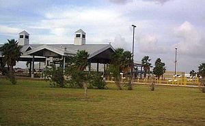
Los Indios Texas Port of Entry
| Los Indios Port of Entry | |
|---|---|
 Los Indios Border Inspection Station | |
| Location | |
| Country | United States |
| Location | 100 Free Trade Bridge, Los Indios, Texas 78567 (Free Trade International Bridge) |
| Coordinates | 26°01′14″N 97°44′22″W / 26.020421°N 97.739359°W |
| Details | |
| Opened | 1992 |
| Phone | (956) 361-0070 |
| Hours | 6:00 AM-Midnight |
| Exit Port | Lucio Blanco |
| Statistics | |
| 2005 Cars | 750,000 |
| 2005 Trucks | 42,580 |
| Pedestrians | 3,000 |
| Website https://www.cbp.gov/contact/ports/brownsvillelos-indios | |
The Los Indios Port of Entry opened in 1992 with the completion of the Free Trade International Bridge in 1992. The crossing handles both passenger vehicles and commercial trucks. Because of the length of the bridge and the rural location, there are very few pedestrians. The Bridge is owned jointly by Cameron County and the cities of Harlingen and San Benito.[1] For many years, Los Indios was the sole port of entry for transmigrantes transporting goods from the United States to Latin America.
References[edit]
- ^ "Transportation - International Bridge". Archived from the original on 12 May 2012. Retrieved 12 Feb 2013.
