
Mace, Indiana
Mace, Indiana | |
|---|---|
 Corner of Main Street and 600 East on the east side of Mace | |
 Mace Location in Montgomery County | |
| Coordinates: 40°00′32″N 86°47′52″W / 40.00889°N 86.79778°W | |
| Country | United States |
| State | Indiana |
| County | Montgomery |
| Township | Walnut |
| Area | |
| • Total | 0.23 sq mi (0.6 km2) |
| • Land | 0.23 sq mi (0.6 km2) |
| • Water | 0.0 sq mi (0 km2) |
| Elevation | 837 ft (255 m) |
| Time zone | UTC-5 (Eastern (EST)) |
| • Summer (DST) | UTC-4 (EDT) |
| ZIP code | 47933 (Crawfordsville |
| Area code | 765 |
| FIPS code | 18-45720[2] |
| GNIS feature ID | 2830469[1] |
Mace is an unincorporated community and census-designated place (CDP) in Walnut Township, Montgomery County, in the U.S. state of Indiana.[1]
History[edit]
Mace, formerly called "Fredericksburg", was laid out in about 1840 by Frederick Long.[4] A post office was established at Mace in 1853, and remained in operation until it was discontinued in 1912.[5]
Geography[edit]
Mace is located in eastern Montgomery County. It is bordered to the south by Linnsburg. U.S. Route 136 passes through the community, leading northwest 6 miles (10 km) to Crawfordsville, the county seat, and southeast 10 miles (16 km) to Jamestown. Downtown Indianapolis is 39 miles (63 km) southeast of Mace.
According to the U.S. Census Bureau, the Mace CDP has an area of 0.23 square miles (0.60 km2), all land.[3] It is drained to the north by an unnamed tributary of the Walnut Fork of Sugar Creek, which flows northwest to Sugar Creek at Crawfordsville and is part of the Wabash River watershed.
References[edit]
- ^ a b c U.S. Geological Survey Geographic Names Information System: Mace, Indiana
- ^ "U.S. Census website". United States Census Bureau. Retrieved January 31, 2008.
- ^ a b "2022 U.S. Gazetteer Files: Indiana". United States Census Bureau. Retrieved April 25, 2023.
- ^ Beckwith, Hiram Williams & Kennedy, P. S. (1881). History of Montgomery County, Together with Historic Notes on the Wabash Valley. H. H. Hill and N. Iddings. pp. 372.
- ^ "Montgomery County". Jim Forte Postal History. Retrieved June 15, 2017.
Gallery[edit]
-
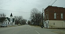 Looking east along U.S. Route 136 into Mace
 -
 Mace Cemetery


Municipalities and communities of Montgomery County, Indiana, United States | ||
|---|---|---|
| City |  | |
| Towns | ||
| Townships | ||
| CDPs | ||
| Other communities | ||
| Footnotes | ‡This populated place also has portions in an adjacent county or counties | |
This Montgomery County, Indiana location article is a stub. You can help Wikipedia by expanding it. |