McCord, Saskatchewan
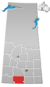
McCord is a hamlet in the Canadian province of Saskatchewan. It is situated about one mile south of Highway 18, between Ferland and Glentworth, in the south-central portion of the province.
McCord has a multi-purpose town hall, grocery store, greenhouse, a Co-Op with a small farming and hardware section, gas pumps, a town museum featuring historical and CPR Railway artifacts, small campground area,[1] two churches, and an arena that previously housed hockey, skating, rodeos, and curling.
Etymology[edit]
McCord is named after James Samuel (Jim) McCord, an early rancher who homesteaded at N36-5-8-W3.[2]
Demographics[edit]
In the 2021 Census of Population conducted by Statistics Canada, McCord had a population of 25 living in 16 of its 22 total private dwellings, a change of -16.7% from its 2016 population of 30. With a land area of 0.34 km2 (0.13 sq mi), it had a population density of 73.5/km2 (190.4/sq mi) in 2021.[3]
References[edit]
- ^ Kos, Veronica (October 2, 2018). "30 Free Places to Camp in Saskatchewan". Explore-mag. Explore-mag. Retrieved April 30, 2024.
- ^ Barry, Bill (September 2005). Geographic Names of Saskatchewan. Regina, Saskatchewan: People Places Publishing, Ltd. p. 258. ISBN 1-897010-19-2.
- ^ "Population and dwelling counts: Canada and designated places". Statistics Canada. February 9, 2022. Retrieved August 31, 2022.
49°25′42″N 106°49′50″W / 49.42833°N 106.83056°W

