
Nieuweschoot
Nieuweschoot
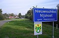
Nijskoat | |
|---|---|
Village | |
 Nieuweschoot church | |
 Flag  Coat of arms | |
 Location in the Heerenveen municipality | |
 Nieuweschoot Location in the Netherlands  Nieuweschoot Nieuweschoot (Netherlands) | |
| Coordinates: 52°56′0″N 5°55′30″E / 52.93333°N 5.92500°E | |
| Country | |
| Province | |
| Municipality | |
| Area | |
| • Total | 3.47 km2 (1.34 sq mi) |
| Elevation | 0.5 m (1.6 ft) |
| Population (2021)[1] | |
| • Total | 185 |
| • Density | 53/km2 (140/sq mi) |
| Postal code | 8445[1] |
| Dialing code | 0513 |
Nieuweschoot (West Frisian: Nijskoat) is a village in Heerenveen in the province of Friesland, the Netherlands. It had a population of around 185 in January 2017.[3]
History[edit]
The village was first mentioned in 1408 as Nye Schoten, and means corner of higher ground. Nieuw (new) has been added to distinguish between Oudeschoot.[4] The Dutch Reformed church of the village date from the 14th century. In 1840, Nieuweschoot was home to 164 people.[5]
Before 1934, Nieuweschoot was part of the Schoterland municipality.[5]
Gallery[edit]
-
 Farm Rika Zathe
 -
 View on Nieuweschoot


References[edit]
- ^ a b c "Kerncijfers wijken en buurten 2021". Central Bureau of Statistics. Retrieved 30 March 2022.
- ^ "Postcodetool for 8445PA". Actueel Hoogtebestand Nederland (in Dutch). Het Waterschapshuis. Retrieved 30 March 2022.
- ^ Kerncijfers wijken en buurten 2017 - CBS Statline
- ^ "Nieuweschoot - (geografische naam)". Etymologiebank (in Dutch). Retrieved 30 March 2022.
- ^ a b "Nieuweschoot". Plaatsengids (in Dutch). Retrieved 30 March 2022.
External links[edit]
![]() Media related to Nieuweschoot at Wikimedia Commons
Media related to Nieuweschoot at Wikimedia Commons
This Friesland location article is a stub. You can help Wikipedia by expanding it. |