
Nový Žďár
Nový Žďár | |
|---|---|
Village | |
 | |
| Coordinates: 50°11′39″N 12°12′35″E / 50.19417°N 12.20972°E | |
| Country | Czech Republic |
| Region | Karlovy Vary |
| District | Cheb |
| Municipality | Aš |
| First mentioned | 1569 |
| Area | |
| • Total | 6.65 km2 (2.57 sq mi) |
| Elevation | 628 m (2,060 ft) |
| Population (2001) | |
| • Total | 24 |
| • Density | 3.6/km2 (9.3/sq mi) |
| Time zone | UTC+1 (CET) |
| • Summer (DST) | UTC+2 (CEST) |
| Postal code | 35201 |
Nový Žďár (German: Neuenbrand) is a small border village in Karlovy Vary Region, Czech Republic; it is one of the districts of Aš. In 2001 the village had a population of 24.
Geography[edit]
Nový Žďár lies 2,5 kilometres south from Aš, about 628 meters above sea level. It neighbour with Aš to the north and with Nebesa to the east. To the west there is the German border. Most of the surrounding area is covered by forests.
History[edit]
Nový Žďár was first mentioned in 1569, as a feudatory of the Zedtwitz.
| Year | 1850 | 1930 | 1947 | 1961 | 1970 | 2001 |
|---|---|---|---|---|---|---|
| Population | 179 | 380 | 166 | 43 | 44 | 24 |
Etymology[edit]
In Czech, Nový means New. Word Žďár is from žďárovat, which means burn out the roots
Landmarks[edit]
- Historical boundary marker with coat-of-arms of the Zedtwitz (Aš-region, Bohemia) and Lindenfels (from Erkersreuth, Bavaria) from 1718-1754.
Gallery[edit]
-
 One of boundary markers. This is from 1754.
 -
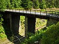 Bridge via railway.


References[edit]
- ^ Progress of population of Nový Žďár between 1850 and 2001, according to: Obce Ašska v proměnách času, Kolektiv autorů, MÚ Aš (2005)