
Eastrum
Eastrum | |
|---|---|
Village | |
 | |
 Flag  Coat of arms | |
 Location in the former Dongeradeel municipality | |
 Eastrum Location in the Netherlands  Eastrum Eastrum (Netherlands) | |
| Coordinates: 53°19′50″N 6°3′40″E / 53.33056°N 6.06111°E | |
| Country | |
| Province | |
| Municipality | Noardeast-Fryslân |
| Area | |
| • Total | 4.26 km2 (1.64 sq mi) |
| Elevation | 0.5 m (1.6 ft) |
| Population (2021)[1] | |
| • Total | 190 |
| • Density | 45/km2 (120/sq mi) |
| Postal code | 9125[1] |
| Dialing code | 0519 |
Eastrum (Dutch: Oostrum) is a village in Noardeast-Fryslân in the province of Friesland, the Netherlands. It had a population of around 188 in January 2017.[3] Before 2019, the village was part of the Dongeradeel municipality.[4]
History[edit]
The village was first mentioned in 1449 as Aesterma, and means "eastern settlement".[5] Eastrum is a terp (artificial living mound) village from the Middle Ages. The terp is 4.5 metres (15 ft) tall, but a large part has been excavated around 1900. The Dutch Reformed church dates from the 16th century, but has a 13th-century tower.[4]
Mellema State was a castle-like stins which probably dated from the 14th century. About 80% of the area around Eastrum was owned by the Mellemas. In 1735, it was demolished and reused to build Heemstra State in Oentsjerk.[6]
In 1840, Eastrum was home to 295 people.[4] In 2006, artefacts were discovered in the terp during an archaeological exploration dating from 3400 to 2850 BC.[7]
The village's official name was changed from Oostrum to Eastrum in 2023.[8][9]
Gallery[edit]
-
 Drawing of Mellema State
 -
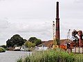 Brickworks


References[edit]
- ^ a b c "Kerncijfers wijken en buurten 2021". Central Bureau of Statistics. Retrieved 1 April 2022.
two entries
- ^ "Postcodetool for 9125EA". Actueel Hoogtebestand Nederland (in Dutch). Het Waterschapshuis. Retrieved 1 April 2022.
- ^ Aantal inwoners per woonplaats in Dongeradeel op 1 januari 2017 Archived 2017-10-21 at the Wayback Machine - Dongeradeel
- ^ a b c "Oostrum (Fryslan)". Plaatsengids (in Dutch). Retrieved 1 April 2022.
- ^ "Oostrum - (geografische naam)". Etymologiebank (in Dutch). Retrieved 1 April 2022.
- ^ "Mellema State te Oostrum". Stinsen in Friesland (in Dutch). Retrieved 1 April 2022.
- ^ "Trechterbekercultuur of enkelgrafcultuur?". RTV Noord (in Dutch). Retrieved 1 April 2022.
- ^ "22 dorpen in Noardeast-Fryslân krijgen op 1 januari 2023 een nieuwe Friese naam" [22 villages in Noardeast-Fryslân will receive a new Frisian name on 1 January 2023]. RTV NOF (in Dutch). 10 December 2022. Retrieved 7 April 2023.
- ^ "Friese namen" [Frisian names]. Taalunie (in Dutch). Retrieved 7 April 2023.
External links[edit]
![]() Media related to Oostrum (Friesland) at Wikimedia Commons
Media related to Oostrum (Friesland) at Wikimedia Commons
This Friesland location article is a stub. You can help Wikipedia by expanding it. |