Penn State Erie (Behrend), Pennsylvania
Penn State Erie (Behrend), Pennsylvania | |
|---|---|
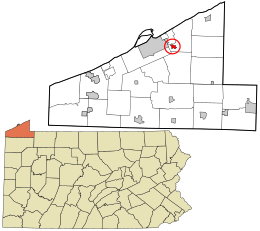
 Location in Erie County and the state of Pennsylvania | |
| Coordinates: 42°07′06″N 79°58′54″W / 42.11833°N 79.98167°W | |
| Country | United States |
| State | Pennsylvania |
| County | Erie |
| Township | Harborcreek |
| Area | |
| • Total | 0.78 sq mi (2.03 km2) |
| • Land | 0.78 sq mi (2.03 km2) |
| • Water | 0.00 sq mi (0.00 km2) |
| Elevation | 1,070 ft (330 m) |
| Population | |
| • Total | 1,486 |
| • Density | 1,900.26/sq mi (733.25/km2) |
| Time zone | UTC-5 (Eastern (EST)) |
| • Summer (DST) | UTC-4 (EDT) |
| ZIP code | 16510[3] |
| Area code | 814 |
| FIPS code | 42-59212 |
| GNIS feature ID | 2633746 |
Penn State Erie (Behrend) is a census-designated place[4] located in Harborcreek Township, Erie County in the U.S. state of Pennsylvania. It is located around the campus of Penn State Erie and near the city of Erie. As of the 2010 census the population was 1,629.[5]
Demographics[edit]
As of the 2020 census, there were 1,486 people and 14 housing units. The median age was 19.6 years old. 100% of the residents were in college. The racial demographics of the CDP were 80.6% White, 12.7% African American, 0.4% Asian, 0.8% of people from some other race, and 5.3% from two or more races. Hispanic and/or Latino Americans made up 6% of the population.[6]
The ancestry of the population was 13.3% German, 10.6% Italian, 7.4% Irish, 5.4% Polish, 5.2% Sub-sarahan African, 3.4% Swedish, and 2.1% English.[7] 12.6% of the population spoke a language other than English at home, including Asian and Pacific Islander languages at 6.4%, Other Indo-European languages at 3.0%, and other languages at 2.6%. 9.1% of the population was not born in the United States.[6]
| Census | Pop. | Note | %± |
|---|---|---|---|
| 2020 | 1,486 | — | |
| U.S. Decennial Census[8] | |||
References[edit]
- ^ "ArcGIS REST Services Directory". United States Census Bureau. Retrieved October 16, 2022.
- ^ "Census Population API". United States Census Bureau. Retrieved Oct 16, 2022.
- ^ "Penn State Erie (Behrend) PA ZIP Code". zipdatamaps.com. 2023. Retrieved May 13, 2023.
- ^ "By Decade".
- ^ "Geographic Identifiers: 2010 Census Summary File 1 (G001): Penn State Erie (Behrend) CDP, Pennsylvania". American Factfinder. U.S. Census Bureau. Archived from the original on February 13, 2020. Retrieved March 22, 2016.
- ^ a b "Explore Census Data". data.census.gov. Retrieved 2024-04-29.
- ^ "Explore Census Data". data.census.gov. Retrieved 2024-04-29.
- ^ "Census of Population and Housing". Census.gov. Retrieved June 4, 2016.
External links[edit]

