
Piletas
Piletas
Piletas Arce | |
|---|---|
Barrio | |
 Mountain view from PR-129 in Piletas, Lares | |
 Location of Piletas barrio within the municipality of Lares shown in red | |
 Piletas | |
| Coordinates: 18°20′05″N 66°52′56″W / 18.334839°N 66.882275°W[1] | |
| Commonwealth | |
| Municipality | |
| Area | |
| • Total | 7.76 sq mi (20.1 km2) |
| • Land | 7.76 sq mi (20.1 km2) |
| • Water | 0 sq mi (0 km2) |
| Elevation | 1,148 ft (350 m) |
| Population (2010) | |
| • Total | 5,671 |
| • Density | 730.8/sq mi (282.2/km2) |
| Source: 2010 Census | |
| Time zone | UTC−4 (AST) |
Piletas is a barrio in the municipality of Lares, Puerto Rico. Its population in 2010 was 5,671.[3][4][5]
History[edit]
Piletas was in Spain's gazetteers[6] until Puerto Rico was ceded by Spain in the aftermath of the Spanish–American War under the terms of the Treaty of Paris of 1898 and became an unincorporated territory of the United States. In 1899, the United States Department of War conducted a census of Puerto Rico finding that the population of Piletas barrio was 2,455.[7]
| Census | Pop. | Note | %± |
|---|---|---|---|
| 1900 | 2,455 | — | |
| 1910 | 2,529 | 3.0% | |
| 1920 | 3,193 | 26.3% | |
| 1930 | 3,131 | −1.9% | |
| 1940 | 4,416 | 41.0% | |
| 1950 | 4,659 | 5.5% | |
| 1960 | 4,090 | −12.2% | |
| 1970 | 3,808 | −6.9% | |
| 1980 | 3,917 | 2.9% | |
| 1990 | 4,526 | 15.5% | |
| 2000 | 5,656 | 25.0% | |
| 2010 | 5,671 | 0.3% | |
| U.S. Decennial Census 1899 (shown as 1900)[8] 1910-1930[9] 1930-1950[10] 1980-2000[11] 2010[12] | |||
Places[edit]
In 2017, as Puerto Rico and Lares continued to struggle economically, community leaders decided that unused public schools, including one in Piletas Arce (on Puerto Rico Highway 129), would be used by the agricultural industry of Lares. The school became a community center for local farmers.[13]
La Piramide de Piletas Restaurant, located in Sector Las Lajas, was featured by the Puerto Rico Department of Tourism Discover Puerto Rico campaign.[14]
Sectors[edit]
Barrios (which are, in contemporary times, roughly comparable to minor civil divisions)[15] and subbarrios,[16] in turn, are further subdivided into smaller local populated place areas/units called sectores (sectors in English). The types of sectores may vary, from normally sector to urbanización to reparto to barriada to residencial, among others.[17][18][19]
The following sectors are in Piletas barrio:[20]
Lito Ramos, Palo Pana, Sector Aquino, Sector Arroyo, Sector Bayón, Sector Borges, Sector Cabán, Sector Castro, Sector Catalino Rodríguez, Sector Club Rotario, Sector Coquí, Sector Escuela 1, Sector Juan Sosa, Sector La Pista, Sector Las Casetas, Sector Los López Segarra, Sector Núñez, Sector Olavarría, Sector Pedro Molina, Sector Ramón Román, Sector Reyes Lugo, Sector Segunda Unidad, Sector Soller, and Tramo Carretera 453.
Gallery[edit]
-
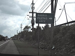 Sign for entrance to Piletas Arce
 -
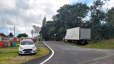
 Puerto Rico Highway 453 in Piletas
 -
 Puerto Rico Highway 4453 in Piletas


See also[edit]
References[edit]
- ^ a b "US Gazetteer 2019". US Census. US Government.
- ^ U.S. Geological Survey Geographic Names Information System: Piletas barrio
- ^ Picó, Rafael; Buitrago de Santiago, Zayda; Berrios, Hector H. Nueva geografía de Puerto Rico: física, económica, y social, por Rafael Picó. Con la colaboración de Zayda Buitrago de Santiago y Héctor H. Berrios. San Juan Editorial Universitaria, Universidad de Puerto Rico,1969.
- ^ Gwillim Law (20 May 2015). Administrative Subdivisions of Countries: A Comprehensive World Reference, 1900 through 1998. McFarland. p. 300. ISBN 978-1-4766-0447-3. Retrieved 25 December 2018.
- ^ Puerto Rico: 2010 Population and Housing Unit Counts.pdf (PDF). U.S. Dept. of Commerce, Economics and Statistics Administration, U.S. Census Bureau. 2010.
- ^ "Anuario del comercio, de la industria, de la magistratura y de la administración. 1881". Biblioteca Nacional de España (in Spanish). p. 1614. Retrieved 4 April 2023.
- ^ Joseph Prentiss Sanger; Henry Gannett; Walter Francis Willcox (1900). Informe sobre el censo de Puerto Rico, 1899, United States. War Dept. Porto Rico Census Office (in Spanish). Imprenta del gobierno. p. 160.
- ^ "Report of the Census of Porto Rico 1899". War Department Office Director Census of Porto Rico. Archived from the original on July 16, 2017. Retrieved September 21, 2017.
- ^ "Table 3-Population of Municipalities: 1930 1920 and 1910" (PDF). United States Census Bureau. Archived (PDF) from the original on August 17, 2017. Retrieved September 21, 2017.
- ^ "Table 4-Area and Population of Municipalities Urban and Rural: 1930 to 1950" (PDF). United States Census Bureau. Archived (PDF) from the original on August 30, 2015. Retrieved September 21, 2014.
- ^ "Table 2 Population and Housing Units: 1960 to 2000" (PDF). United States Census Bureau. Archived (PDF) from the original on July 24, 2017. Retrieved September 21, 2017.
- ^ Puerto Rico: 2010 Population and Housing Unit Counts.pdf (PDF). U.S. Dept. of Commerce Economics and Statistics Administration U.S. Census Bureau. 2010. Archived (PDF) from the original on 2017-02-20. Retrieved 2019-08-02.
- ^ "DTOP traspasa escuelas en desuso al municipio de Lares". Metro (in Spanish). Retrieved 11 June 2019.
- ^ "La Piramide de Piedra". Discover Puerto Rico. Retrieved 23 June 2020.
- ^ "US Census Barrio-Pueblo definition". factfinder.com. US Census. Archived from the original on 13 May 2017. Retrieved 5 January 2019.
- ^ "P.L. 94-171 VTD/SLD Reference Map (2010 Census): Lares Municipio, PR" (PDF). www2.census.gov. U.S. DEPARTMENT OF COMMERCE Economics and Statistics Administration U.S. Census Bureau. Archived (PDF) from the original on 22 August 2020. Retrieved 22 August 2020.
- ^ "Agencia: Oficina del Coordinador General para el Financiamiento Socioeconómico y la Autogestión (Proposed 2016 Budget)". Puerto Rico Budgets (in Spanish). Retrieved 28 June 2019.
- ^ Rivera Quintero, Marcia (2014), El vuelo de la esperanza: Proyecto de las Comunidades Especiales Puerto Rico, 1997-2004 (first ed.), San Juan, Puerto Rico Fundación Sila M. Calderón, ISBN 978-0-9820806-1-0
- ^ "Leyes del 2001". Lex Juris Puerto Rico (in Spanish). Retrieved 24 June 2020.
- ^ "PRECINTO ELECTORAL LARES 053" (PDF). Comisión Estatal de Elecciones (in Spanish). PR Government. 14 June 2019. Retrieved 19 June 2019.