
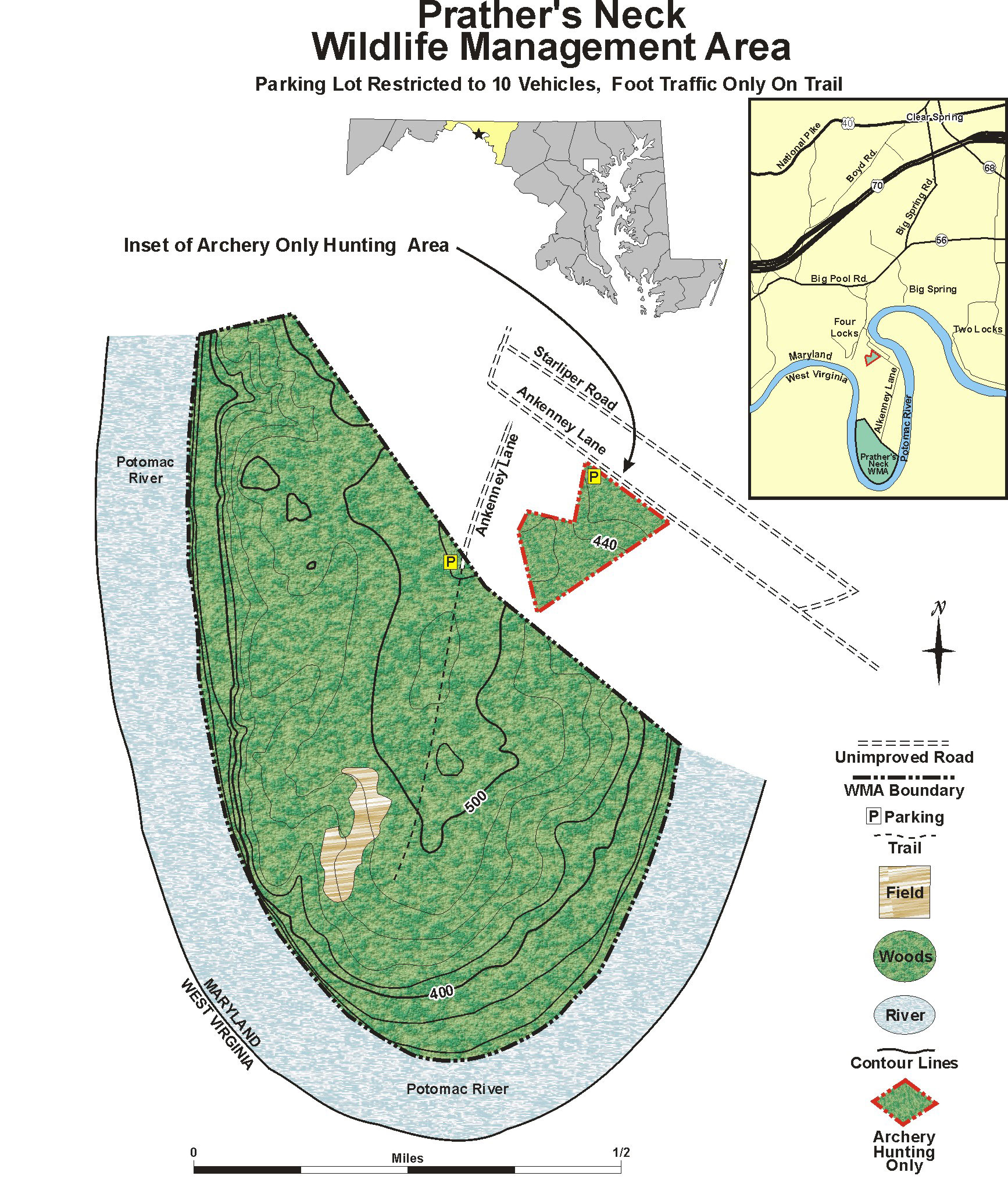
Prather's Neck Wildlife Management Area
| Powell Marsh Wildlife Area | |
|---|---|
IUCN category V (protected landscape/seascape)[1] | |
 Oblique view looking north of Prather's Neck Wildlife Management Area | |
 Location within Maryland  Location within United States | |
| Location | Washington County, Maryland |
| Nearest city | Hagerstown, MD |
| Coordinates | 39°35′43″N 77°56′34″W / 39.59517181554317°N 77.94281619908536°W |
| Area | 215 acres (87 ha) |
| Established | 2007 |
| Governing body | Maryland Department of Natural Resources |
Prather's Neck Wildlife Management Area is a Wildlife Management Area in Washington County, Maryland. The majority of it lies on the southern tip of Prather's Neck, a peninsula of land formed by a meander of the Potomac River. A small portion reserved for archery hunting lies north of the main area.[2] The Prather's Neck Trail allows access to the area.[3]
References[edit]
- ^ Protected Area Profile for Prathers Neck Heritage Conservation Archived April 10, 2024, at the Wayback Machine from the World Database on Protected Areas. Retrieved April 10, 2024.
- ^ "Prather's Neck Map". Maryland Department of Natural Resources. Archived from the original on 10 April 2024. Retrieved 10 April 2024.
- ^ "Prather's Neck Trail". AllTrails. Archived from the original on 10 April 2024. Retrieved 9 April 2024.
External links[edit]