
Puerto Rico Highway 568
Highway 568 | ||||
|---|---|---|---|---|
| Ruta 568 | ||||
| Route information | ||||
| Maintained by Puerto Rico DTPW | ||||
| Length | 30.1 km[1] (18.7 mi) | |||
| Existed | 1953[2]–present | |||
| Major junctions | ||||
| South end | ||||
| North end | ||||
| Location | ||||
| Country | United States | |||
| Territory | Puerto Rico | |||
| Municipalities | Orocovis, Corozal | |||
| Highway system | ||||
| ||||
| ||||

Puerto Rico Highway 568 (PR-568) is a road that travels from the municipality of Orocovis to Corozal in Puerto Rico. With a length of 30.1 km (18.7 mi), it begins at its intersection with PR-5155 in downtown Orocovis and ends at PR-159 in western Corozal.[3]
Route description[edit]
This highway consists of one lane per direction for its entire length due to its rural characteristics. In Orocovis, it begins at PR-5155 in the municipal center and continues to the north, passing through Orocovis, Botijas and Mata de Cañas barrios before entering Corozal.[4] In Corozal, PR-568 continues to the north on its way through Magueyes, Palmarito, Negros, Cuchillas and Padilla barrios until its end at PR-159 on the Padilla–Cibuco line.[5]
- Puerto Rico Highway 568 by municipality
-
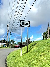
 Northbound sign in Orocovis
 -
 Curvy stretch in Orocovis
 -
 Heading north in Padilla, Corozal
.jpg)

.jpg)
Rivers crossed[edit]
Puerto Rico Highway 568 crosses the following rivers:
- Quebrada Grande (Salto Grande) in Corozal[6]
- Quebrada Riachuelo in Corozal[7]
- Río Botijas in Orocovis[8]
- Río Grande de Manatí in Corozal[9]
History[edit]
The entire length of PR-568 is part of the old Road No. 10, a highway that led from Dorado to Coamo through Toa Alta, Corozal and Orocovis until the 1953 Puerto Rico highway renumbering, a process implemented by the Puerto Rico Department of Transportation and Public Works (Spanish: Departamento de Transportación y Obras Públicas) that increased the insular highway network to connect existing routes with different locations around Puerto Rico. Route 10 extended from PR-165 (old Road No. 2) near Toa Alta to PR-14 (former Road No. 1) in downtown Coamo.[10] Its original way currently corresponds to PR-165, from PR-8865 in Dorado to PR-159 in Toa Alta;[11] PR-159, from PR-165 in Toa Alta to PR-568 in Corozal, except in downtown area, where PR-891 replaces PR-159;[2] PR-568, from PR-159 in Corozal to PR-5155 in Orocovis;[12] PR-5155, from PR-568 north of downtown to PR-155 south of downtown, and PR-155, from PR-5155 in Orocovis to PR-14 in Coamo.[13]
Major intersections[edit]
-
 PR-568 north approaching PR-772 intersection in Botijas, Orocovis
 -
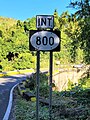 PR-568 south near PR-800 intersection in Palmarito, Corozal
 -
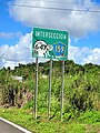
 PR-801 west near PR-568 junction in Palmarito, Corozal
 -
 PR-568 south at the southern terminus of PR-5568 in Padilla, Corozal


| Municipality | Location | km[1] | mi | Destinations | Notes | |||
|---|---|---|---|---|---|---|---|---|
| Orocovis | Orocovis–Orocovis barrio-pueblo line | 0.0 | 0.0 | Southern terminus of PR-568 | ||||
| Orocovis | 0.8 | 0.50 | ||||||
| Botijas | 4.8 | 3.0 | ||||||
| Corozal |
No major junctions | |||||||
| Orocovis |
No major junctions | |||||||
| Corozal | Palmarito | 15.2 | 9.4 | |||||
| 15.2– 15.3 | 9.4– 9.5 | Puente del Riachuelo over the Quebrada Riachuelo[14] | ||||||
| 15.8 | 9.8 | |||||||
| Negros | 22.2 | 13.8 | ||||||
| Padilla | 25.0 | 15.5 | ||||||
| 28.6– 28.7 | 17.8– 17.8 | |||||||
| Padilla–Cibuco line | 30.1 | 18.7 | Northern terminus of PR-568 | |||||
| 1.000 mi = 1.609 km; 1.000 km = 0.621 mi | ||||||||
Related route[edit]
Highway 5568 | |
|---|---|
| Location | Corozal |
| Length | 4.4 km[15] (2.7 mi) |
Puerto Rico Highway 5568 (PR-5568) is a spur route located in Padilla, a barrio of the municipality of Corozal.[3] With a length of 4.4 km (2.7 mi), it begins at PR-568 and ends at its junction with PR-159 and PR-647 near Unibón and Cienegueta barrios. PR-5568 is a rural road with one lane in each direction along its entire length and serves as access to several neighborhood in western Padilla.[16] The entire route is located in Corozal.
-
 Sign for PR-5568 in Padilla, Corozal, heading north
 -
 PR-5568 north approaching PR-159 and PR-647 junction in Padilla, Corozal
 -
 PR-647 south approaching PR-159 and PR-5568 junction in Cienegueta, Vega Alta


| Location | km[15] | mi | Destinations | Notes | |
|---|---|---|---|---|---|
| Padilla | 0.0 | 0.0 | Southern terminus of PR-5568 | ||
| Padilla–Cibuco line | 4.4 | 2.7 | Northern terminus of PR-5568 | ||
| 1.000 mi = 1.609 km; 1.000 km = 0.621 mi | |||||
See also[edit]
References[edit]
- ^ a b Google (29 February 2020). "PR-568" (Map). Google Maps. Google. Retrieved 29 February 2020.
- ^ a b "Corozal, Memoria Núm. 61" (PDF). Puerto Rico Planning Board (in Spanish). 1955. Retrieved 22 February 2020.
- ^ a b National Geographic Maps (2011). Puerto Rico (Map). 1:125,000. Adventure Map (Book 3107). Evergreen, Colorado: National Geographic Maps. ISBN 978-1566955188. OCLC 756511572.
- ^ "PR-568, Orocovis, Puerto Rico". pr.geoview.info. Retrieved 12 August 2019.
- ^ "PR-568, Corozal, Puerto Rico". pr.geoview.info. Retrieved 12 August 2019.
- ^ Press, Detroit Free. "PR 568 over GRANDE CREEK Corozal Municipio, Puerto Rico Bridge Inspection Report". Detroit Free Press. Retrieved 9 August 2023.
- ^ Press, Detroit Free. "PR 568 over RIACHUELO RIVER Corozal Municipio, Puerto Rico Bridge Inspection Report". Detroit Free Press. Retrieved 9 August 2023.
- ^ Press, Detroit Free. "PR 568 over BOTIJAS RIVER Orocovis Municipio, Puerto Rico Bridge Inspection Report". Detroit Free Press. Retrieved 9 August 2023.
- ^ Press, Detroit Free. "PR 568 over GRANDE DE MANATI RIVER Corozal Municipio, Puerto Rico Bridge Inspection Report". Detroit Free Press. Retrieved 9 August 2023.
- ^ "Revista de Obras Públicas de Puerto Rico, Febrero 1929". Colección Puertorriqueña UPR RP (in Spanish). 1929. pp. 22–23. Retrieved 9 August 2023.
- ^ "Toa Alta, Memoria Núm. 57" (PDF). Puerto Rico Planning Board (in Spanish). 1955. Retrieved 9 August 2023.
- ^ "Orocovis, Memoria Núm. 47" (PDF). Puerto Rico Planning Board (in Spanish). 1955. Retrieved 9 August 2023.
- ^ "Coamo, Memoria Núm. 33" (PDF). Puerto Rico Planning Board (in Spanish). 1953. Retrieved 9 August 2023.
- ^ Luis F. Pumarada O’Neill (1991). "Los Puentes Históricos de Puerto Rico" (PDF) (in Spanish). p. 68. Retrieved 10 March 2020.
- ^ a b Google (29 February 2020). "PR-5568" (Map). Google Maps. Google. Retrieved 29 February 2020.
- ^ "PR-5568, Corozal, Puerto Rico". pr.geoview.info. Retrieved 12 August 2019.
External links[edit]
 Media related to Puerto Rico Highway 568 and Puerto Rico Highway 5568 at Wikimedia Commons
- Historia de las carreteras de Puerto Rico (in Spanish)