
Puerto Rico Highway 955
Highway 955 | ||||
|---|---|---|---|---|
| Ruta 955 | ||||
| Route information | ||||
| Maintained by Puerto Rico DTPW | ||||
| Length | 6.1 km[1][2] (3.8 mi) | |||
| Major junctions | ||||
| West end | ||||
| East end | ||||
| Location | ||||
| Country | United States | |||
| Territory | Puerto Rico | |||
| Municipalities | Río Grande | |||
| Highway system | ||||
| ||||

Puerto Rico Highway 955 (PR-955) is an east–west road located entirely in the municipality of Río Grande, Puerto Rico. With a length of 6.1 kilometers (3.8 mi),[1][2] it begins at its intersection with PR-3 in Jiménez barrio, staying parallel to PR-3 through Zarzal barrio until its end at its junction with PR-3 and PR-968 in Mameyes II barrio.[3]
Major intersections[edit]
The entire route is located in Río Grande.
-
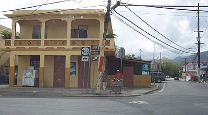 PR-191 south at PR-955 junction in Mameyes II barrio
 -
 PR-191 north at PR-955 junction


| Location | km[1][2] | mi | Destinations | Notes | |
|---|---|---|---|---|---|
| Jiménez | 0.0 | 0.0 | Western terminus of PR-955; no access to eastbound | ||
| 0.6 | 0.37 | ||||
| 0.9 27.0[a] | 0.56 16.8 | Western terminus of PR-3 concurrency; no access to eastbound | |||
| 27.2[a] 1.0 | 16.9 0.62 | Eastern terminus of PR-3 concurrency | |||
| Zarzal | 2.8 | 1.7 | |||
| 3.6– 3.7 | 2.2– 2.3 | ||||
| 4.0 | 2.5 | ||||
| 4.7 | 2.9 | ||||
| Mameyes II | 5.7– 5.8 | 3.5– 3.6 | No access to northbound | ||
| 6.1 | 3.8 | Eastern terminus of PR-955 | |||
1.000 mi = 1.609 km; 1.000 km = 0.621 mi
| |||||
See also[edit]
References[edit]
- ^ a b c Google (14 August 2020). "PR-955 west" (Map). Google Maps. Google. Retrieved 14 August 2020.
- ^ a b c Google (14 August 2020). "PR-955 east" (Map). Google Maps. Google. Retrieved 14 August 2020.
- ^ "PR-955, Río Grande, Puerto Rico". Retrieved 14 August 2020.
External links[edit]
 Media related to Puerto Rico Highway 955 at Wikimedia Commons
This Puerto Rico road-related article is a stub. You can help Wikipedia by expanding it. |