
Red Cross, North Carolina
Red Cross, North Carolina | |
|---|---|
| Coordinates: 35°15′59″N 80°21′44″W / 35.26639°N 80.36222°W | |
| Country | United States |
| State | North Carolina |
| County | Stanly |
| Area | |
| • Total | 3.73 sq mi (9.67 km2) |
| • Land | 3.73 sq mi (9.67 km2) |
| • Water | 0.00 sq mi (0.00 km2) |
| Elevation | 659 ft (201 m) |
| Population (2020) | |
| • Total | 762 |
| • Density | 204.18/sq mi (78.82/km2) |
| Time zone | UTC-5 (Eastern (EST)) |
| • Summer (DST) | UTC-4 (EDT) |
| ZIP code | N/A |
| Area code | 704 |
| FIPS code | 37-55460 |
| GNIS feature ID | 2407184[2] |
| Website | redcross-nc.com |
Red Cross is a town in Stanly County, North Carolina, United States. The population was 742 as of the 2010 census.
History[edit]
With growth resulting from the expansion of suburban communities around Charlotte, Red Cross incorporated on August 1, 2002. The people wanted to keep their area agricultural and rural to the extent that it was possible.[3]
Demographics[edit]
| Census | Pop. | Note | %± |
|---|---|---|---|
| 2010 | 742 | — | |
| 2020 | 762 | 2.7% | |
| U.S. Decennial Census[4] | |||
2020 census[edit]
| Race | Number | Percentage |
|---|---|---|
| White (non-Hispanic) | 697 | 91.47% |
| Black or African American (non-Hispanic) | 4 | 0.52% |
| Native American | 2 | 0.26% |
| Other/Mixed | 22 | 2.89% |
| Hispanic or Latino | 37 | 4.86% |
As of the 2020 United States census, there were 762 people, 323 households, and 177 families residing in the town.
References[edit]
- ^ "ArcGIS REST Services Directory". United States Census Bureau. Retrieved September 20, 2022.
- ^ U.S. Geological Survey Geographic Names Information System: Red Cross, North Carolina
- ^ "Domain parked by OnlyDomains". redcross-nc.com. Retrieved November 25, 2008.
- ^ "Census of Population and Housing". Census.gov. Retrieved June 4, 2015.
- ^ "Explore Census Data". data.census.gov. Retrieved December 21, 2021.
External links[edit]
Municipalities and communities of Stanly County, North Carolina, United States | ||
|---|---|---|
| Cities | 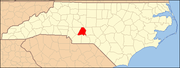 | |
| Towns | ||
| CDPs | ||
| Unincorporated communities | ||
| Footnotes | ‡This populated place also has portions in an adjacent county or counties | |