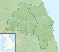
River Don, Tyne and Wear
This article relies largely or entirely on a single source. (May 2017) |
| River Don | |
|---|---|
 Don near Boldon Colliery | |
| Location | |
| Country | England |
| County | Tyne and Wear |
| Physical characteristics | |
| Source | |
| • location | Springwell |
| Mouth | |
• location | River Tyne at Jarrow |
• coordinates | 54°59′10″N 1°28′20″W / 54.986114°N 1.472084°W |
| Length | 15.4 km (9.6 mi) |
| Basin size | 42.7 km2 (16.5 sq mi) |
The River Don is a 15.4 kilometres (9.6 mi) long tributary of the River Tyne in Tyne and Wear, North East England.[1]
It rises near Springwell and flows east for about 6 km, then turns north. It flows under the Jarrow Bridge and meets the river Tyne at Jarrow. For much of its length in the upper section, it is the boundary between Gateshead and Sunderland.
See also[edit]
References[edit]
Wikimedia Commons has media related to River Don, Tyne and Wear.

