
Sapphire Ridge, Montana
Sapphire Ridge, Montana | |
|---|---|
 Sapphire Ridge  Sapphire Ridge | |
| Coordinates: 46°53′12″N 110°15′9″W / 46.88667°N 110.25250°W | |
| Country | United States |
| State | Montana |
| County | Judith Basin |
| Area | |
| • Total | 0.54 sq mi (1.40 km2) |
| • Land | 0.54 sq mi (1.40 km2) |
| • Water | 0.00 sq mi (0.00 km2) |
| Elevation | 4,894 ft (1,492 m) |
| Population (2020) | |
| • Total | 26 |
| • Density | 48.15/sq mi (18.58/km2) |
| Time zone | UTC-7 (Mountain (MST)) |
| • Summer (DST) | UTC-6 (MDT) |
| ZIP Code | 59452 (Hobson) |
| Area code | 406 |
| FIPS code | 30-66317 |
| GNIS feature ID | 2806632[2] |
Sapphire Ridge is a census-designated place (CDP) in Judith Basin County, Montana, United States. The community is more commonly known as Sapphire Village.[3][4] It is in the southern part of the county, on the west side of the valley of the Judith River, a northeast-flowing tributary of the Missouri River.
Pigeye Road is the main route out of the community, leading northeast 10 miles (16 km) down the Judith River valley to Utica. To the southwest the road leads into the Little Belt Mountains and Lewis and Clark National Forest.
Sapphire Ridge was first listed as a CDP prior to the 2020 census.[2]
Demographics[edit]
| Census | Pop. | Note | %± |
|---|---|---|---|
| 2020 | 26 | — | |
| U.S. Decennial Census[5] | |||
Climate[edit]
Lewistown 42 WSW is a weather station located near Sapphire Village.[6] Lewistown 42 WSW has a humid continental climate (Köppen Dfb), bordering on a subalpine climate (Köppen Dfc).
| Climate data for Lewistown 42 WSW, Montana, 1991–2020 normals, 2008-2023 extremes: 5070ft (1545m) | |||||||||||||
|---|---|---|---|---|---|---|---|---|---|---|---|---|---|
| Month | Jan | Feb | Mar | Apr | May | Jun | Jul | Aug | Sep | Oct | Nov | Dec | Year |
| Record high °F (°C) | 67 (19) |
65 (18) |
70 (21) |
80 (27) |
82 (28) |
95 (35) |
95 (35) |
96 (36) |
96 (36) |
85 (29) |
71 (22) |
64 (18) |
96 (36) |
| Mean maximum °F (°C) | 54.0 (12.2) |
52.6 (11.4) |
61.2 (16.2) |
71.1 (21.7) |
76.4 (24.7) |
85.0 (29.4) |
89.8 (32.1) |
91.1 (32.8) |
86.9 (30.5) |
75.3 (24.1) |
63.5 (17.5) |
53.6 (12.0) |
92.2 (33.4) |
| Mean daily maximum °F (°C) | 36.5 (2.5) |
35.8 (2.1) |
43.5 (6.4) |
49.8 (9.9) |
59.5 (15.3) |
67.4 (19.7) |
77.5 (25.3) |
77.3 (25.2) |
68.5 (20.3) |
53.3 (11.8) |
42.1 (5.6) |
34.7 (1.5) |
53.8 (12.1) |
| Daily mean °F (°C) | 24.9 (−3.9) |
24.0 (−4.4) |
31.5 (−0.3) |
37.3 (2.9) |
46.3 (7.9) |
53.7 (12.1) |
60.9 (16.1) |
60.6 (15.9) |
52.2 (11.2) |
40.6 (4.8) |
31.2 (−0.4) |
24.0 (−4.4) |
40.6 (4.8) |
| Mean daily minimum °F (°C) | 13.3 (−10.4) |
12.1 (−11.1) |
19.6 (−6.9) |
24.7 (−4.1) |
33.0 (0.6) |
40.0 (4.4) |
44.3 (6.8) |
43.8 (6.6) |
36.0 (2.2) |
27.8 (−2.3) |
20.4 (−6.4) |
13.3 (−10.4) |
27.4 (−2.6) |
| Mean minimum °F (°C) | −18.7 (−28.2) |
−19.3 (−28.5) |
−7.3 (−21.8) |
6.8 (−14.0) |
18.5 (−7.5) |
29.5 (−1.4) |
34.6 (1.4) |
31.9 (−0.1) |
22.9 (−5.1) |
5.8 (−14.6) |
−5.9 (−21.1) |
−18.0 (−27.8) |
−28.8 (−33.8) |
| Record low °F (°C) | −32 (−36) |
−39 (−39) |
−39 (−39) |
−9 (−23) |
10 (−12) |
24 (−4) |
30 (−1) |
23 (−5) |
8 (−13) |
−15 (−26) |
−21 (−29) |
−41 (−41) |
−41 (−41) |
| Average precipitation inches (mm) | 0.61 (15) |
0.82 (21) |
0.86 (22) |
1.60 (41) |
2.83 (72) |
3.07 (78) |
1.70 (43) |
1.40 (36) |
1.34 (34) |
1.33 (34) |
0.65 (17) |
0.55 (14) |
16.76 (427) |
| Average precipitation days (≥ 0.01 in) | 8.5 | 10.3 | 9.5 | 13.3 | 15.2 | 12.3 | 9.4 | 9.0 | 7.1 | 8.8 | 7.7 | 9.3 | 120.4 |
| Source 1: NOAA[7] | |||||||||||||
| Source 2: XMACIS2 (temp records & 2008-2023 monthly max/mins)[8] | |||||||||||||
References[edit]
- ^ "ArcGIS REST Services Directory". United States Census Bureau. Retrieved September 5, 2022.
- ^ a b c "Sapphire Ridge Census Designated Place". Geographic Names Information System. United States Geological Survey, United States Department of the Interior.
- ^ "Sapphire Village, Montana". RussellCountry.com. Retrieved June 10, 2021.
- ^ "Sapphire Village". Geographic Names Information System. United States Geological Survey, United States Department of the Interior.
- ^ "Census of Population and Housing". Census.gov. Retrieved June 4, 2016.
- ^ "Data of Meteorological Station Lewistown 42 Wsw, Montana". geographic.org. Retrieved January 11, 2024.
- ^ "Lewistown 42 WSW, Montana 1991-2020 Monthly Normals". Retrieved January 11, 2024.
- ^ "xmACIS". National Oceanic and Atmospheric Administration. Retrieved January 11, 2024.
Municipalities and communities of Judith Basin County, Montana, United States | ||
|---|---|---|
| City | 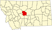 | |
| Town | ||
| CDPs | ||
| Other community | ||
| Ghost town | ||
This Judith Basin County, Montana state location article is a stub. You can help Wikipedia by expanding it. |