Talk:Bayshore Route
| Bayshore Route has been listed as one of the Engineering and technology good articles under the good article criteria. If you can improve it further, please do so. If it no longer meets these criteria, you can reassess it. Review: August 19, 2021. (Reviewed version). |
A fact from Bayshore Route appeared on Wikipedia's Main Page in the Did you know column on 13 September 2021 (check views). The text of the entry was as follows:
|
| This article is rated GA-class on Wikipedia's content assessment scale. It is of interest to the following WikiProjects: | |||||||||||||||||||||||||||||||||||||
| |||||||||||||||||||||||||||||||||||||
- The following is an archived discussion of the DYK nomination of the article below. Please do not modify this page. Subsequent comments should be made on the appropriate discussion page (such as this nomination's talk page, the article's talk page or Wikipedia talk:Did you know), unless there is consensus to re-open the discussion at this page. No further edits should be made to this page.
The result was: promoted by Theleekycauldron (talk) 08:13, 3 September 2021 (UTC)
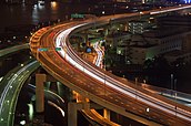
- ... that street racing was once prevalent along the Tokyo area's Bayshore Route (pictured)? Source: "From the late 1980s all the way to 1999 there was a presence on the Bayshore Route with street racers racing along the expressway" [1]
- Reviewed: Metropolitan Tower (Manhattan)
Improved to Good Article status by Mccunicano (talk). Self-nominated at 18:10, 24 August 2021 (UTC).
 New enough GA. The hook source is different from that provided in the article itself, which is a Japanese-language offline source, so I will AGF. The article presents no textual issues. @Mccunicano: Tick coming when a QPQ is supplied. Sammi Brie (she/her • t • c) 18:51, 24 August 2021 (UTC)
- @Sammi Brie: Thanks for the review, my QPQ has now been done. ❯❯❯ Mccunicano☕️ 15:15, 25 August 2021 (UTC)
 Tick! Sammi Brie (she/her • t • c) 17:05, 25 August 2021 (UTC)
Route map highlighting[edit]
In the map in this article's infobox, I only see a short section of the Bayshore Route highlighted in red (immediately north of the Tokyo Port Tunnel), rather than the entire 62-km length described in the article body. I see in the article's GA review that Downsize43 noticed that the route wasn't highlighted in mobile view - I'm using desktop view on Windows, and see the incomplete highlighting on Firefox and Chrome. I did notice that the {{Highway system OSM map}} template is using d:Q1369525, the Shuto Expressway, as its highway_system_qid rather than d:Q4874809, but using the latter in the template seems (from the edit preview) to show a map centered at 0°N, 0°E, so I assume Q4874809 is missing route data. I don't know enough about this to determine whether the cause and solution of this problem are in the article, the template, the Wikidata entry, or OpenStreetMap - if someone who knows more about creating route maps could take a look, that would be helpful. Otherwise, I wonder if we should go back to using c:File:Shutoko_expwy_wangan_route.png for the time being. --Opus 113 (talk) 19:00, 13 September 2021 (UTC)
- Wikipedia good articles
- Engineering and technology good articles
- Wikipedia Did you know articles
- GA-Class Japan-related articles
- Mid-importance Japan-related articles
- WikiProject Japan Tokyo taskforce
- WikiProject Japan articles
- GA-Class Highways articles
- Mid-importance Highways articles
- GA-Class Asia road transport articles
- Mid-importance Asia road transport articles
- Asia road transport articles
- GA-Class Road transport articles
- Mid-importance Road transport articles
- WikiProject Highways articles


