Template:POTD/2014-06-04
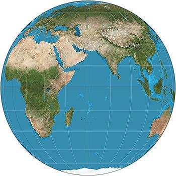
An orthographic projection of the Eastern Hemisphere from 30W–150E, based on NASA's The Blue Marble. The orthographic projection, a map projection used in cartography, depicts a hemisphere of the globe as it appears from outer space, where the horizon is a great circle. It is a perspective (or azimuthal) projection, in which the sphere is projected onto a tangent plane or secant plane with parallel rays, as if seen from an infinite distance. The shapes and areas are distorted, particularly near the edges.Map: Strebe, using Geocart

