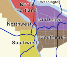
Template:Portland NRHP click map
This image map was created in September 2008 by Werewombat. It looks complicated but it is repairable using specialist (but free and easy) tools. The one used here is at http://tools.wikimedia.de/~dapete/ImageMapEdit/ImageMapEdit.html?en

| This template's documentation is missing, inadequate, or does not accurately describe its functionality and/or the parameters in its code. Please help to expand and improve it. |
