Trams in Khabarovsk
| Trams in Khabarovsk | |||
|---|---|---|---|
 | |||
| Overview | |||
| Locale | Khabarovsk, Russia | ||
| Service | |||
| Type | Tramway | ||
| Operator(s) | MUP «Gorodskoy Elektrotransport» | ||
| Rolling stock | 66 trams | ||
| History | |||
| Opened | 5 November 1956 | ||
| Technical | |||
| Line length | 33.5 km (20.8 mi) | ||
| Number of tracks | double track | ||
| Track gauge | 1,524 mm (5 ft) | ||
| Electrification | yes | ||
| |||
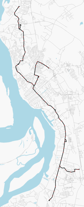
The Tram in Khabarovsk (Russian: Хабаровский трамвай) is the primary transportation in Khabarovsk, Russia. The first section opened on 5 November 1956.[1] The last time the network was expanded in 1979. Today, the Khabarovsk Tram network consists of 4 operating routes.
List of routes[edit]

1. Chemical Pharmaceutical Factory – Khabarovsk Railway Station
2. Khabarovsk Railway Station – Ruberoidnyi zavod
5. Kirov Town – Khabarovsk Railway Station
6. No.19 School – Lazo District
See also[edit]
References[edit]
External links[edit]
![]() Media related to Tram transport in Khabarovsk at Wikimedia Commons
Media related to Tram transport in Khabarovsk at Wikimedia Commons

