User:Crouch, Swale/CP infoboxes
Should the BUA or parish population be used? Should we use an infobox for a settlement (Infobox UK place) for for a CP (Infobox settlement) when there is a settlement of the same name. In the case of Edwardstone and North Huish there's no data for the village so the parish data has been used.
| Fulford | |
|---|---|
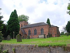
 St Nicholas Church | |
Location within Staffordshire | |
| Area | 0.302 km2 (0.117 sq mi) |
| Population | 659 (2019 estimate) |
| • Density | 2,182/km2 (5,650/sq mi) |
| Civil parish |
|
| District | |
| Shire county | |
| Region | |
| Country | England |
| Sovereign state | United Kingdom |
| Website | http://www.fulfordvillage.com/ |
Fulford | |
|---|---|
Civil parish | |
 St Nicholas Church | |
| Coordinates: 52°56′24″N 2°04′18″W / 52.939897°N 2.0717819°W | |
| Country | England |
| Primary council | Stafford |
| County | Staffordshire |
| Region | West Midlands |
| Status | Parish |
| Settlements | Fulford, Crossgate, Leadendale, Meir Heath, Mossgate, Rough Close, Saverley Green, Stallington, Townend and part of Blythe Bridge |
| Area | |
| • Total | 14.9 km2 (5.8 sq mi) |
| Population (2011) | |
| • Total | 5,931 |
| • Density | 400/km2 (1,000/sq mi) |
| Website | http://www.fulford-parish-council.org/ |
| Edwardstone | |
|---|---|
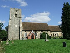
 St Mary's Church | |
Location within Suffolk | |
| Area | 7.56 km2 (2.92 sq mi) |
| Population | 352 (2011 Census) |
| • Density | 47/km2 (120/sq mi) |
| Civil parish |
|
| District | |
| Shire county | |
| Region | |
| Country | England |
| Sovereign state | United Kingdom |
| Website | http://edwardstonepc.onesuffolk.net/ |
Edwardstone | |
|---|---|
Civil parish | |
 St Mary's Church | |
| Coordinates: 52°02′39″N 0°49′56″E / 52.044152°N 0.83218394°E | |
| Country | England |
| Primary council | Babergh |
| County | Suffolk |
| Region | East of England |
| Status | Parish |
| Settlements | Edwardstone, Mill Green, Priory Green, Round Maple and Sherbourne Street |
| Area | |
| • Total | 7.56 km2 (2.92 sq mi) |
| Population (2011) | |
| • Total | 352 |
| • Density | 47/km2 (120/sq mi) |
| Website | http://edwardstonepc.onesuffolk.net/ |
| Woodbury | |
|---|---|
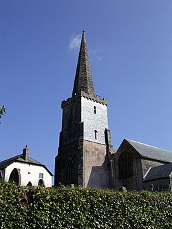
 St Swithun's Church | |
Location within Devon | |
| Area | 0.682 km2 (0.263 sq mi) |
| Population | 1,739 (2019 estimate) |
| • Density | 2,550/km2 (6,600/sq mi) |
| Civil parish |
|
| District | |
| Shire county | |
| Region | |
| Country | England |
| Sovereign state | United Kingdom |
| Website | http://www.woodburydevon.co.uk/ |
Woodbury | |
|---|---|
Civil parish | |
 St Swithun's Church | |
| Coordinates: 50°40′37″N 3°24′02″W / 50.676865°N 3.4005113°W | |
| Country | England |
| Primary council | East Devon |
| County | Devon |
| Region | South West England |
| Status | Parish |
| Settlements | Woodbury, Exton, Woodbury Salterton and Woodmanton |
| Area | |
| • Total | 26.4 km2 (10.2 sq mi) |
| Population (2011) | |
| • Total | 3,807 |
| • Density | 140/km2 (370/sq mi) |
| Website | https://woodbury-pc.org.uk/ |
| North Huish | |
|---|---|
 | |
Location within Devon | |
| Area | 10.7 km2 (4.1 sq mi) |
| Population | 393 (2011 Census) |
| • Density | 37/km2 (96/sq mi) |
| Civil parish |
|
| District | |
| Shire county | |
| Region | |
| Country | England |
| Sovereign state | United Kingdom |
| Website | https://www.avonwicknorthhuish.co.uk/ |
North Huish | |
|---|---|
Civil parish | |
 | |
| Coordinates: 50°23′40″N 3°48′48″W / 50.394574°N 3.8134438°W | |
| Country | England |
| Primary council | South Hams |
| County | Devon |
| Region | South West England |
| Status | Parish |
| Settlements | North Huish, Avonwick, Horsebrook and Lupridge |
| Area | |
| • Total | 10.7 km2 (4.1 sq mi) |
| Population (2011) | |
| • Total | 393 |
| • Density | 37/km2 (95/sq mi) |
| Website | https://www.northhuishparishcouncil.co.uk/ |
| Stanhope | |
|---|---|
 | |
Location within County Durham | |
| Area | 0.630 km2 (0.243 sq mi) |
| Population | 1,627 (2019 estimate) |
| • Density | 2,583/km2 (6,690/sq mi) |
| Civil parish |
|
| Unitary authority | |
| Shire county | |
| Region | |
| Country | England |
| Sovereign state | United Kingdom |
| Website | https://www.stanhopeparishcouncil.co.uk/ |
Stanhope | |
|---|---|
Civil parish | |
 | |
| Coordinates: 54°44′57″N 2°00′42″W / 54.749087°N 2.0117597°W | |
| Country | England |
| Primary council | County Durham |
| County | Durham |
| Region | North East England |
| Status | Parish |
| Settlements | Stanhope, Bridge End, Brotherlee, Copthill, Cornriggs, Cowshill, Crawleyside, Daddry Shield, East Blackdene, Eastgate, Frosterley, Hill End, Ireshopeburn, Killhope, Lanehead, Lintzgarth, New House, Rookhope, Shittlehope, St John's Chapel, Unthank, Wearhead, West Blackdene, Westgate and White Kirkley |
| Area | |
| • Total | 256 km2 (99 sq mi) |
| Population (2011) | |
| • Total | 4,581 |
| • Density | 18/km2 (46/sq mi) |
| Website | https://www.stanhopeparishcouncil.co.uk/ |
| Boxford | |
|---|---|
 St Mary's Church | |
Location within Suffolk | |
| Area | 0.475 km2 (0.183 sq mi) |
| Population | 1,100 (2019 estimate) |
| • Density | 2,316/km2 (6,000/sq mi) |
| Civil parish |
|
| District | |
| Shire county | |
| Region | |
| Country | England |
| Sovereign state | United Kingdom |
| Website | https://www.boxfordsuffolk.com/ |
Boxford | |
|---|---|
Civil parish | |
 St Mary's Church | |
| Coordinates: 52°01′43″N 0°51′33″E / 52.028571°N 0.85917733°E | |
| Country | England |
| Primary council | Babergh |
| County | Suffolk |
| Region | East of England |
| Status | Parish |
| Settlements | Boxford, Calais Street, Hagmore Green and Stone Street |
| Area | |
| • Total | 5.38 km2 (2.08 sq mi) |
| Population (2011) | |
| • Total | 1,221 |
| • Density | 230/km2 (590/sq mi) |
| Website | https://www.boxfordsuffolk.com/BoxfordParishCouncil.cfm |


