
User:Johnragla/Maharahara
| This is not a Wikipedia article: It is an individual user's work-in-progress page, and may be incomplete and/or unreliable. For guidance on developing this draft, see Wikipedia:So you made a userspace draft. Find sources: Google (books · news · scholar · free images · WP refs) · FENS · JSTOR · TWL |
Maharahara railway station | |||||||||||
|---|---|---|---|---|---|---|---|---|---|---|---|
 Maharahara railway station in 1962 | |||||||||||
| General information | |||||||||||
| Coordinates | 40°16′52″S 175°59′37″E / 40.281225°S 175.993509°E | ||||||||||
| Elevation | 165 m (541 ft) | ||||||||||
| Owned by | KiwiRail | ||||||||||
| Line(s) | Palmerston North–Gisborne Line | ||||||||||
| Distance | Palmerston North 43.75 km (27.18 mi) | ||||||||||
| History | |||||||||||
| Opened | 22 March 1887 | ||||||||||
| Closed | 27 September 1975 | ||||||||||
| Previous names | Matahiwi until 2 May 1904 | ||||||||||
| Services | |||||||||||
| |||||||||||
Maharahara railway station on the Palmerston North–Gisborne line, opened on 22 March 1887,[1] to serve a rural area south of Dannevirke, in the Manawatū-Whanganui region, with people (2018 census) scattered over two meshblocks, totalling 0 km2 (0 sq mi).[2] The station closed on .[1] Only a single line now passes through the station site.[3]
Just to the east of the station the railway crosses the Raparapawai Stream over bridge 135.[4]
History[edit]

By 1879 10 mi (16 km) of the line to Oringi was being surveyed and the line beyond, including Maharahara, was being explored and contoured.[5]
| Section | length | opened |
|---|---|---|
| Spit-Napier | 2 mi 16 ch (3.5 km) | 25 Nov 1874 |
| Napier-Hastings | 11 mi 64 ch (19.0 km) | 12 Oct 1874 |
| Hastings-Pakipaki | 4 mi 27 ch (7.0 km) | 1 Jan 1875 |
| Pakipaki-Te Aute | 10 mi 17 ch (16.4 km) | 17 Feb 1876 |
| Te Aute-Waipawa | 12 mi 53 ch (20.4 km) | 28 Aug 1876 |
| Waipawa-Waipukurau | 4 mi 49 ch (7.4 km) | 1 Sep 1876 |
| Waipukurau-Takapau | 12 mi 79 ch (20.9 km) | 12 Mar 1877 |
| Takapau-Kopua | 5 mi 63 ch (9.3 km) | 25 Jan 1878 |
| Kopua-Makotuku | 5 mi 22 ch (8.5 km) | 9 Aug 1880 |
| Makotuku-Matamau | 4 mi 22 ch (6.9 km) | 23 Jun 1884 |
| Matamau-Tahoraite | 7 mi 43 ch (12.1 km) | 1 Dec 1884 |
| Tahoraite-Woodville | 15 mi 10 ch (24.3 km) | 22 Mar 1887 |
| Woodville-Palmerston | 17 mi 21 ch (27.8 km) | 9 Mar 1891[6] |
The area was part of the Ngāti Raukawa rohe.[7] In 1877 land was acquired for a railway ballast pit at Kopua.[8] In 1879 Kopua was a clearing of about 1 mi (1.6 km) by ¼ mile[9] in the Seventy Mile bush.[10] Sawmills were set up as soon as the line opened.[11] Wilding & Bull had a mill at
From 1880 Kopua had 2 trains a day.[12] It was shown in 1891 as a flag station, still with 2 trains a day.[13] It didn't appear in 1897 adverts.[14]
By 1896 there was a shelter shed, platform, urinals and a passing loop for wagons. In 1898 the loop was for wagons and further lengthened in 1911 to and 1940 to wagons. Cattle yards were added in and railway houses in and .[8]
1 December 1884 Reporting extension of Napier line to Tahoraite is ready for opening. Mon, 15 December 1884 Tahoraiti – Matamau Section opened for traffic.[8] The line through Maharahara opened on 22 March 1887, when the 15 mi 10 ch (24.3 km) Tahoraiti (later Tapuata) to Woodville section extended the line from Napier.[15]
A Royal Commissioner reported adversely on the Napier line extension to Woodville, which stopped until the end of 1881, except for a few short lengths for unemployment relief just before the 1881 election. Mangatawainui viaduct, between Makatoko and Matanui, cost about £8,000. In the middle of 1883 tenders were called for this portion of the line, but the contractors failed and the Government took over.[16] Joseph Jay & Henry James Haines had won the Tahoraite contract for £13,615 on 8 June 1883.[17] Haines put the failure down to unusually bad weather.[18] The engineer from Kopua to Tahoraite is Mr J. T. Carr, who has been assisted by Messrs J. Fulton, H. F. Moody, and D. Ross. The principal bridge contractors were Messrs Proudfoot and McKay, of Dunedin, Joseph Saunders, of Wellington, and H. M'Kenzie and Co., of Dunedin. Mr Glendinning, of Napier, was contractor for the permanent way. The excursion train at the opening of the extension carried about 500. On reaching the terminus there was a large assemblage of settlers and Maoris. Several carriages conveyed those who desired it back along the road to Allardice's Hotel which was the nearest place for dinner, 4 coach loads went to Woodville.[16]
1885 Tamaki Timber Coy – asking permission to connect tramway with station. Use of Tamaki Timber Coy's siding by Wilding & Coy who leased the tramway. 1887 Proposal of McKay & Coy to lengthen siding. 1896 Level crossing at Gammon & Coy's sawmill near Tahoratite. 1926 Vacuum Oil Coy's lease of part of railway reserve at Tahoraiti and use of siding. 1943 Proposed private siding and stacking site – Public Works Department.
Sat, 29 January 1887 Re: opening line from Tahoraite to Woodville for traffic. 14 May 1887 Goods shed is being removed. When the buildings have been removed Tahoraiti to Dannevirke, recommends Tahoraiti be rated as a flag station. On and from Monday, 13/6/1887, Tahoraiti will be flag station and Dannevirke will be opened as a booking station, with stationmaster. 6 July 1887 Stationmaster's house shifted from Tahoraite to Danevirke recently. 1887 Removal of store. 1888 That cattle yards at Tahoraite be removed to Oringi. By 1896 shelter shed, passenger platform, urinals. Loop 26 wagons, backshunt 15 wagons (north end). 1896 Recommends extension of siding. 1898 Loop 54 wagons, loop 34 wagons, backshunt 11 wagons. 1904 loading bank.
Mon, 11 February 1889 Petition in favour of exchanging names of Tamaki and Tahoraiti stations. 5 April 1889 From the same date the present Tahoraiti siding will be called the Tamaki Sawmill Company's siding. On and from April 8th the name of the Tamaki station will be changed to Tahoraiti.[8] Tahoraiti has been an official name since 1939.[19]
Matahiwi was at the south end of the Seventy Mile bush. Contracts to clear a line, 66 ft (20 m) wide, through, for what later became SH2, were let in 1871.[20]
Thursday, 15 April 1886 Removal of Matahiwi station from present site to junction of Heretaunga Road.
Tuesday, 13 July 1886 Matahiwi station site – report with plan.
Saturday, 23 November 1889 Application of Danevirke Road Board for a crossing for a new road near Matahiwi.
Saturday, 26 July 1890 Suggests removal of cattle yards and goods shed from Oringi and erection at Matahiwi.
Friday, 31 March 1893 New water service provided.
Friday, 7 July 1893 Land slips near Matahiwi station.
Saturday, 16 December 1893 Lease of right to lay tramway on railway reserve at Matahiwi to N Campbell.
Monday, 28 May 1894 Urging erection of cattle and sheep yards.
Monday, 27 January 1896 Cost of a 30 foot by 15 foot goods shed on piles would be £70.
Friday, 1 May 1896 Approval for the erection of a goods shed, estimated cost £70. Local carpenters will be employed on the work.
Wednesday, 1 July 1896 Accommodation shelter shed, passenger platform, cart access to platform, goods shed 30ft x 15ft, loading bank, water service, urinals.
Wednesday, 1 July 1896 Loop 27 wagons, loop 32 wagons.
Wednesday, 1 July 1896 Mileage 85 miles 50 chains from Napier.
Thursday, 23 September 1897 Accommodation shelter shed, passenger platform, cart approach to platform, goods shed 30ft x 15ft, water service, urinals.
Thursday, 23 September 1897 Loop 27 wagons, loop 32 wagons.
Thursday, 2 December 1897 Authority for £45 for cattle yards.
Saturday, 7 May 1898 Cattle and sheep yards have been erected and are now ready for use.
Monday, 15 August 1898 Stockyards have been erected. Settlers have contributed £30 towards the cost.
Thursday, 1 December 1898 Accommodation shelter shed, passenger platform (left side), cart approach to platform, goods shed 30ft x 15ft, cattle and sheep yards, water service.
Thursday, 1 December 1898 Loop 30 wagons, loop 31 wagons.
Wednesday, 31 May 1899 Palmerston North Sash, Door, & Timber Coy Ltd's tramway crossing over the railway near Matahiwi. The cost of semaphore signals to protect this crossing would be £70 and the wages of a signalman 7/- per day, or £109.11.0 per annum.
Saturday, 1 December 1900 Loop 30 wagons, loop 31 wagons.
Monday, 2 May 1904 Name of Matahiwi station changed to Maharahara.
Monday, 2 May 1904 Name of Matahiwi station changed to Maharahara.
Thursday, 1 September 1904 Estimate for a loading bank 20 feet long is £20.
Wednesday, 21 September 1904 Please arrange to erect a loading bank.
Tuesday, 1 November 1904 Accommodation shelter shed, passenger platform (left side), cart approach to platform, goods shed 30ft x 15ft, loading bank, water service, urinals.
Tuesday, 1 November 1904 Loop 30 wagons, loop 31 wagons.
Tuesday, 1 November 1904 Mileage 26 miles 19 chains from Palmerston North.
Monday, 29 October 1906 Accommodation shelter shed, passenger platform (left side), cart approach to platform, goods shed 30ft x 15ft, loading bank, water service, urinals.
Monday, 29 October 1906 Loop 30 wagons, loop 31 wagons.
Tuesday, 11 April 1911 Giving up land at Maharahara to Woodville County Council for road purposes.
Friday, 1 December 1911 Accommodation shelter shed, passenger platform (left side), cart approach to platform, goods shed 30ft x 15ft, loading bank, cattle and sheep yards.
Friday, 1 December 1911 Loop 30 wagons, loop 31 wagons.
Friday, 9 August 1912 Complaint re lodging hut placed on loading bank.
Friday, 3 September 1926 Crossing loop, goods shed loop.
Friday, 3 September 1926 Station building, passenger platform, stockyards, goods shed, loading bank, approach roads to platform and goods yard.
Wednesday, 22 September 1926 Approval for improvements to stockyards, estimated cost £54.
Tuesday, 21 December 1926 The improvements to the stock yards have been carried out.
Thursday, 5 December 1935 Windmill to be shifted from Maharahara to Linton, at an estimated cost of £40, approved. To provide a water service for the stockyards.
Tuesday, 22 September 1936 Water service has now been removed.
Tuesday, 25 January 1938 Application for stacking site – Public Works Department.
Sunday, 5 December 1943 Mileage 26 miles 18 chains from Palmerston North.
Friday, 4 May 1945 Approval to rebuilt lavatory convenience, estimated cost £100.
Friday, 4 May 1945 The lavatory convenience was destroyed by fire on 24/2/1945.
Wednesday, 21 December 1949 Station building is 16 feet by 7 feet.
Friday, 11 August 1950 Approval for new goods shed, estimated cost £600.
Tuesday, 22 August 1950 Approval for the construction of a new goods shed approximately 25 feet by 14 feet.
Tuesday, 22 August 1950 Existing goods shed is to be demolished.
Tuesday, 9 January 1951 The existing goods shed is beyond repair. Size 25 feet by 14 feet.
Thursday, 23 August 1951 A tender in the sum of £699 has been received for construction of new goods shed. Requesting additional authority £99.
Monday, 13 January 1958 The station buildings at Maharahara and Tahoraiti may be handed over to the District Engineer for use by the members of the Way & Works Branch. [Shelter sheds]
Monday, 2 March 1959 Loop 38 wagons, loop 27 wagons (goods shed).
Monday, 2 March 1959 The loop at Maharahara was provided mainly for dealing with stalled trains on the ascending gradient of 1 in 53 between Papatawa and Maharahara (Matahiwi bank) but consequent upon the use of higher powered locomotives (J and K classes) in the area the incidence of trains stalling on the grade referred to has decreased and is now an uncommon occurrence.
Saturday, 16 May 1959 Removal of loop approved.
Monday, 19 July 1965 Existing lighting – nil.
Saturday, 28 November 1970 Goods shed is of the lean-to type.
Tuesday, 3 October 1972 Tenders to be called for the sale and removal of the goods shed.
Wednesday, 8 November 1972 Closed to all traffic except goods in wagon lots on 15/10/1972.
Monday, 25 November 1974 Loop siding, passenger platform, stockyards, goods shed, loading bank.
Monday, 25 November 1974 North end of platform is near 26¼ miles.
Monday, 25 November 1974 The tablet locked siding was closed to traffic except goods in wagon lots, on 15/10/1972.
Monday, 25 November 1974 There are no passenger services scheduled to stop at Maharahara.
Wednesday, 5 March 1975 Maharahara will be closed to all traffic from 30/3/1975.
Thursday, 19 June 1975 The tender of Mr F R Souncess, Dannevirke, for $205 accepted for the removal of the stockyards.[8]
References[edit]
- ^ a b Names & Opening & Closing Dates of Railway Stations in New Zealand by Juliet Scoble (2012)
- ^ "2018 Census Individual (part 1) total New Zealand by Statistical Area 1 - GIS". datafinder.stats.govt.nz. Retrieved 2021-09-13.
{{cite web}}: CS1 maint: url-status (link) - ^ "Heretaunga Rd". Google Maps. Nov 2013. Retrieved 2021-10-06.
{{cite web}}: CS1 maint: url-status (link) - ^ "KiwiRail Network Map". kiwirail.maps.arcgis.com. Nov 2018. Retrieved 2021-10-06.
{{cite web}}: CS1 maint: url-status (link) - ^ "PUBLIC WORKS STATEMENT, BY THE MINISTER FOR PUBLIC WORKS, THE HON. JAMES MACANDREW, THURSDAY, 7TH AUGUST, 1879". paperspast.natlib.govt.nz. Retrieved 2021-09-16.
{{cite web}}: CS1 maint: url-status (link) - ^ "TABLE of LENGTHS of GOVERNMENT LINES AUTHORISED, CONSTRUCTED, and SURVEYED up to 31st March, 1898. Appendix to the Journals of the House of Representatives". paperspast.natlib.govt.nz. Retrieved 2022-04-09.
- ^ "CORRESPONDENCE. WANANGA". paperspast.natlib.govt.nz. 1 Dec 1877. Retrieved 2021-09-17.
{{cite web}}: CS1 maint: url-status (link) - ^ a b c d e "Station Archive". NZR Rolling Stock Lists. Retrieved 10 August 2020.
{{cite web}}: CS1 maint: url-status (link) - ^ "KOPUA. WAIPAWA MAIL". paperspast.natlib.govt.nz. 15 Feb 1879. Retrieved 2021-09-09.
{{cite web}}: CS1 maint: url-status (link) - ^ "NEW ZEALAND TIMES". paperspast.natlib.govt.nz. 21 Nov 1877. Retrieved 2021-09-07.
{{cite web}}: CS1 maint: url-status (link) - ^ "HAWKE'S BAY HERALD". paperspast.natlib.govt.nz. 30 May 1878. Retrieved 2021-09-13.
{{cite web}}: CS1 maint: url-status (link) - ^ "HAWKE'S BAY HERALD". paperspast.natlib.govt.nz. 3 May 1880. Retrieved 2021-09-09.
{{cite web}}: CS1 maint: url-status (link) - ^ "WAIPAWA MAIL". paperspast.natlib.govt.nz. 3 Mar 1891. Retrieved 2021-09-17.
{{cite web}}: CS1 maint: url-status (link) - ^ "HASTINGS STANDARD". paperspast.natlib.govt.nz. 10 May 1897. Retrieved 2021-09-17.
{{cite web}}: CS1 maint: url-status (link) - ^ "PUBLIC WORKS STATEMENT BY THE HON. W. HALL-JONES, MINISTER FOR PUBLIC WORKS 27th SEPTEMBER, 1898". paperspast.natlib.govt.nz. Retrieved 2021-10-07.
{{cite web}}: CS1 maint: url-status (link) - ^ a b "OPENING OF THE RAILWAY TO TAHORAITE. DAILY TELEGRAPH". paperspast.natlib.govt.nz. 16 Dec 1884. Retrieved 2021-09-23.
{{cite web}}: CS1 maint: url-status (link) - ^ "HAWKE'S BAY HERALD". paperspast.natlib.govt.nz. 12 Jun 1883. Retrieved 2021-09-23.
{{cite web}}: CS1 maint: url-status (link) - ^ "IN BANKRUPTCY. WOODVILLE EXAMINER". paperspast.natlib.govt.nz. 16 Sep 1884. Retrieved 2021-09-24.
{{cite web}}: CS1 maint: url-status (link) - ^ "Tahoraiti". gazetteer.linz.govt.nz. Retrieved 2021-09-25.
{{cite web}}: CS1 maint: url-status (link) - ^ "HAWKE'S BAY TIMES". paperspast.natlib.govt.nz. 11 Jan 1871. Retrieved 2021-10-08.
{{cite web}}: CS1 maint: url-status (link)
External links[edit]
- 1890s photo of copper mine
- 1910 photo of cheese factory
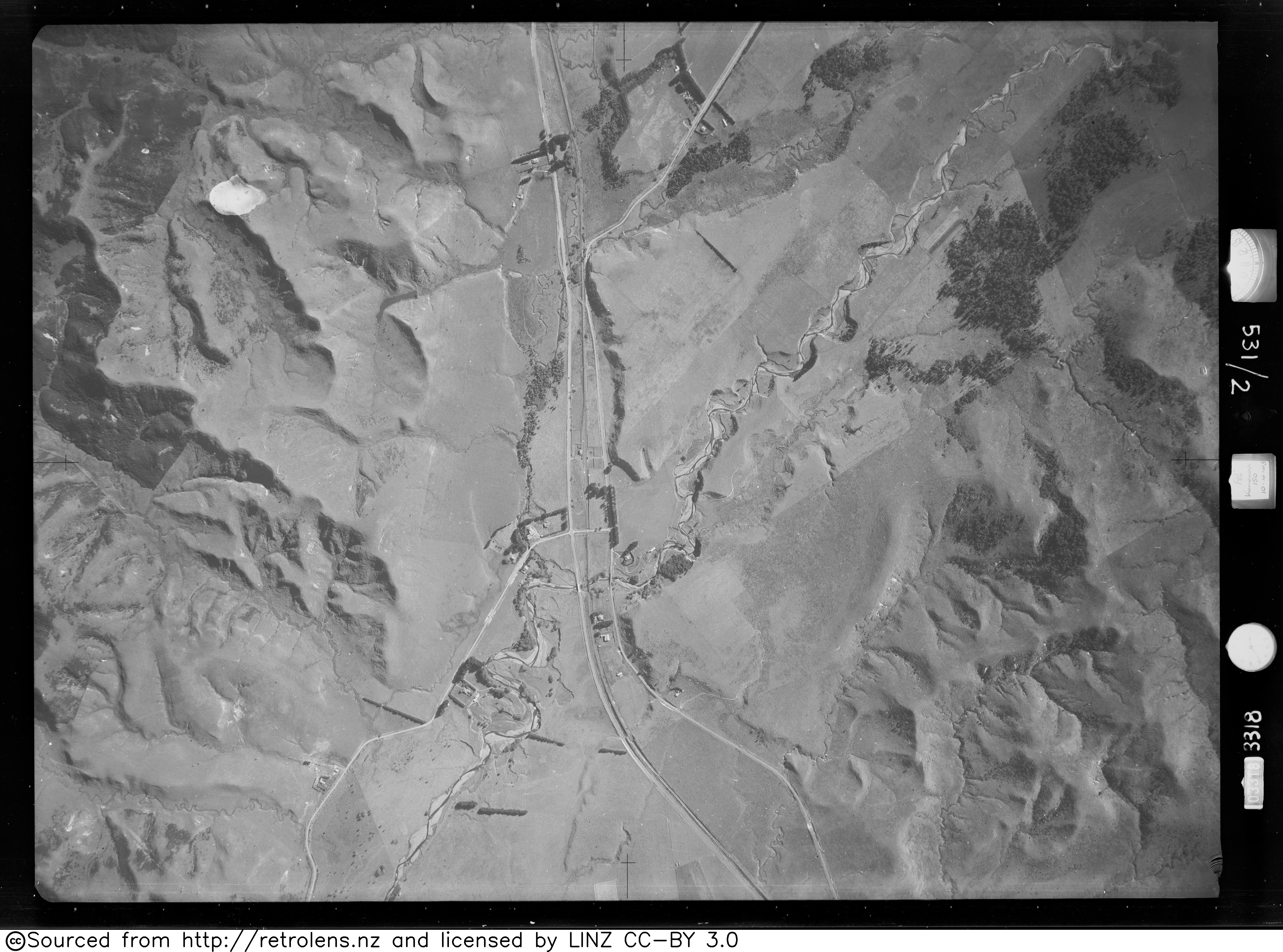
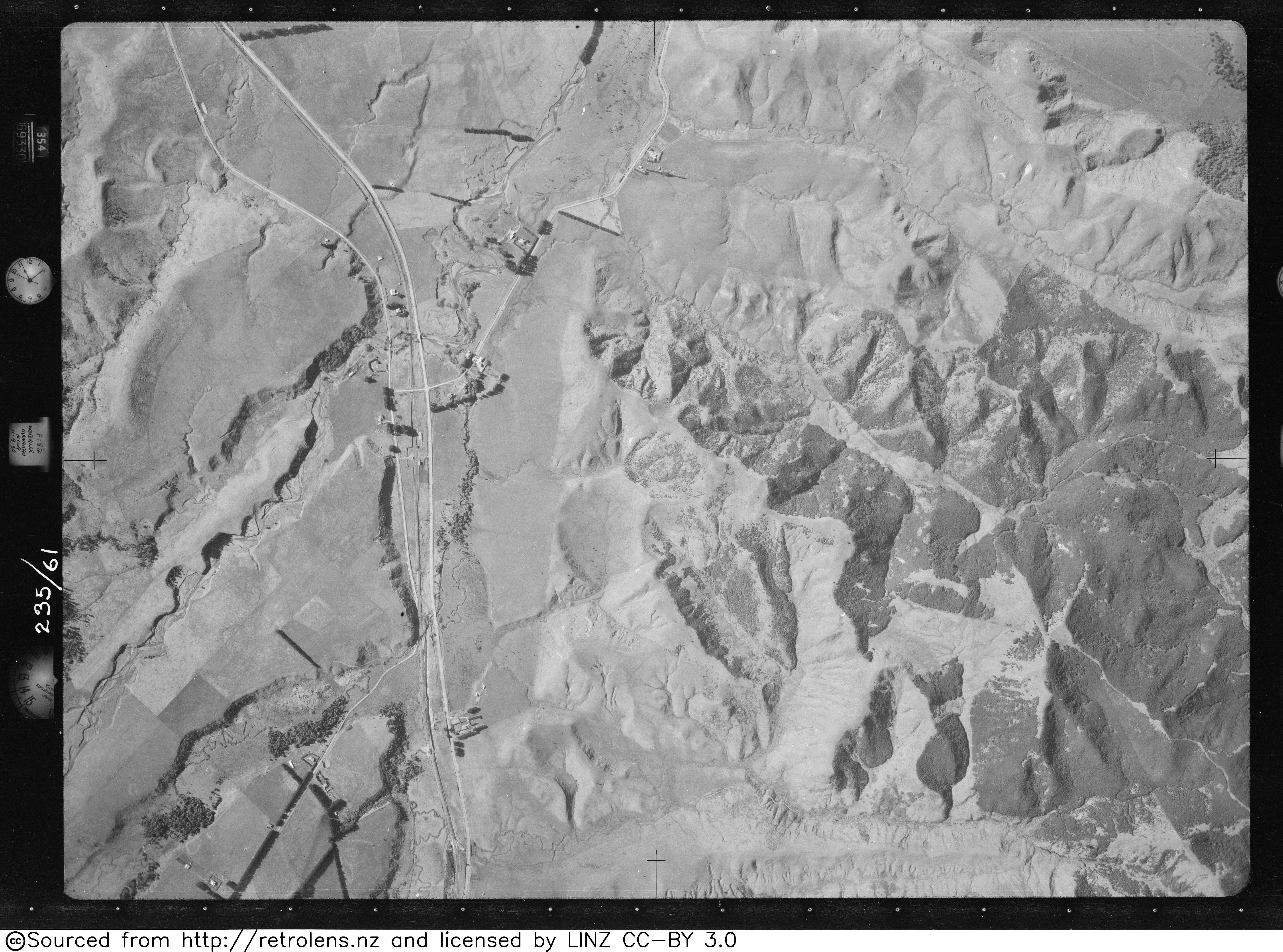
- Retrolens aerial views - 1943, 1950
Category:Railway stations in New Zealand Category:Railway stations opened in 1887 Category:Railway stations closed in 1975 Category:Defunct railway stations in New Zealand Category:Buildings and structures in Manawatū-Whanganui Category:Rail transport in Manawatū-Whanganui Category:Tararua District