
User:Kew Gardens 613/sandbox 5
| This is a Wikipedia user page. This is not an encyclopedia article or the talk page for an encyclopedia article. If you find this page on any site other than Wikipedia, you are viewing a mirror site. Be aware that the page may be outdated and that the user in whose space this page is located may have no personal affiliation with any site other than Wikipedia. The original page is located at https://en.wikipedia.org/wiki/User:Kew_Gardens_613/sandbox_5. |


 |
NYC Subway History Post-Unification  |
 |


User:Epicgenius/sandbox/Metropolitan Transportation Authority
User:Epicgenius/sandbox/article-draft1 — Manhattan Bridge subway closure
User:Kew Gardens 613/Subways70s80s
User:Kew Gardens 613/NYSTC Annual Reports
User:Tdorante10/sandbox3 – Includes draft bus articles
Queens Bus Routes and lines – A list of bus article projects
User:Epicgenius/sandbox/1 – Interesting track map drafts
User:Epicgenius/sandbox/3 – Includes draft bus articles
User:Epicgenius/sandbox/5 – Includes a draft split of Technology of the New York City Subway that I have been wanting to work on
This sandbox is going to be used for subway expansion plans and proposals, past and present. Capital Program projects will also be here. Other editors, feel free to add, fix, and add references to what is here. The goal is to transfer this material to the mainspace. On the top of the page are links to use to add to pages and provide information from.
Links[edit]
NYCTA Brochures[edit]
Use for R110A and R110B articles + New Technology Train
World's Fair Line[edit]
Add to IND World's Fair Line article
Second Avenue Subway[edit]
Add to Second Avenue Subway article
1952 Route – Board of Transportation Proceedings
Construction Contract Signed–ERA
Construction in the 1970s – The Launch Box
Metropolitan Transportation Authority Reports[edit]
Regional Transportation Program August 1969
THE MTA BLUE RIBBON COMMISSION ON SUSTAINABILITY SMART GROWTH/TOD REPORT October 29, 2008
Tri-State Regional Planning Commission[edit]
Maintaining Mobility: The Plan and Program for Regional Transportation Through 2000
The Committee for Better Transit[edit]
Office of the Borough President of Queens[edit]
Penn Station Access[edit]
Add to Penn Station Access article
Jamaica Yard Expansion[edit]
Add to Jamaica Yard section of the List of New York City Subway Yards article
MTA Board Action Items January 2006
World Trade Center Transfer[edit]
Add to Cortlandt Street and Chambers Street–World Trade Center/Park Place articles
Manhattan Community Board 1 Full Board Meeting Tuesday, June 28, 2016
Monthly Board Meeting Tuesday, June 27, 2017
Capital Program Documents[edit]
Add to articles concerning projects
MTA Twenty-Year Capital Needs Assessment 2015-2034[edit]
September 16, 2013 Briefing to CPOC
MTA Twenty-Year Capital Needs Assessment 2015-2034 October 2013
Major Projects[edit]
Capital Projects[edit]
Completing the Second Avenue Subway (SAS)
Strategic Approaches to Address Remaining “HotSpots” and Crowding
Over 75% of New York’s subway lines could meet projected peak-hour CBD-bound travel needs in 2035 (assuming completion of planned Megaprojects and system improvements). However, there will still be several “hot spots” where growth in customer demand will exceed operating capacity:
Northern Queens Corridor–crowding will increase at 7 with development at Flushing and Willets Point/rezoning in LIC and Jamaica will increase crowding
Manhattan West Side Corridor–additional capacity needed–heavy peak use/potential capacity of the line is restricted by capacity limits at key junctions and switching locations at the south end of the line in Brooklyn.
Northern Brooklyn Corridor: L ridership skyrocketing
Lower East Side: Growth in F ridership in Downtown Brooklyn and the Lower East Side, combined with the replacement of V service by the M train (bypassing the 2nd Ave. station) has increased ridership, with limited capacity for increased service without CBTC implementation.
In identifying solutions for these choke points in the subway system the MTA needs to be cognizant of the long time horizon that “megaproject”-type solutions require. For example, the currently under-construction Second Avenue Subway took nearly 10 years to go through planning, engineering and required environmental analyses,and will take nearly the same amount of time for construction of its first phase. This schedule makes it difficult for megaproject-sized strategies to address current or anticipated transportation needs in a timely manner. Therefore, the MTA needs to evaluate additional strategic solutions that make the greatest possible use of existing bus and subway lines to meet the evolving needs of an ever more mobile population.
In addition to regular state of good repair maintenance and regular replacement of power, signals and track, there are needed upgrades to the existing subway system to support additional system capacity. Critical among these is expansion of Communications-Based Train Control. Currently available on the L line and being installed on the 7 line, CBTC will allow more frequent train service on crowded corridors such as the Queens Blvd. line.
Maximizing the benefits of CBTC, however, may require fleet expansion to provide more frequent train service, which in turn may require more yard space for train storage and maintenance, as well as increased power generation capacity for the busier subway lines.
Other strategies which may alleviate hotspots may include:
- Corridoranalysisstudiestobetteranalyzespecifictraveltrendsandidentifycost- and time-effective capacity improvement efforts.
- Rebuilding critical subway junctions where lines merge and separate (such as Nostrand Junction on the 2 3 4 5 lines) to maximize train throughput and reduce delays
- Rebuilding constrained terminals stations (such as Brooklyn College/Flatbush Terminal) to address capacity choke points.
- Restructuring existing service to maximize throughput.
- Expanded Select Bus Service utilizing dedicated bus stops, off-board fare collection and limited stops to provide alternative travel routes in congested corridors.
Station Access Improvements
- New station entry points at stations with single or limited entry or where changes in passenger flow create pressure on existing station facilities
- reopen closed entrance
- platform scree doors at key stations
addressinggrowingdemandfornonhub-basedtravelpatterns
- 10th Avenue Station: The Flushing Line, with funding support from New York City, is being extended to serve the last major redevelopment area in the Manhattan core, the far West Side. This extension from Times Square to West 34th St. at 11th Ave. uses the “best practice” approach of leveraging revenues from large land use redevelopment to fund greater transit capacity. This “value capture” approach is one of the largest ever undertaken, and will help create a thriving West Midtown district of up to 34 million square feet of new residential, commercial and retail development. Construction of this intermediate station could provide better transit access to the north edge of the Hudson Yards Development area and the growing “West Midtown” residential district.
Utilizing Available Rail Rights-of-Way: One challenge in providing for non-core based travel is the availability of travel corridors supporting radial routes linking existing subway, bus and rail lines. A possible option is the utilization of abandoned or underutilized Rights of Way such as the LIRR Bay Ridge Branch (linking southern and eastern Brooklyn with Central and northern Queens) or the abandoned Rockaway Beach Branch (linking Howard Beach and Ozone Park with Woodhaven) as transverse routes linking radial subway lines. Conversion of existing ROWs, where a solution to an identified travel need can be defined, could help reduce land acquisition and construction costs, and facilitate construction time in densely developed areas.
New Access to Suburban Employment Centers: Meeting the demands of reverse commute customers depends both on accessibility of transit from residential locations and connectivity to suburban job sites or employment-based transportation links. In conjunction with rezoning, the area around the LIRR’s former Republic train station is expected to see significant new development and economic activity. Along with continuing development of office/commercial space in the nearby Route 110 corridor, this could create prime conditions for the LIRR to construct a new Republic Hub station, following the completion of the double track from Farmingdale to Ronkonkoma. This strategically located Republic Hub would facilitate access to the NYC-based labor force for new businesses setting up in the area.
Enhancing Service in Diesel Territory: In order to maximize the utility of new LIRR rail service to GCT associated with East Side Access, train slots on the Main Line should be targeted to serve the busiest lines and stations. In diesel territory, “scoot” services, utilizing new diesel-powered train equipment, can operate between interchange/transfer points with the electrified lines and local stations on the more lightly-used branch lines. This would enable enhanced service availability and would better address service demand within diesel territory. The Oyster Bay Branch and service between Ronkonkoma and Greenport are two areas where this type of service could be beneficial.
Developing a Regional Rail Network: The commuter rail system in the New York City area has been plagued by two long-standing problems: limited Manhattan destination choices and constrained CBD terminal capacity. In addition, demand on large portions of the rail system has been growing. Metro-North has overtaken LIRR as the nation’s largest commuter railroad, and ridership on service provided by New Jersey Transit and Amtrak are at record levels, increasing the pressure on an already constrained regional rail system. As a result, by 2030, peak capacity on the regional rail network will be strained by growth already underway. Left unaddressed, this obstacle could stifle economic growth. The MTA in cooperation with the New York City area’s other commuter and long-haul railroads, are investigating several possible short- and medium-term initiatives to both expand destination choices and increase capacity. These initiatives include: implementing Penn Station Access for Metro-North’s New Haven Line; developing a strategy for thru-running of trains between different rail networks; and improving the functionality and capacity of Penn Station.
Penn Station Access (PSA): MNR Access to Penn Station (would extend the reach of Metro- North’s commuter shed and enhance Metro- North’s CBD terminal capacity similar to LIRR’s Access to GCT. The PSA project, currently in development, would provide regular MNR service between the New Haven Line and Penn Station via Amtrak’s Hell Gate Line and add four new stations in the Bronx. A future phase could add a new link via the Amtrak Empire line for Hudson Line trains and provide potential new intermediate Manhattan west side stations. The new service would provide critical resiliency to the MNR network which today relies on a single link to Manhattan, the Harlem River Lift Bridge. MNR access to Penn Station would decrease travel times for Metro-North customers traveling to the West Midtown Manhattan area by up to 21 minutes and provide greater mobility to residents and employees of underserved communities in eastern Bronx.
Thru-Running: Completion of a Metro-North link to Penn Station would also facilitate shorter term operating strategies to enhance commuter rail capacity and optimize train movements and storage through the congested Penn Station. Today, arriving LIRR trains either have to quickly “reverse move” out the way they came into the station, or lay up in a storage yard with limited capacity for growth, while NJ Transit trains terminate at a handful of stub-end tracks or take up limited tunnel space under the East River en-route to Sunnyside Yard in Queens. Thru running agreements and compatible rolling stock would enable LIRR, MNR and New Jersey Transit trains to pass through Penn Station and continue in service on another rail system’s tracks, thus providing additional capacity and congestion relief. It also promises to improve reliability and enable the region’s employers to tap into new and more distant labor force pools using a more extensive rail system that spans three states. A pilot service linking the
New Haven line through Penn and the Northeast Corridor to the NJT network and the Meadowlands Sports Complex is underway, provided in the Fall of each year.
Maximizing the opportunities presented by thru-running will call for addressing the variations in power systems (e.g. overhead catenary and different formats of third rail) used by the region’s separate rail systems. Future plans for rolling stock purchases should take into account design needs for possible future regional rail operations. Penn Station Enhancements: Even with completion of the LIRR East Side Access link to Grand Central, Penn Station will continue to be the primary destination hub for LIRR customers with 75,000 arrivals during the AM peak period. The current station complex, shared with Amtrak and New Jersey Transit, and potentially with Metro-North in the future, is a cramped maze of passageways and links to the street and connecting subway lines. MTA railroads, in cooperation with Amtrak and New Jersey Transit, have embarked on a landmark study of transforming Penn Station into a world-class rail facility with improved functionality, customer amenities and convenience. By 2035, the railroads foresee a revised station design that is passenger-friendly, easy to traverse, iconic in appearance, and meets the future needs of the region for additional passenger capacity while accommodating the influx of new visitors, employees, and residents to midtown Manhattan. The goal of this effort is to develop a master plan for improvements and provide a clear, predictable and systematic process and schedule to transform the Penn Station through a set of interim, medium, and longer term enhancements to implement the 2035 Vision. This incremental approach will ultimately serve as building blocks to create a renewed, world-class Penn Station complex.
NYCT[edit]
Rockaway Line improvements [edit]
In the 2015-2034 period, there is a need for major reconstruction of NYC Transit’s Rockaway Line. While this investment is driven by state of good repair needs, not capacity needs, it falls into this “Major System Improvement” category because of the comprehensive and cross-cutting nature of the work.
The Rockaway Line carries A train service in Queens. It includes a bridge/viaduct segment that traverses Jamaica Bay over water, and a concrete viaduct that runs overland along the Rockaway peninsula between Far Rockaway and Rockaway Park. Structural repair projects were completed in recent capital plans, which stabilized deterioration and extended the life of the structures. However, major reconstruction and/or full replacement will be required within the 2015-2034 period. Alternative alignments and/or alternative technologies may be considered, to better meet the needs of Rockaway customers and their communities. Depending on the alternative selected, work may not be limited to structural reconstruction, but may also include installation of all applicable supporting infrastructure (e.g., track, signals, communications, power). The over-water segment would be addressed in the 2025- 2029 period and the overland segment in the 2030-2034 period.
Continue station component strategy[edit]
Times Square and Grand Central circulation improvements[edit]
A major reconfiguration project is planned at NYC Transit’s busiest station complex, 42 St.-Times Square, in the 2015-2019 period. Work will include renewal and reconfiguration of the Shuttle station, both to improve passenger circulation and to make the station ADA-accessible. The existing Shuttle station has various deficiencies, including circuitous customer paths, platform edge gap fillers and other components that are not in good repair, and a general station appearance that does not match the standard achieved through the rest of the Times Square complex. The work is also essential to comply with ADA mandates. Other system improvement projects – such as passenger circulation improvements, new passenger transfer facilities, and/or new intermodal facilities – are planned in each period beginning in 2020-2024. Among the possible system improvement projects is the installation of platform edge doors, to enhance safety and security by preventing customer access to tracks. Installing platform edge doors in NYC Transit stations may involve structural retrofits and other technical challenges; feasibility is currently being studied.
Contactless fare collection to replace MetroCard [edit]
Fare collection equipment will be replaced over the 20-year period. Phase 1 of the NFPS is funded in the 2010-2014 Capital Plan. This next generation of fare equipment will involve contactless “tap and go” technology, and promises to transform access to the region’s transportation systems much like MetroCard did years ago. Phase 2 of NFPS implementation is planned for the 2015-2019 period. Subsequent normal replacement reinvestment is planned in 2030-2034.
Modernize interlockings and expand CBTC[edit]
Over the next 20 years, the rollout of CBTC signals will continue with installation on 322.5 miles of track, including the western portion of the Queens Blvd. Line and major Manhattan trunk lines: 8th Ave. Line (2015-2019), 6th Ave. Line (2020-2024), Broadway and Lexington Ave. lines (2025- 2029), and Broadway-7 Ave. Line (2030-2034). Installation on the remaining lines in the NYCT system will continue for several capital plans after 2034.
This plan requires an intense focus on project implementation. Interlocking modernizations are planned to occur in advance of CBTC deployment, and all cars operating in CBTC territory must be equipped with specialized equipment. Since CBTC equipment can only be installed on new-technology cars (the R142-class cars and newer), the pace of CBTC equipment installation is coordinated with the planned schedule for delivery of new cars. By 2027, all revenue cars in the NYC Transit system will be CBTC-equipped.
There are 183 interlockings in the mainline NYC Transit system. Interlockings are controlled from signal towers, where NYC Transit personnel can monitor the position of trains and specify the route for each train to take. The backlog of interlockings will be addressed by the 2025-29 program. An additional 34 interlockings will undergo normal replacement upgrades, which are necessary for compatibility with CBTC. Interlocking investments begin with 13 in the 2015-2019 period and then ramp up to approximately 20 in each period within the 2020-2034 window.
On lines that will be upgraded with CBTC signals (as discussed above), it is expected that additional power will be required to support the higher train throughput enabled by CBTC. Providing this power will require new substations at key locations, as well as enhancements to other power infrastructure. The assessment reflects new substations on the 8th Ave. and Queens Blvd. lines, along with other investments (at locations to be determined) beginning in the 2015-2019 period and continuing through 2025-2029. These system improvement projects will ensure that the full customer benefits of CBTC can be achieved – specifically, more frequent, higher- capacity train service – and will also allow for improved reliability.
Real-time information infrastructure [edit]
Fleet normal replacement [edit]
New structures component strategy [edit]
Continue track component strategy [edit]
As part of the mainline track replacement program, traditional bolted rail will be replaced with continuously welded rail (CWR) at critical locations, to prevent the occurrence of broken rails. This is a key investment strategy for the continued safety of the rail system. Other benefits of CWR are reduced damage to rolling stock and better ride quality. As appropriate, new investments in CWR will be made to address critical rail breaks throughout the 20-year period.
NYC Transit proposes to construct 26 new or expanded fan plants by 2034 to achieve modern ventilation standards at the next group of high-priority tunnel segments. The number of plants built in each successive five-year period will ramp up over the next 20 years to help mitigate the challenge of achieving this increased pace of construction. Plants will be built based on a priority ranking and other site considerations. In addition, smaller-scale investment is programmed to extend the useful life of existing fan plants that are in poor condition.
One new deep well location is planned for construction in the 2020-2024 period.
Junius–Livonia transfer[edit]
Subway Cars[edit]
Replacement of R62/R62As (1,140 cars) 2020-2024 and 2025-2029 Capital Programs
Replacement of R46s (752 cars, 940 with 60-foot cars) 2015-2019
Replacement of R68/R68s (625 cars) 2025-2029
At the time, 75 foot cars were planned tor replace them, but this has changed
168 growth cars – B Div 2015-2019 and 2025-2029, A Div – 2025-2029
2015-2019 cars expected for E, G, L, N
NYC Transit proposes to purchase 211 new work train cars by 2034, in order to ensure that operations and capital construction projects are properly supported. This includes fleet growth of 10 additional locomotives in the 2015-2019 period for capital and maintenance workload needs. Otherwise, the investments in 2015-2034 are limited to replacement of the existing work train fleet.
Accessibility[edit]
Mandate to upgrade 100 Key Stations to become fully ADA-accessible by 2020 (including three Staten Island Railway stations).
89 stations will be complete by the end of the 2010-2014 Capital Plan
remaining 11 stations will be included in the 2015-2019 period.
25 stations beyond these Key Stations are also wholly or partially accessible, as of 2014.)
Yards[edit]
Lastly, a new facility will be created to service track geometry cars and other work trains, which will enhance NYC Transit’s ability to maintain these vehicles and keep them available for productive operation.
The signal systems at four yards will be replaced by 2034, starting with Jamaica Yard in 2020-2024.
Train storage capacity, security, and other yard needs are also identified. Jamaica Yard is planned to undergo an expansion that will double its storage capacity and greatly reduce the need to store trains along the mainline during off-peak hours; this will be implemented in phases in the 2020-2024 and 2025-2029 periods.
LIRR/MNRR[edit]
Increased service at city stations
Possible addition of pocket tracks, signal enhancements, and station platform extensions to increase capacity
More trains would be able to study–enhancing both CBD-bound service and reverse-commuter travel
Kew Gardens and Forest Hills–lengthening platforms from four cars–allowing additional passengers to use the stations without having to pass between cars toa ccess the stop
station dwell times would decrease, shorter travel times between Jamaica and Penn
As ESA opens, as LIRR service to two Manhattan terminals will help to decrease overcrowding on Queens Blvd.
Encourage TOD
Strategic improvements along the Main Line will also help to facilitate the investigation of new “scoot” service within diesel territory. New “scoot” service could allow for more frequent connecting service into electric territory, including improved service east of Ronkonkoma and on the Oyster Bay Branch, upgrading commutation service for residents living outside of LIRR electric territory. This potential new service will serve Nassau County commuters on the Oyster Bay Branch as well as residents of eastern Long Island and recreational travelers.
Penn Station[edit]
Penn Station has and will continue to be a defining aspect of the LIRR customer experience. In this regard, a Penn Station Vision has been under development – a collaborative effort between LIRR, New Jersey Transit, Amtrak and the MTA. This Vision Study will yield a collection of projects which have independent utility that will improve the customer experience over the 2015-2034 period. The focus of the Penn Station Vision includes widened and lengthened corridors, signage and lighting improvements, significant improvements to station entrances/exits, and enhanced ADA access and retail experiences.
Expansion[edit]
- second track from Ronkonkoma to Yaphank–allowing LIRR to provide additional service to diesel territory customers
- two new yard facilities in Suffolk County, in addition to the Mid-Suffolk Yard which is included in the 2010 – 2014 Capital Plan.
- one on the Huntington / Port Jefferson Branch, and one on the Babylon / Montauk Branch. New facilities will allow the LIRR to begin additional train starts in Suffolk County, providing enhanced service for some of the LIRR’s busiest stations and adequate seating capacity systemwide.
- future extensions of electrification on the Port Jefferson Branch, the Main Line, and the Montauk Branch.
- Completion would bring electric train service to 16 stations in Suffolk County. Currently, 85 of the LIRR’s 124 stations have electric train service. These electrification efforts are anticipated to be undertaken in conjunction with double tracking and construction of new electric train storage yards, as a phased effort over multiple capital plans, and will likely continue beyond this 20-year planning horizon.
Expansion[edit]
- third track from Crestwood to North White Plains
- flyover at Woodlawn
- additional capacity is needed on the West of Hudson lines to serve some of the fastest growing counties in the MTA region. Strategies to be considered include additional track and yard facilities on the Port Jervis line.
Rebuild[edit]
- Moodna and Woodbury Viaducts replacement –these bridges must ultimately be replaced and a state of good repair will not be achieved until post 2034.
Smart Growth, generally defined as a way to prevent or mitigate the unnecessary costs of sprawl development, is an important goal for New York State. Consistent with New York’s 2010 Smart Growth Public Infrastructure Policy Act, MTA supports Smart Growth investments by improving public transportation and reducing automobile dependency, especially in and around municipal centers. MTA has incorporated smart growth consideration into its capital planning process; capital work emphasizes improvement of existing infrastructure, often in coordination with local governments and community groups. As an example, LIRR is working to promote “Wyandanch Rising,” an effort to encourage development around the Wyandanch Station on the railroad’s Ronkonkoma Branch and that includes a parking structure at the station. Similarly, MTA is establishing a partnership and package of incentives with New York State to support TOD development throughout the MTA service area. As capital plans are developed and services designed, MTA will support Smart Growth where practical.
Additional Rail Capacity[edit]
- Second track from Farmingdale to Ronkonkoma
- completion of Jamaica Capacity Improvements–including universal 12-car platforms, new higher speed switches, track reconfiguration and signal modernization.
- new power substations in Queens
- additional track capacity to support reverse commute service on the LIRR Main Line
- expanded yard capacity on Suffolk County’s Huntington/Port Jefferson and Montauk Branches
SBS[edit]
Lastly, in the 2015-2019 period, the assessment includes construction of a new off-street busway in Ridgewood, Queens that will reduce travel times and reduce operating costs for several bus routes.
Exclusive Busways: In Staten Island, the Governor’s 2100 Commission on resiliency for potential future flood events has identified development of Bus Rapid Transit operating on a dedicated busway on the right-of-way of the abandoned north shore rail line as a strategy to boost the resiliency of the Staten Island bus network. This bus corridor, built with multiple entry/exit points will allow the Borough’s population, which is heavily dependent on express bus services to Manhattan for commuting, to access ferry service to Lower Manhattan, providing valuable travel route redundancy in the event of highway congestion or tunnel closings due to coastal flooding, electrical blackout or other emergency conditions. Construction of the busway, requiring shore line stabilization and raising of the right-of-way, will also provide a barrier against potential flooding in the Kill Van Kull. With post-Sandy travel times to and from Staten Island approaching three hours, this transit resiliency is essential.
Planned Canarsie Line Relocation-Program for Action[edit]
Background[edit]
Description[edit]
Also in Brooklyn, the BMT Canarsie Line would gain an eastern branch to Spring Creek, serving Starrett City (now Spring Creek Towers). The mainline would also be lengthened from its southern terminus at Rockaway Parkway to a new terminus in Midwood and Flatlands near the existing Flatbush Avenue–Brooklyn College IRT station.[1][2][3][4][5] The reroute would not use the existing segment between New Lots Avenue and Rockaway Parkway.[a] Later plans suggested extending the line as far west as McDonald Avenue near the Avenue I station of the IND Culver Line or possibly to New Utrecht Avenue to the New Utrecht Avenue/62nd Street station, creating crosstown service through central Brooklyn.[6] It was also proposed to relocate the Canarsie Line west of its current right-of-way south of Broadway Junction, along the parallel LIRR Bay Ridge Branch (currently a freight-only branch) or in the median of the proposed Queens Interboro Expressway and Cross Brooklyn Expressway, which would have been built along both the LIRR branch and Linden Boulevard. The re-alignment would have facilitated both extensions. The current Bushwick Avenue, Broadway Junction and Atlantic Avenue stations would have been consolidated into one station on the Bay Ridge Line, new Sutter Avenue and Livonia Avenue stations would have been built, and the East 105th Street station would be replaced with a station at Rockaway Avenue on the Bay Ridge Line. Additional stations would have been built at Remsen Avenue, Ralph Avenue, Utica Avenue to connect with the Utica Avenue Line, Nostrand Avenue to connect with the Nostrand Avenue Line, Avenue H to connect with the Brighton Line, and McDonald Avenue to connect to the Culver Line before terminating at New Utrecht Avenue.[1][2][7][3][4][5][6]
The City Planning Commission ended up not favoring a line via Utica Avenue, feeling that it was unnecessary with the Nostrand Avenue Line extension and the lack of available funds. Instead it suggested that the BMT Canarsie Line extension be built instead.[6]
According to the October 1968 New York Division Electric Railroaders' Association Bulletin, "On September 20, 1968, the city Board of Estimate approved the construction of several subway routes, reported to be the greatest at least since the dual contracts of 1913. The approved routes are:
20- Elimination of the the present BMT Canarsie Line south from Broadway Junction to Rockaway Parkway and relocation along the proposed Queens Interboro Expressway, which would run parallel to the present line to near Linden Blvd (between New Lots and East 105 Street Stations) the Queens Interboro expressway would join the proposed Cross Brooklyn Expressway. The replaced Canarsie Line would then turn east along the Cross Brooklyn Expressway, which would run Parallel Flatlands Ave Ave and terminate near the Queens-Brooklyn Border."
There was also an 'A' branch which would run west along the 'CBX' to an unknown terminal, using a 'to be determined conveyance.
This map was created by Raleigh D'Adamo, and accompanied his 'Discrete Routings' report ("Simplified Subway Routings: Key to Better Transit in New York City", October 30, 1970), for the Transportation Administration, City of New York. The map does not describe the actual services, but the services as D'Adamo recommended re-organizing them to minimize switching trains between trunks, at-grade crossings, etc. http://www.hopetunnel.org/temp/map.pdf
The Expressway was to be designated Interstate 878, and it was to run above the Long Island Rail Road Bay Ridge Branch, from the Verrazano Bridge to Conduit Avenue in East New York, running through Bensonhurst, Midwood and East Flatbush. One problem was that the Bay Ridge Branch gets very narrow in Midwood where there are Victorian-era private homes and Brooklyn College. There would not have been enough space for a four to six lane expressway. A New York City Planning Commission document from about 1968 described the plan for relocating the Canarsie Line onto the Bay Ridge Branch south of Wilson Avenue. Part of the plan called for keeping a shuttle from New Lots Avenue to Rockaway Parkway for a while to get residents of Canarsie to realize that they would have to rely on extended B42 bus service to get onto the train. The plan would have improved Southern Brooklyn access to Central Queens. The line would have terminated at 8th Avenue on the Sea Beach Line.
The Queens-Interboro Expressway was to go into the cut of the New York Connecting RR, with freight/Canarsie service in the median. The Cross Brooklyn Expressway was to be elevated over the Bay Ridge Branch from Albany Avenue and Van Sinderen Avenue.
History[edit]
Plans for Bay Ridge Line
Fiscal Crisis
The planned extensions and realignment of the Canarsie Line were cancelled in 1973,[8] due to community opposition against the proposed expressways that the line would have been built along with.[9]
Triboro Rx[edit]
RPA Plans
Sander
Twenty-Year Capital Needs Assessment
References[edit]
- ^ a b "Full text of "Metropolitan transportation, a program for action. Report to Nelson A. Rockefeller, Governor of New York."". Internet Archive. November 7, 1967. Retrieved October 1, 2015.
- ^ a b "Regional Transportation Program" (PDF). Metropolitan Transportation Authority. Retrieved July 26, 2016.
- ^ a b "1968 NYCTA Expansion Plans (Picture)". Second Avenue Sagas. Retrieved December 1, 2013.
- ^ a b Feinman, Mark. "The New York Transit Authority in the 1970s". nycsubway.org. Retrieved April 23, 2015.
- ^ a b "A Record $250-Million Is Asked for Transit Expansion Here". The New York Times. November 5, 1968. Retrieved October 2, 2015.
- ^ a b c Prial, Frank J. (March 21, 1971). "Long-Awaited Subway Line on Utica Ave. in Brooklyn Is Still an Idea That Keeps Getting Untracked". The New York Times. Retrieved October 3, 2015.
- ^ Burks, Edward C. (May 23, 1971). "INTERBORO ROUTE ANGERS RESIDENTS; Proposal for a Truck Link Assailed in Queens". The New York Times. Retrieved October 3, 2015.
- ^ 1968–1973, the Ten-year Program at the Halfway Mark. Metropolitan Transportation Authority. 1973.
- ^ "Broadway Junction Transportation Study: NYC Department of City Planning Final Report-November 2008" (PDF). nyc.gov. New York City Department of City Planning. November 2008. Retrieved October 27, 2015.
External Links[edit]
Queens Subway Options Study[edit]
Background[edit]
1963 Study[1]
Description[edit]
63rd Street–Southeast Queens line[edit]

Phase I's flagship project was the 63rd Street–Southeast Queens line, which would stretch from the existing 57th Street subway station in Midtown Manhattan to the existing Laurelton LIRR station in Springfield Gardens.[2][3][4][5][6][7][8] The construction of this line was to be split up into three parts. The first part, Route 131–A, would run from Sixth and Seventh Avenues in Manhattan below 63rd Street and the East River to Northern Boulevard. The next part, Route 131–B, the Super–Express Bypass Line, would continue along the LIRR right-of-way to Forest Hills. And finally, Route 131–D, the Southeastern Queens Line, would build a branch of the Queens Boulevard Line at Briarwood through Downtown Jamaica to Springfield Gardens via the LIRR's Atlantic Branch, with a ramp to eliminate the Jamaica Avenue elevated structure in Downtown Jamaica.[9]
The westernmost part of the line entailed aggressive completion of the 63rd Street Tunnel, as well as the connections from the tunnel to the IND Sixth Avenue Line and the BMT Broadway Line. The 63rd Street portion of the line would reduce overcrowding on the IND Queens Boulevard Line, on the IRT Flushing Line, and on the 60th Street Tunnel's services.[3][4][5][6][7][8] The 63rd Street tunnel would facilitate service between the Queens Boulevard Line and the Second Avenue Subway, via bellmouths west of Roosevelt Island which turn south towards Midtown and Lower Manhattan;[10] these turnouts may be used for the third and fourth phases of a new Second Avenue Subway project, which started in 2007.[11][12]
Southeast Queens Line | ||||||||||||||||||||||||||||||||||||||||||||||||||||||||||||||||||||||||||||||||||||||||||||||||||||||||||||||||||||||||||||||||||||||||||||||||||||||||||||||||||||||||||||||||||||||||||||||||||||||||||||||||||||||||||||||||||||||||||||||||||||||||||||||||||||||||||||||||||||||||||||||||||||||||||||||||||||||||||||||||||||||||||||||||||||||||||||||||||||||||||||||||||||||||||||||||||||||||||||||||||||||
|---|---|---|---|---|---|---|---|---|---|---|---|---|---|---|---|---|---|---|---|---|---|---|---|---|---|---|---|---|---|---|---|---|---|---|---|---|---|---|---|---|---|---|---|---|---|---|---|---|---|---|---|---|---|---|---|---|---|---|---|---|---|---|---|---|---|---|---|---|---|---|---|---|---|---|---|---|---|---|---|---|---|---|---|---|---|---|---|---|---|---|---|---|---|---|---|---|---|---|---|---|---|---|---|---|---|---|---|---|---|---|---|---|---|---|---|---|---|---|---|---|---|---|---|---|---|---|---|---|---|---|---|---|---|---|---|---|---|---|---|---|---|---|---|---|---|---|---|---|---|---|---|---|---|---|---|---|---|---|---|---|---|---|---|---|---|---|---|---|---|---|---|---|---|---|---|---|---|---|---|---|---|---|---|---|---|---|---|---|---|---|---|---|---|---|---|---|---|---|---|---|---|---|---|---|---|---|---|---|---|---|---|---|---|---|---|---|---|---|---|---|---|---|---|---|---|---|---|---|---|---|---|---|---|---|---|---|---|---|---|---|---|---|---|---|---|---|---|---|---|---|---|---|---|---|---|---|---|---|---|---|---|---|---|---|---|---|---|---|---|---|---|---|---|---|---|---|---|---|---|---|---|---|---|---|---|---|---|---|---|---|---|---|---|---|---|---|---|---|---|---|---|---|---|---|---|---|---|---|---|---|---|---|---|---|---|---|---|---|---|---|---|---|---|---|---|---|---|---|---|---|---|---|---|---|---|---|---|---|---|---|---|---|---|---|---|---|---|---|---|---|---|---|---|---|---|---|---|---|---|---|---|---|---|---|---|---|---|---|---|---|---|---|---|---|---|---|---|---|---|---|---|---|---|---|---|---|---|---|---|---|---|---|---|---|---|---|---|---|---|---|---|---|---|---|---|---|
| ||||||||||||||||||||||||||||||||||||||||||||||||||||||||||||||||||||||||||||||||||||||||||||||||||||||||||||||||||||||||||||||||||||||||||||||||||||||||||||||||||||||||||||||||||||||||||||||||||||||||||||||||||||||||||||||||||||||||||||||||||||||||||||||||||||||||||||||||||||||||||||||||||||||||||||||||||||||||||||||||||||||||||||||||||||||||||||||||||||||||||||||||||||||||||||||||||||||||||||||||||||||
| ||||||||||||||||||||||||||||||||||||||||||||||||||||||||||||||||||||||||||||||||||||||||||||||||||||||||||||||||||||||||||||||||||||||||||||||||||||||||||||||||||||||||||||||||||||||||||||||||||||||||||||||||||||||||||||||||||||||||||||||||||||||||||||||||||||||||||||||||||||||||||||||||||||||||||||||||||||||||||||||||||||||||||||||||||||||||||||||||||||||||||||||||||||||||||||||||||||||||||||||||||||||
East of Northern Boulevard, where there would be a track junction with the Queens Boulevard Line, the 63rd Street–Southeast Queens line would become a "super-express" bypass of the Queens Boulevard line.[3][4][6][7][10] This bypass, which was proposed due to the overall congestion of the line during peak hours,[7][13][14] was originally a single "high speed express track", with no intermediate stops, in order to allow trains to travel at speeds of up to 70 miles per hour (110 km/h). The bypass would have used one of the two trackways parallel to, and surrounding, the four-track LIRR Main Line; the trackways, formerly used by the Rockaway Beach Branch, are currently unused.[15][16][17] It would stretch from the 63rd Street Line east of 21st Street–Queensbridge near the Sunnyside Yard, with the possibility of access to the 60th Street and 53rd Street Tunnels. At its east end, it would have left the LIRR right-of-way near Whitepot Junction and ran under Yellowstone Boulevard to the Queens Boulevard Line near 71st Avenue station. The 71st Avenue station would have been converted into a bi-level or tri-level station, with the super express tracks using the lower level(s) built south of the current station, before rejoining the main line Queens Boulevard tracks.[15][3][4][18][10][16][17][19][20] Later plans called for two tracks and an intermediate stop next to the current Woodside LIRR station; there would have also been a three-track station along the 63rd Street Line at Northern Boulevard, adjacent to the existing Queens Plaza station. The bypass and proposed Woodside station would have necessitated the widening of the LIRR Main Line right-of-way onto private property west of Winfield Junction, where the Main Line merges with the Port Washington Branch, and reorganization of the track layout in the Sunnyside Yards.[17][21][19][20][22] The IND Queens Boulevard Line was to be reverse-signaled as well to further increase capacity.[5][23]
Queens Bypass[edit]
Description of Yellowstone/Forest Hills station and merge
Station at Woodside
Station at Northern Boulevard
Montauk/Archer[edit]
Discontinuation of BMT Jamaica Line south of Crescent Street
Rebuild of stations
Electrification
Transfer at Thompson/QSOS Rail[edit]
Transfer at Thompson
Queens Boulevard Local Connection[edit]
Rebuild of 36th Street Interlocking
Only gain of 15 TPH
History[edit]
Financial Crisis[edit]
1984 EIS
1990 EIS
Community Opposition to Lower Montauk option
63rd Street Subway[edit]

By November 1974, the MTA projected a 1981 opening date for the Archer Avenue Line to Springfield Boulevard, as well as a 1982 opening date for the 63rd Street Line and for the SAS from 34th Street to 125th Street. In 1983, the Queens Super Express Bypass was to open, and in the same year, the Bronx extension of the SAS and the BMT Jamaica Line reroute to Archer Avenue would open. The MTA thought that the SAS's southern extension to Whitehall Street would open by 1988, and that by 1993, the Utica Avenue, Nostrand Avenue, and LIE subway lines and the LIRR East Side Access would all open.[24]
By the summer of 1976, the 63rd Street Subway, which would comprise part of the Southeast Queens Line "from Central Park to Jamaica via the new 63rd Street tunnel," was being delayed to 1987–1988, since the planned 5.8-mile super express bypass had yet to begin construction. The authority proposed a new station at Northern Boulevard, adjacent to the existing Queens Plaza station, with transfers between mainline Queens Boulevard trains and 63rd Street/super-express trains, to be opened by 1983 or 1984.[25] The Manhattan section of that line was completed that year.[26]
The projects ran out of funding due to the 1975–1976 fiscal crisis that affected the city,[27] along with the fact that the MTA did not have a consistent funding source (its five-year Capital Programs were implemented in 1982 due to further decline in the subway after 1975–1976[28]). Expected to be completed by the mid-1970s and early 1980s,[29][30] lines for the Program for Action had to be reduced or canceled altogether due to the 1970s fiscal crisis.[31] Because of the fiscal crisis, the Archer Avenue and 63rd Street lines, the only two complete lines to be built under the program, were truncated and delayed, and there were plans to abandon the expansions altogether.[31][32][33][34]
The MTA's proposed "40 miles of new subway" in Queens was reduced to 15 miles of tracks,[35] and at the end, only three lines were even constructed: the 63rd Street Line, Archer Avenue Line, and portions of the SAS.[27]
The New York Times reported in May 1978 that the expansion had been reduced to 3⁄8 of its original length, saying, "The line costs $100,000 a foot, will be very short and will serve only a modest number of riders." The article now noted that the Queens super-express had been deferred "to 1988 at the earliest," and the only sections in progress were the 63rd Street Line to Northern Boulevard, and "a small piece along Archer Avenue." The opening date of the 63rd Street Subway to Jamaica was projected for 1985.[26] By 1980, the MTA considered stopping the project and diverting the money to existing subway infrastructure, which was heavily vandalized, severely deteriorating, and devoid of riders. At this point, the 63rd Street Subway was to be completed in 1985, with the bypass to be completed later.[36]
By the end of 1985, though, the 63rd Street Subway's eastern Queens extension was no longer being planned,[37][38] although a bellmouth was built at the end of the tunnel, past 21st Street–Queensbridge, as a provision for the express bypass.[39][40][41][42] At the then-terminal of the line, 21st Street–Queensbridge, usage estimates for that station in 1984 were 220 passengers per hour. The MTA considered four alternatives to improve the line's functionality by extending it farther into Queens:[39][43][44][37][45][46]
- The Queens Express Bypass: extending the line along the LIRR Main Line to Forest Hills–71st Avenue. It would be completed in 1998 and cost $931 million. This was the original plan for this line proposed in the 1968 Program for Action. This was also the only option that the MTA felt that would add passenger and train capacity to the E and F express services. At a proposed station at Northern Boulevard, a transfer concourse to Queens Plaza would have allowed transfers between local, express, and bypass trains.[49]
- Feeding the line into the IND Queens Boulevard Line's local tracks under Northern Boulevard. This alternative would be completed the earliest, by 1993, ran the shortest distance (1,500 feet between 29th Street and Northern Boulevard), and was the cheapest, at a cost of $222 million. However, some pointed out that the E and F services in Queens, the most crowded in the system, would not see any added capacity from such a connection, while the 63rd Street line would run at only 1⁄3 of its total capacity, in addition to reducing the viability of future extensions to the line.[49][50] It would also require the G service to terminate at Court Square instead of operating local on the Queens Boulevard Line.[39] An option similar to this was ultimately chosen, and the F was rerouted through the line to reduce congestion, with G service eliminated north of Court Square (see below).[51][52][53]
- Extending the line through the Sunnyside Yard and onto the LIRR Montauk Branch, running directly to the lower level of the Archer Avenue Line in Jamaica. The Montauk Branch in Queens is currently used for freight service, last seeing passenger service in 1998, and would have been rebuilt and electrified. The Montauk line would merge with the BMT Jamaica elevated at Lefferts Boulevard just west of 121st Street, using the BMT approach to the Archer Avenue subway. The Jamaica El would truncated to Crescent Street in Brooklyn and replaced by bus service. New stations would be built at Thomson Avenue within the Sunnyside Yard, and at Fresh Pond Road (the site of the former Fresh Pond station) and Woodhaven Boulevard (at the former Ridgewood station site) along the Montauk Branch. The now-closed Richmond Hill station on the Montauk Branch would be renovated and lengthened for subway service. The LIRR would have exclusive use of the tracks during overnight hours for freight service.[49][42] This $594 million option would be open by 1997, but people living around the Montauk Branch opposed the proposal due to fears of increased traffic and danger from the Montauk Branch's multiple grade crossings, though plans called for new overpasses and access roads to eliminate these crossings.[39][37][48][42]
- Extending the line to a new subway/LIRR terminal at Thomson Avenue within the Sunnyside Yard, with a walking transfer to the Queens Plaza station, and a transfer to a new LIRR route that would go to Rosedale and Queens Village via the Montauk Branch. The LIRR would be rebuilt, grade-separated, and electrified. The Richmond Hill station would be renovated for additional LIRR service, while the Hollis and Queens Village stations would be converted from side platform stations to island platform configurations. This $488 million option, to be completed by 1995, was also opposed by people living along the Montauk Branch.[49][42]
None of these options came to pass, and the 63rd Street Line was opened in 1989 after more than a decade of delays, its terminal station at 21st Street, rendering the once-grandiosely-planned line a "useless subway to nowhere".[48][38][54] In 1990, a modified version of the Queens Boulevard Line connection was selected, with connections to both the local and express Queens Boulevard tracks.[40][42] In 2001, the 63rd Street Connection was completed between the Queens stub of the 63rd Street Line at 29th Street and the 36th Street station of the Queens Boulevard line, allowing service from both Queens Boulevard local and express trains to serve the line. The connection cost $645 million and resulted in several major service changes (see below).[51][50][52][53] Under the 1985 connector plans, the B, N (which operated on Queens Boulevard until 1987), Q (then called the QB), and a resurrected K Sixth Avenue route, were among the routes to be extended along Queens Boulevard or a bypass route via 63rd Street, while the F would have retained its routing via 53rd Street.[39] As part of the connector, a new bellmouth and additional tail tracks were built to facilitate a future line such as the bypass options or construction of a transfer station.[40][55]
63rd Street Connection[edit]
The second occurred on Sunday, October 29, 1989, when the 63rd Street Lines opened.[56] By contrast, when the 63rd Street Subway opened, there were fewer service changes. The B and Q trains and the JFK Express were extended from 57th Street/Sixth Avenue in Manhattan to 21st Street–Queensbridge in Queens;[57] the JFK Express would be eliminated less than six months later in 1990.[58]Local connection to IND Queens Boulevard Line chosen with a modification–lack of funding
Provisions for Queens Bypass–ROW preservation through Sunnyside
Reroutes 2000-2001
Service test
When proposed in the mid-1960s under the MTA's Program for Action, the Archer Avenue and 63rd Street subway lines were two parts of a major planned expansion of Queens Boulevard line service.[59][60] The 63rd Street tunnel would have facilitated service between the Queens Boulevard line and the Second Avenue Subway, via bellmouths west of Roosevelt Island which turn south towards Midtown and Lower Manhattan. These turnouts may be used for the third and fourth phases of the Second Avenue Subway.[61][62] The proposed connection to the LIRR Rockaway Beach Branch resurfaced, with proposed branch lines along other LIRR lines to outer Queens areas without rapid transit service.[59] Expected to be completed by the mid-1970s and early 1980s,[63][64] these plans (the most important of which are outlined below) were derailed by the 1970s fiscal crisis, which delayed the completion of the Archer Avenue and 63rd Street lines.[59][60][65]
"Super-express" line[edit]

The Archer Avenue and 63rd Street lines were planned to be connected by a "super-express" bypass of the Queens Boulevard line,[60][64][68] The bypass would have used the outer two of the six trackways of the LIRR Main Line (formerly used by the Rockaway Beach Branch), which are currently unused, and would have allowed trains to travel at speeds of up to 70 miles per hour. It would stretch from the 63rd Street Line east of 21st Street–Queensbridge, with the possibility of access to the 60th and 53rd Street tunnels. At its east end, it would have left the LIRR right-of-way near Whitepot Junction and ran under Yellowstone Boulevard to the Queens Boulevard Line near 71st Avenue station. The 71st Avenue station would have been converted into a bi-level or tri-level station, with the super express tracks using the lower level(s) built south of the current station, before rejoining the main line Queens Boulevard tracks.[59][64][61]
There were also plans for an intermediate stop at the current Woodside LIRR station, and an additional 63rd Street line station at Northern Boulevard adjacent to Queens Plaza. The bypass and proposed Woodside station would have necessitated the widening of the LIRR Main Line right-of-way onto private property west of Winfield Junction, where the Main Line merges with the Port Washington Branch, and reorganization of the track layout in the Sunnyside Yards.[66][67] Later proposals suggested routing the bypass directly to the Archer Avenue line via the LIRR Montauk Branch (which no longer has passenger service).[61][47]
While plans to construct the bypass existed as late as 1985, the connection to the Queens Boulevard line at Northern Boulevard was built as an alternative to the bypass.[65][47] A bellmouth was built at the end of the tunnel should construction on the bypass ever commence.[69]
In December 2001, the connection to the IND 63rd Street Line (built along with the Archer Avenue subway), was opened and F trains were rerouted away from the 53rd Street tunnel. Around this time, the G was truncated to Court Square during peak hours and the V train was created to replace the F via 53rd Street.[70][71][72]
The 2001 opening of the 63rd Street Connection resulted in more major service changes in the subway system, such as the reroute of the B and Q train away from the 63rd Street tunnel, the introduction of F express service between Queens Boulevard and the tunnel, the truncation of G service to Court Square during weekdays, and the creation of the V train to cover the portions of the IND Queens Boulevard Line that were formerly served by the F and G trains.[73][74][75][76]
Opposition to service change
SAS connection–non-revenue–possible future bypass along LIRR
References[edit]
- ^ "Better rapid transit for New York City : a report and program /". archive.org. New York City Planning Commission. May 1, 1963. Retrieved September 5, 2017.
- ^ 1968–1973, the Ten-year Program at the Halfway Mark. Metropolitan Transportation Authority. 1973.
- ^ a b c d "Regional Transportation Program" (PDF). Metropolitan Transportation Authority. Retrieved July 26, 2016.
- ^ a b c d "1968 NYCTA Expansion Plans (Picture)". Second Avenue Sagas. Retrieved December 1, 2013.
- ^ a b c Feinman, Mark. "The New York Transit Authority in the 1970s". nycsubway.org. Retrieved April 23, 2015.
- ^ a b c Joseph B. Raskin (November 1, 2013). The Routes Not Taken: A Trip Through New York City's Unbuilt Subway System. Fordham University Press. ISBN 978-0-8232-5369-2. Retrieved August 12, 2015.
- ^ a b c d Johnson, Kirk (December 9, 1988). "Big Changes For Subways Are to Begin". The New York Times. Retrieved July 14, 2015.
- ^ a b "New Line May Get Double Trackage: Transit Unit Shift on Queens Super-Express". The New York Times. February 21, 1971. Retrieved September 26, 2015.
- ^ "Number One Transportation Progress An Interim Report". thejoekorner.com. Metropolitan Transportation Authority. December 1968. Retrieved August 19, 2016.
- ^ a b c Program for Action maps from thejoekorner.com
- ^ "Second Avenue Subway Final Environmental Impact Statement (FEIS): Track Diagram, North of 55th Street" (PDF). mta.info. Metropolitan Transportation Authority. Retrieved August 27, 2015.
- ^ 2nd Avenue Subway – Tentative track plan, Manhattan portion, nycsubway.org
- ^ "Review of F Line Operations, Ridership, and Infrastructure" (PDF). nysenate.gov. MTA New York City Transit Authority. October 7, 2009. Archived from the original (PDF) on May 31, 2010. Retrieved July 28, 2015.
- ^ "Review of the G Line" (PDF). mta.info. Metropolitan Transportation Authority. July 10, 2013. Retrieved August 2, 2015.
- ^ a b "Full text of "Metropolitan transportation, a program for action. Report to Nelson A. Rockefeller, Governor of New York."". Internet Archive. November 7, 1967. Retrieved October 1, 2015.
- ^ a b Burks, Edward C. (March 20, 1970). "Board Approves Downtown Subway Route and East Side Loop". The New York Times. Retrieved September 26, 2015.
- ^ a b c Burks, Edward C. (June 6, 1976). "Shortage of U.S. Funds May Delay Subway Link". The New York Times. Retrieved September 27, 2015.
- ^ "1970s NYC Subway Map That Never Was – Business Insider". Business Insider. June 18, 2013.
- ^ a b Erlitz, Jeffrey (February 2005). "Tech Talk". New York Division Bulletin. 48 (2). Electric Railroaders Association: 9–11. Retrieved July 10, 2016.
- ^ a b Queens Subway Options Study, New York: Environmental Impact Statement. United States Department of Transportation, Metropolitan Transportation Authority, Urban Mass Transit Administration. May 1984. pp. 83–. Retrieved July 10, 2016.
- ^ Burks, Edward C. (July 29, 1976). "New Subway Line Delayed 5 or 6 Years". The New York Times. Retrieved September 27, 2015.
- ^ "PLAYING IN THE NEIGHBORHOOD: LONG ISLAND CITY; Tortoise Heads Into Queens". The New York Times. October 18, 1998. Retrieved September 27, 2015.
- ^ Levine, Richard (February 7, 1987). "M.T.A. Proposes Opening 63d Street Tunnel in '89". The New York Times. Retrieved October 20, 2011.
- ^ Montgomery, Paul L. (November 8, 1974). "5 M.T.A. PROJECTS POSTPONED TO '87". The New York Times. ISSN 0362-4331. Retrieved December 25, 2016 – via New York Times Archive.
- ^ Burks, Edward C. (July 29, 1976). "New Subway Line Delayed 5 or 6 Years". The New York Times. p. 35. Retrieved October 20, 2011.
- ^ a b Lichtenstein, Grace (May 9, 1978). "Planned 40-Mile Queens Subway, Cut to 15, is Costly and Behind Time". The New York Times. p. 68. Retrieved October 20, 2011.
- ^ a b Feinman, Mark. "The New York Transit Authority in the 1970s". nycsubway.org. Retrieved April 23, 2015.
- ^ Seaman, Mark; de Cerreño, Allison L. C.; English-Young, Seth. "From Rescue to Renaissance: The Achievements of the MTA Capital Program 1982 - 2004" (PDF). nyu.edu. Rudin Center for Transportation Policy & Management. Retrieved October 14, 2016.
- ^ "New Line May Get Double Trackage: Transit Unit Shift on Queens Super-Express". The New York Times. February 21, 1971. Retrieved September 26, 2015.
- ^ Burks, Edward C. (October 24, 1973). "Work Begun on Queens Subway Extension". The New York Times. Retrieved September 26, 2015.
- ^ a b Joseph B. Raskin (November 1, 2013). The Routes Not Taken: A Trip Through New York City's Unbuilt Subway System. Fordham University Press. ISBN 978-0-8232-5369-2. Retrieved August 12, 2015.
- ^ Johnson, Kirk (December 9, 1988). "Big Changes For Subways Are to Begin". The New York Times. Retrieved July 14, 2015.
- ^ Roger P. Roess; Gene Sansone (August 23, 2012). The Wheels That Drove New York: A History of the New York City Transit System. Springer Science & Business Media. pp. 416–417. ISBN 978-3-642-30484-2.
- ^ Kennedy, Randy (May 25, 2001). "Panel Approves New V Train but Shortens G Line to Make Room". The New York Times. Retrieved March 20, 2010.
- ^ Lichtenstein, Grace (May 9, 1978). "Planned 40-Mile Queens Subway, Cut to 15, is Costly and Behind Time". The New York Times. p. 68. Retrieved October 20, 2011.
- ^ Andelman, David A. (October 11, 1980). "Tunnel Project, Five Years Old, Won't Be Used". The New York Times. p. 25. Retrieved October 20, 2011.
- ^ a b c Daley, Suzanne (November 1, 1984). "63D ST. SUBWAY TUNNEL: MORE SETBACKS FOR A TROUBLED PROJECT". The New York Times. Retrieved September 27, 2015.
- ^ a b Kennedy, Randy (May 25, 2001). "Panel Approves New V Train but Shortens G Line to Make Room". The New York Times. Retrieved March 20, 2010.
- ^ a b c d e f Queens Subway Options Study, New York: Environmental Impact Statement. United States Department of Transportation, Metropolitan Transportation Authority, Urban Mass Transit Administration. May 1984. pp. 83–. Retrieved July 10, 2016.
- ^ a b c Final Environmental Impact Statement for the 63rd Street Line Connection to the Queens Boulevard Line. Queens, New York, New York: Metropolitan Transportation Authority, United States Department of Transportation, Federal Transit Administration. June 1992. Retrieved July 23, 2016.
- ^ "MTA 63rd Street Connector". Metropolitan Transportation Authority. Archived from the original on October 30, 2014. Retrieved October 1, 2015.
- ^ a b c d e La Guardia International Airport and John F. Kennedy International Airport, Port Authority of New York and New Jersey Airport Access Program, Automated Guideway Transit System (NY, NJ): Environmental Impact Statement. Port Authority of New York and New Jersey, United States Department of Transportation, Federal Aviation Administration, New York State Department of Transportation. June 1994. Retrieved July 23, 2016.
- ^ a b Burks, Edward C. (June 6, 1976). "Shortage of U.S. Funds May Delay Subway Link". The New York Times. Retrieved September 27, 2015.
- ^ a b Burks, Edward C. (July 29, 1976). "New Subway Line Delayed 5 or 6 Years". The New York Times. Retrieved September 27, 2015.
- ^ a b Burks, Edward C. (September 24, 1976). "Coming: Light at End of 63d St. Tunnel". The New York Times. Retrieved September 27, 2015.
- ^ a b Burks, Edward C. (August 7, 1976). "New York Improving Subway, But Still Trails Foreign Cities". The New York Times. Retrieved September 27, 2015.
- ^ a b c Daley, Suzanne (November 1, 1984). "63D ST. SUBWAY TUNNEL: MORE SETBACKS FOR A TROUBLED PROJECT". The New York Times. Retrieved September 27, 2015.
- ^ a b c Feinman, Mark. "The New York Transit Authority in the 1980s". nycsubway.org. Retrieved April 23, 2015.
- ^ a b c d See:[39][43][44][47][48][45][46]
- ^ a b Saulny, Susan (November 28, 2000). "Another Tunnel Offers Breathing Room for E and F Trains". The New York Times. Retrieved October 9, 2015.
- ^ a b "Review of the G Line" (PDF). mta.info. Metropolitan Transportation Authority. July 10, 2013. Retrieved August 2, 2015.
- ^ a b "E,F Detour in 2001, F trains via 63 St, E no trains running, take R instead". The Subway Nut. Retrieved October 20, 2011.
- ^ a b O'Neill, Natalie (April 13, 2012). "History shows it's not the G train 'extension' — it's the G train renewal". The Brooklyn Paper. Retrieved August 2, 2015.
- ^ Lorch, Donatella (October 29, 1989). "The 'Subway to Nowhere' Now Goes Somewhere". The New York Times. Retrieved October 20, 2011.
- ^ East Side Access in New York, Queens, and Bronx Counties, New York, and Nassau and Suffolk Counties, New York: Environmental Impact Statement. Metropolitan Transportation Authority, United States Department of Transportation, Federal Transit Administration. March 2001. Retrieved July 23, 2016.
- ^ Lorch, Donatella (October 29, 1989). "The 'Subway to Nowhere' Now Goes Somewhere". The New York Times. Retrieved October 20, 2011.
- ^ Lorch, Donatella (October 29, 1989). "The 'Subway to Nowhere' Now Goes Somewhere". The New York Times. Retrieved October 20, 2011.
- ^ Grynbaum, Michael M. (November 25, 2009). "If You Took the Train to the Plane, Sing the Jingle". Retrieved July 3, 2016.
- ^ a b c d Joseph B. Raskin (November 1, 2013). The Routes Not Taken: A Trip Through New York City's Unbuilt Subway System. Fordham University Press. ISBN 978-0-8232-5369-2. Retrieved August 12, 2015.
- ^ a b c Johnson, Kirk (December 9, 1988). "Big Changes For Subways Are to Begin". The New York Times. Retrieved July 14, 2015.
- ^ a b c * "Full text of "Metropolitan transportation, a program for action. Report to Nelson A. Rockefeller, Governor of New York."". Internet Archive. November 7, 1967. Retrieved October 1, 2015.
- "1970s NYC Subway Map That Never Was – Business Insider". Business Insider. June 18, 2013.
- Burks, Edward C. (March 20, 1970). "Board Approves Downtown Subway Route and East Side Loop". The New York Times. Retrieved September 26, 2015.
- Queens Subway Options Study, New York: Environmental Impact Statement. United States Department of Transportation, Metropolitan Transportation Authority, Urban Mass Transit Administration. May 1984. pp. 83–. Retrieved July 10, 2016.
- ^ * "Second Avenue Subway Final Environmental Impact Statement (FEIS): Track Diagram, North of 55th Street" (PDF). mta.info. Metropolitan Transportation Authority. Retrieved August 27, 2015.
- 2nd Avenue Subway – Tentative track plan, Manhattan portion, nycsubway.org
- ^ Burks, Edward C. (October 24, 1973). "Work Begun on Queens Subway Extension". The New York Times. Retrieved September 26, 2015.
- ^ a b c * "New Line May Get Double Trackage: Transit Unit Studies Shift on Queens Super-Express". The New York Times. February 21, 1971. Retrieved September 26, 2015.
- Program for Action maps from thejoekorner.com
- "1968 NYCTA Expansion Plans (Picture)". Second Avenue Sagas. Retrieved October 31, 2016.
- ^ a b Kennedy, Randy (May 25, 2001). "Panel Approves New V Train but Shortens G Line to Make Room". The New York Times. Retrieved March 20, 2010.
- ^ a b "Mysteries of the Queens Boulevard Subway". September 23, 2015. Retrieved July 10, 2016.
- ^ a b * Burks, Edward C. (June 6, 1976). "Shortage of U.S. Funds May Delay Subway Link". The New York Times. Retrieved September 27, 2015.
- Erlitz, Jeffrey (February 2005). "Tech Talk". New York Division Bulletin. 48 (2). Electric Railroaders Association: 9–11. Retrieved July 10, 2016.
- Burks, Edward C. (July 29, 1976). "New Subway Line Delayed 5 or 6 Years". The New York Times. Retrieved September 27, 2015.
- ^ * "Review of F Line Operations, Ridership, and Infrastructure" (PDF). nysenate.gov. MTA New York City Transit Authority. October 7, 2009. Archived from the original (PDF) on May 31, 2010. Retrieved July 28, 2015.
- "Review of the G Line" (PDF). mta.info. Metropolitan Transportation Authority. July 10, 2013. Retrieved August 2, 2015.
- ^ "MTA 63rd Street Connector". Metropolitan Transportation Authority. Archived from the original on October 30, 2014. Retrieved October 1, 2015.
- ^ * "Review of F Line Operations, Ridership, and Infrastructure" (PDF). nysenate.gov. MTA New York City Transit Authority. October 7, 2009. Archived from the original (PDF) on May 31, 2010. Retrieved July 28, 2015.
- "Review of the G Line" (PDF). mta.info. Metropolitan Transportation Authority. July 10, 2013. Retrieved August 2, 2015.
- ^ * O'Neill, Natalie (April 13, 2012). "History shows it's not the G train 'extension' — it's the G train renewal". The Brooklyn Paper. Retrieved August 2, 2015.
- "E,F Detour in 2001, F trains via 63 St, E no trains running, take R instead". The Subway Nut. Retrieved October 20, 2011.
- ^ Kennedy, Randy (May 25, 2001). "Panel Approves New V Train but Shortens G Line to Make Room". The New York Times. Retrieved March 20, 2010.
- ^ "Review of the G Line" (PDF). mta.info. Metropolitan Transportation Authority. July 10, 2013. Retrieved August 2, 2015.
- ^ Saulny, Susan (November 28, 2000). "Another Tunnel Offers Breathing Room for E and F Trains". The New York Times. Retrieved October 9, 2015.
- ^ "E,F Detour in 2001, F trains via 63 St, E no trains running, take R instead". The Subway Nut. Retrieved October 20, 2011.
- ^ O'Neill, Natalie (April 13, 2012). "History shows it's not the G train 'extension' — it's the G train renewal". The Brooklyn Paper. Retrieved August 2, 2015.
External Links[edit]
- Alternatives Analysis/Draft Environmental Impact Statement for the Queens Subway Options Study May 1984
- Alternative Analysis/Supplemental Draft Environmental Impact Statement for the Queens Subway Options Study May 1990
- Reducing Subway Overcrowding at the Manhattan CBD Cordons - Vol. 1: The Queens Cordon
Utica Avenue subway extension[edit]
Background[edit]
Utica Avenue is a major avenue in Brooklyn, New York City, New York, United States.It runs north–south and occupies the position of East 50th Street in the Brooklyn street grid, with East 49th Street to its west and East 51st Street to its east for most of its path. The south end of Utica Avenue is at Flatbush Avenue; its north end is at Fulton Street, beyond which it is continued by Malcolm X Boulevard (formerly Reid Avenue) in Bedford–Stuyvesant. Malcolm X Boulevard continues to Broadway, where it terminates on Broadway between Lawton Street and Hart Street.
The avenue runs primarily through the neighborhoods of Flatlands, Flatbush, and Crown Heights, intersecting with other main streets such as Flatlands Avenue, Kings Highway, and Linden Boulevard. Utica Avenue is a four-lane avenue throughout its entire stretch, and an important commercial street.
Utica Avenue is served by the New York City Subway's IRT Eastern Parkway Line (3 and 4 trains) at the Crown Heights–Utica Avenue station at Eastern Parkway[1] and by the IND Fulton Street Line (A and C trains) at the Utica Avenue station on Fulton Street.[2] It is also served by the B46 and B46 SBS bus lines.[3]
https://www.nyc.gov/html/brt/html/routes/utica.shtml
History[edit]
https://www.vanshnookenraggen.com/_index/2018/03/the-future-of-the-utica-ave-subway/
https://www.vanshnookenraggen.com/_index/2023/05/the-lost-1943-ind-second-system-plan/
Early proposals[edit]
Some lines proposed under the Contracts were not built, most notably an IRT line to Marine Park, Brooklyn (at what is now Kings Plaza) under either Utica Avenue, using a brand-new line, or Nostrand Avenue and Flatbush Avenue, using the then-new IRT Nostrand Avenue Line. There were also alternate plans for the Nostrand Avenue Line to continue down Nostrand Avenue to Sheepshead Bay.[4]
On August 28, 1922, Mayor John Francis Hylan unveiled his own plans for the subway system, which was relatively small at the time. His plan included building over 100 miles (160 km) of new lines and taking over nearly 100 miles (160 km) of existing lines. By the end of 1925, all of these routes were to have been completed. The lines were designed to compete with the IRT and BMT.[5][6]
Hylan's plan contained the following lines:[7]
- A line running along Manhattan's West Side, stretching from the edge of the city at Yonkers to 14th Street. It would be a two-track line south to Dyckman Street, a three-track line to 162nd Street, and then-on it would be a four-track line. The line would have two southern branches that would diverge at 14th Street. A connection to the BMT Canarsie Line would use a pair of the tracks, while the other pair would go to Atlantic Avenue and Hicks Street in Brooklyn through an East River tunnel. Then it would turn down to Red Hook. There would also be a loop at Battery Park. Another branch would be built; it would consist of two tracks, and would go between 162nd Street and 190th Street via Amsterdam Avenue.
- A First Avenue line, consisting of four tracks, would stretch from the Harlem River to City Hall. At 10th Street, the line would cease to be a four-track line, with the line splitting into two branches. One branch would run to a loop near City Hall, while the other would go to a new Lafayette Avenue line in Brooklyn, running via Third Avenue and the Bowery. On the northern end, at 161st Street, the line would split into two 3-track lines. One of the lines would go to Southern Boulevard and Fordham Road; the other would continue to 241st Street after merging with the existing IRT White Plains Road Line at Fordham Road and Webster Avenue.
- A line from Astoria, Queens, likely connecting to the BMT Astoria Line, across the East River and via 125th Street (near today's Henry Hudson Parkway).
- A line running from Hunters Point in Queens heading southeast to Lafayette Avenue in Brooklyn. The line would consist of between two and four tracks, and at Lafayette Avenue, the line would split. Two of them would continue as a Lafayette Avenue, but would then become four tracks. The remaining two tracks would run to Franklin and Flatbush Avenues.
- A new 4-track trunk line along Lafayette Avenue in Brooklyn from Borough Hall to Bedford Avenue. The line would narrow to three tracks to Broadway. Then the line would have continued underneath the BMT Jamaica Line to 168th Street. By running underneath the Jamaica Line, the line would directly compete with the BMT. A two-track connection would also be provided to a First Avenue line.
- A new line running under Utica Avenue to Flatlands Avenue. The line would be a branch of the IRT Eastern Parkway Line.[8]: 120
- A four-track Flatbush Avenue line to Emmons Avenue in Sheepshead Bay, before turning west to Surf Avenue in Coney Island via Emmons Avenue. Service to Floyd Bennett Field would be provided with a branch via Flatbush Avenue.
Second System[edit]
Before unification in 1940, the government of New York City made plans for expanding the subway system, under a plan referred to in contemporary newspaper articles as the IND Second System (due to the fact that most of the expansion was to include new IND lines, as opposed to BMT/IRT lines). The first one, conceived in 1929, was to be part of the city-operated Independent Subway System (IND). By 1939, with unification planned, all three systems were included. Very few of these far-reaching lines were built, though provisions were made for future expansion on lines that intersect the proposals.[9]
The core Manhattan lines of the expansion were the Second Avenue Line (with an extension into the Bronx) and the Worth Street Line, connecting to the Rockaways. The Rockaways were eventually served by the subway via a city takeover of the Long Island Rail Road's Rockaway Beach Branch. A segment of the proposed Second Avenue Subway opened for passenger service in January 2017. The majority of the proposed lines were to be built as elevated subways, likely a cost-cutting measure. The majority of the expansion was to occur in Queens, with the original proposal suggesting 52 miles (84 km) of track be built in Queens alone.[9]
Details[edit]
The first plan was made on September 15, 1929 (before the IND even opened), and is detailed in the table below.[9] Cost is only for construction, and does not include land acquisition or other items.[10]
The IND expansion plan was revised in 1932. It differs from the 1929 plan, but there are 60.93 route‑miles (98.06 km), of which 12.49 miles (20.10 km) are in Manhattan, 12.09 miles (19.46 km) in the Bronx, 13.14 miles (21.15 km) in Brooklyn, and 23.21 miles (37.35 km) in Queens. It would include a new 34th Street crosstown line, a Second Avenue Subway line, a connection to the New York, Westchester and Boston Railway, and extensions of the IRT Nostrand Avenue Line, IRT Flushing Line, and BMT Astoria Line. It would have created a subway loop bounded by 2nd and 10th Avenues, and 34th and 125th Streets. This plan included no extensions to Whitestone, Queens, however, with the plan to instead serve more densely populated areas such as Astoria and the Roosevelt Avenue corridor.[11]
The New York City Board of Transportation revised its plans for subway expansion, and released them in 1938 and 1940.
- A new IND line would run from the Lower East Side to Avenue U in Brooklyn, with a possible extension to Floyd Bennett Field.[12] The new line would run via Houston Street and Essex Street in Manhattan, and via Utica Avenue and Flatbush Avenue.[13]
1940s and 1950s[edit]
In 1946, the Board of Transportation issued a $1 billion plan that would extend the subway to the farthest reaches of the outer boroughs.[14][15]
- A branch of the BMT Fourth Avenue Line at 59th Street under the Narrows to Saint Nicholas Street and Grent Street in Staten Island.
- A branch of the IND Fulton Street Line running via Utica Avenue to Avenue U.
On September 13, 1951, the Board of Estimate approved a plan put forth by the New York Board of Transportation that would cost $500 million.[16][17] Many things were planned:
- Construction of the IRT Utica Avenue Line from Crown Heights–Utica Avenue to Kings Plaza.[16]
Program for Action[edit]
INCLUDE CITES FOR MAPS WITH STATION LOCATIONS
In Brooklyn, several extensions were proposed to serve the then-burgeoning areas of Mill Basin and Spring Creek.[18] The Rogers Junction on the IRT Eastern Parkway Line was a serious traffic bottleneck during the rush hours due to the IRT Nostrand Avenue Line tracks' at-grade junctions with the bi-level IRT Eastern Parkway Line.[18][19] The Rogers Junction would have to be reconstructed with flying junctions to increase capacity for several extensions. The initial plan had the IRT Nostrand Avenue Line would be extended past Flatbush Avenue–Brooklyn College along Flatbush Avenue to Avenue U at Kings Plaza. Other plans had the line extended along Nostrand Avenue from Avenue H, where the exiting tunnel ends, to Sheepshead Bay at Avenue W or Voorhies Avenue;[18][20][21] this second plan had been proposed as part of the line's original construction.[22][23] The Nostrand Avenue plan, Route 29–C, which was approved by the Board of Estimate on June 3, 1969, would have had three stations added at Kings Highway, Avenue R, and Avenue W, with a storage yard constructed south of Avenue W.[24] A branch of the Eastern Parkway line, the Utica Avenue Line or Route 57–B,[23] was also proposed to be extended to Flatbush Avenue and Avenue U, however via Utica Avenue, which was also a long-planned extension.[25] There would have been four stops on the line. The stations would have been at Winthrop Street, with an exit at Rutland Road, at Kings Highway, with an exit/entrance at Glenwood Road, but none at Kings Highway, and a terminal station at Kings Plaza and Avenue U. The stop at Kings Highway would have had a connection to the line running via the Bay Ridge Branch (see below), and it would have had an exit at East 48th Street.[20][26][22][21][27][28] The IRT New Lots Line in East New York, meanwhile, would be extended southerly through the Livonia Yard to Flatlands Avenue; this line would run at ground level.[18]
Also in Brooklyn, the BMT Canarsie Line would gain an eastern branch to Spring Creek, serving Starrett City (now Spring Creek Towers). The mainline would also be lengthened from its southern terminus at Rockaway Parkway to a new terminus in Midwood and Flatlands near the existing Flatbush Avenue–Brooklyn College IRT station.[18][20][26][27] The reroute would not use the existing segment between New Lots Avenue and Rockaway Parkway.[b] Later plans suggested extending the line as far west as McDonald Avenue near the Avenue I station of the IND Culver Line or possibly to New Utrecht Avenue to the New Utrecht Avenue/62nd Street station, creating crosstown service through central Brooklyn.[29] It was also proposed to relocate the Canarsie Line west of its current right-of-way south of Broadway Junction, along the parallel LIRR Bay Ridge Branch (currently a freight-only branch) or in the median of the proposed Queens Interboro Expressway and Cross Brooklyn Expressway, which would have been built along both the LIRR branch and Linden Boulevard. The re-alignment would have facilitated both extensions. The current Bushwick Avenue, Broadway Junction and Atlantic Avenue stations would have been consolidated into one station on the Bay Ridge Line, new Sutter Avenue and Livonia Avenue stations would have been built, and the East 105th Street station would be replaced with a station at Rockaway Avenue on the Bay Ridge Line. Additional stations would have been built at Remsen Avenue, Ralph Avenue, Utica Avenue to connect with the Utica Avenue Line, Nostrand Avenue to connect with the Nostrand Avenue Line, Avenue H to connect with the Brighton Line, and McDonald Avenue to connect to the Culver Line before terminating at New Utrecht Avenue.[18][20][30][26][27][29]
The City Planning Commission ultimately did not favor a line via Utica Avenue, deciding that it was unnecessary with the Nostrand Avenue Line extension and the lack of available funds. Instead it suggested that the BMT Canarsie Line extension be built instead.[29]
On September 20, 1968, the New York City Board of Estimate and Mayor John Lindsay approved six of the Transit Authority's eight recommended routes at the cost of $1.3 billion.[31] The Second Avenue Subway from 34th Street to East 180th Street, the 63rd Street–Southeast Queens Line, and the Long Island Expressway Line were all approved. The Board of Estimate requested that the following six additional subway routes be built:
- A continuation of the Second Avenue Subway south of 34th Street to Battery Park.[31]
- An extension of the IRT Nostrand Avenue Line from Avenue H to Avenue W.[31]
- A Utica Avenue Line in Brooklyn branching off of the IRT Eastern Parkway Line to Kings Highway.[31]
- A route along the right-of-way of the Harlem Division of Penn Central from 149th Street to the City line to allow for the demolition of the Third Avenue elevated. This line would either connect to the IRT Lexington Avenue Line or the Second Avenue Subway.[31]
- A new crosstown link in Manhattan along 48th Street between First Avenue and Twelfth Avenue.[31]
- The relocation and extension of the BMT Canarsie Line in the median of the proposed Queens Interborough and Cross–Brooklyn expressways to East Flatbush.[31]
On June 3, 1969, the Utica Avenue Line was approved by the Board of Estimate with a slight modification. Instead of ending at Kings Highway, it would end at Flatbush Avenue and Avenue U, with borings underway in 1970.[32][33] Studies for the midtown people mover commenced in November 1969.[34]
In the summer of 1972, ground was broken on the Southeast Queens Line along Archer Avenue to 147th Place.[35] Two southeast Brooklyn IRT routes—the IRT Nostrand Avenue Line extension to Avenue W, as well as an IRT Eastern Parkway Line branch under Utica Avenue to Avenue U—were being designed.[36] The MCTA, which was by now renamed the MTA, were rerouting the proposed IRT Pelham Line branch to Co-op City via New Haven Railroad right of way.[36]
The planned extensions and realignment of the Canarsie Line were canceled in 1973,[37] due to community opposition against the proposed expressways that the line would have been built along with.[38] Later that year, the LIE line was canceled[37] because New York state voters had declined a $3.5 billion bond measure that would have paid for five subway extensions, including the LIE line. This was the second time that voters declined a bond issue to finance this extension, with the first being on November 2, 1971 for $2.5 billion.[39]: 238 The defeat set back the construction of subway construction projects, including the Lower East Side Loop, the Utica Avenue Line, the Nostrand Avenue extension, the Jamaica Avenue Line, and the Northeast Queens Line.[39]: 238 [37]
The MTA still believed that many other projects would still be built. By November 1974, the MTA projected a 1981 opening date for the Archer Avenue Line to Springfield Boulevard, as well as a 1982 opening date for the 63rd Street Line and for the SAS from 34th Street to 125th Street. In 1983, the Queens Super Express Bypass was to open, and in the same year, the Bronx extension of the SAS and the BMT Jamaica Line reroute to Archer Avenue would open. The MTA thought that the SAS's southern extension to Whitehall Street would open by 1988, and that by 1993, the Utica Avenue, Nostrand Avenue, and LIE subway lines and the LIRR East Side Access would all open.[40]
2010s[edit]
In April 2015, New York City Mayor Bill de Blasio announced a new plan for building a subway line under Utica Avenue in Brooklyn. Previous plans, most recently the Program for Action, had provisions for such a line. It would branch off from the IRT Eastern Parkway Line (2, 3, 4, and 5 trains) at Crown Heights–Utica Avenue. The new line being proposed is part of de Blasio's "One New York" plan, which aims to improve transit, reduce emissions, and fight poverty. If built, the line would go to Flatbush Avenue, near Kings Plaza. Since the Metropolitan Transportation Authority had budget shortages as of April 2015[update], however, it is unclear how the line would be funded or built.[41][42]
The MTA Board allocated $5 million for a feasibility study, the Utica Avenue Subway Extension Study, for this proposal in the MTA's 2015–2019 Capital Program.[43] In August 2016, it was reported that the MTA was looking into an extension of the IRT Nostrand Avenue Line along Flatbush Avenue to Marine Park, which would allow trains to serve Kings Plaza.[44] Both the Utica Avenue and Nostrand Avenue proposals for extensions to Kings Plaza have been proposed since the 1910s.[45] Planning on the Utica Avenue Line stalled[46][47] because it was no longer viewed as a priority by the MTA.[48] Planning resumed in April 2019 when New York City Transit joined city agencies in launching the Utica Avenue Transit Improvement Study. The study will look into a subway extension, improved bus rapid transit, and a new light rail line.[49] Since the study occurred concurrently with the 2020 redesign of Brooklyn bus routes, the MTA decided to prioritize the Utica Avenue transit study.[50]
In November 2017, the RPA suggested building both lines as part of its fourth plan. The Nostrand Line was envisioned as a three-stop extension to Avenue Z, while the Utica Line was planned as a five-stop spur to Kings Plaza.[51]
2020 study[edit]
https://drive.google.com/drive/folders/1e2xHcfUu7P9G_jJVNUMiA8Q_gNqqtP72?usp=sharing
https://www.villagevoice.com/what-ever-happened-to-the-utica-avenue-subway-extension/
https://www.gothamgazette.com/city/6767-little-progress-made-on-utica-avenue-subway-expansion-study
Provisions[edit]
At Utica Avenue on the IND Fulton Street Line, a four-track station above can be seen in the ceiling of the existing station. This portion of the Utica Avenue Line was built with the construction of the Fulton Street Line. Ramps were built from the mezzanine to the platforms because the normal vertical distance of ten feet from the mezzanine floor to the platforms was increased to 25 feet in anticipation of the Utica Avenue Line. The existing mezzanine passes over the unused space.[52][53]
The center of the station slopes down and there is a lowered ceiling compared to the rest of the station.[54] Above is a disused portion of a mezzanine and an unfinished upper level station. The tracks are outlined by a pattern in the ceiling on top of the four trackways at the Utica Avenue station; therefore it appears that there are four trackways and two island platforms running diagonally across the ceiling in the center.[55] The unfinished upper level station was to be built for a subway line down Utica Avenue as part of the IND Second System.[56]
There were blocked stairways up from the platform level to the upper level that were removed during the station's renovation. Climbing the steps to the intermediate level, there are locked doors that serve as access to the unfinished platforms. There are also some windows in this level. Looking into the window reveals a cinder-block wall that were erected to prevent glimpses into the closed portion of the intermediate level mezzanine. Climbing the ramp to the entrance level reveals more windows and doors These doors provide access to the disused portion of the upper level mezzanine, which has steps leading to the disused portion of the intermediate level mezzanine (which in turn leads directly to the unfinished station).
Extensions of the IRT subway east or south of the station have been proposed since the line's planning in the 1910s, which included terminating the line at Buffalo Avenue just east of the station, or extending the line down Utica Avenue towards Flatbush Avenue and Avenue U near Kings Plaza. The Utica Avenue extension in particular has been proposed several times as part of the New York City Transit Authority's 1968 expansion proposals, in older pre-unification plans, and in the competing pre-unification expansion plans of the Independent Subway System (IND).[57][58][59][60][61] Just east of this station, a bellmouth splits away from the local track on both levels, and curves south. This was built into the station as a provision for the proposed Utica Avenue Line, which is why the station itself has no exits to Utica Avenue.[62] In 2015, New York City Mayor Bill de Blasio announced his proposal for an extension of the 3 and 4 trains down Utica Avenue.[63]
References[edit]
- ^ nycsubway.org – Utica Avenue: Brooklyn IRT
- ^ nycsubway.org – Utica Avenue: Fulton Street Subway
- ^ MTA Regional Bus Operations. "B46 bus schedule".
- ^ "Transit Outlook Bright in Brooklyn – First Branch Lines on Assessment Plan Likely to be Built in That Borough". The New York Times. March 6, 1910. ISSN 0362-4331. Retrieved August 9, 2016.
- ^ "Two Subway Routes Adopted by City". The New York Times. August 4, 1923. p. 9.
- ^ "Plans Now Ready to Start Subways". The New York Times. March 12, 1924. p. 1.
- ^ nycsubway.org—History of the Independent Subway
- ^ Raskin, Joseph B. (2013). The Routes Not Taken: A Trip Through New York City's Unbuilt Subway System. New York, New York: Fordham University Press. doi:10.5422/fordham/9780823253692.001.0001. ISBN 978-0-82325-369-2.
- ^ a b c nycsubway.org—IND Second System – 1929 Plan
- ^ 100 Miles of Subway in New City Project; 52 of them in Queens, The New York Times September 16, 1929, p. 1. Retrieved June 11, 2014
- ^ "New Links Planned For Subway System – Revised City Program Includes Acquisition of Rockaway Division of Long Island – Recapture of a B.M.T. Line – Use of Local Tracks of Boston & Westchester Road in Bronx Also Is Contemplated – Based on 2d Av. Project – Crosstown Tube at 34th St. Part of Plan to Be Offered Soon – No Construction for at Least a Year". The New York Times. February 29, 1932. Retrieved May 27, 2017..
- ^ "CENTRAL PARK TUBE URGED BY BOARD; Delaney Proposes Extension of B.M. T.'s 7th Ave. Line to 145th Street HINGES ON UNIFICATION Project Is Last in List of 20 Given in Capital Budget of $860,080,200 for 6 Years" (PDF). The New York Times. August 10, 1939. ISSN 0362-4331. Retrieved January 16, 2018.[dead link]
- ^ Cite error: The named reference
nycsubwaywas invoked but never defined (see the help page). - ^ "Borough Subway Relief Still 2 to 3 Years Off". Brooklyn Daily Eagle. Newspapers.com. December 6, 1946. p. 5. Retrieved January 22, 2016.
- ^ "Borough Subway Relief Still 2 to 3 Years Off". Brooklyn Daily Eagle. Newspapers.com. December 6, 1946. p. 1. Retrieved January 22, 2016.
- ^ a b "Board of Transportation - 1951". Thejoekorner.com. Archived from the original on February 24, 2021. Retrieved March 25, 2014.
- ^ Crowell, Paul (September 14, 1951). "$500,000,000 Voted For 2d Ave. Subway By Estimate Board: Program Including Connections to Existing Lines Depends on Public's Exemption of Bonds: Offer to L.I.R.R. Backed: Authorization Comes After Quill Admits That He Cannot Support 'Steal' Charge" (PDF). The New York Times. Retrieved January 25, 2016.
- ^ a b c d e f Cite error: The named reference
int-arch2was invoked but never defined (see the help page). - ^ For a map of the tracks at Rogers Junction, see:
- "www.nycsubway.org: New York City Subway Track Maps". www.nycsubway.org. October 9, 2015. Retrieved October 9, 2015.
- ^ a b c d Cite error: The named reference
MTA-ProgramforAction2-Aug19693was invoked but never defined (see the help page). - ^ a b King, Seth S. (September 21, 1968). "City Approves 2d Ave. Subway And 11 Other New Transit Lines; A 2D AVE SUBWAY APPROVED BY CITY" (PDF). The New York Times. Retrieved October 3, 2015.
- ^ a b Cite error: The named reference
Raskin-RoutesNotTaken-20135was invoked but never defined (see the help page). - ^ a b Cite error: The named reference
:72was invoked but never defined (see the help page). - ^ Erlitz, Jeffrey (June 2004). "Tech Talk". New York Division Bulletin. 47 (6). Electric Railroader's Association: 8–9. Retrieved July 26, 2016.
- ^ Cite error: The named reference
:62was invoked but never defined (see the help page). - ^ a b c Cite error: The named reference
MTA-Program4ActionMap3was invoked but never defined (see the help page). - ^ a b c "A Record $250-Million Is Asked for Transit Expansion Here" (PDF). The New York Times. November 5, 1968. Retrieved October 2, 2015.
- ^ Prial, Frank J. (October 31, 1971). "Brooklyn Bemoans Its Ancient Subways" (PDF). The New York Times. Retrieved September 16, 2015.
- ^ a b c Prial, Frank J. (March 21, 1971). "Long-Awaited Subway Line on Utica Ave. in Brooklyn Is Still an Idea That Keeps Getting Untracked" (PDF). The New York Times. Retrieved October 3, 2015.
- ^ Burks, Edward C. (May 23, 1971). "INTERBORO ROUTE ANGERS RESIDENTS; Proposal for a Truck Link Assailed in Queens" (PDF). The New York Times. Retrieved October 3, 2015.
- ^ a b c d e f g Cite error: The named reference
:52was invoked but never defined (see the help page). - ^ Transportation, New York (State) Legislature Select Legislative Committee on (1971). Annual Report. p. 26.
- ^ Annual Report - State of New York Joint Legislative Committee on Transportation. Legislature of New York State. 1970. p. 26.
- ^ "CITY IS STUDYING 'PEOPLE MOVER'; Transport System Would Run Under 48th St" (PDF). The New York Times. November 4, 1969. Retrieved September 28, 2017.
- ^ Cite error: The named reference
MTA-Halfway-19734was invoked but never defined (see the help page). - ^ a b Cite error: The named reference
Raskin-RoutesNotTaken-20137was invoked but never defined (see the help page). - ^ a b c Cite error: The named reference
MTA-Halfway-19732was invoked but never defined (see the help page). - ^ Cite error: The named reference
NYCDCP-BwayJctStudy-20082was invoked but never defined (see the help page). - ^ a b Cite error: The named reference
Danielson Doig 1982was invoked but never defined (see the help page). - ^ Montgomery, Paul L. (November 8, 1974). "5 M.T.A. PROJECTS POSTPONED TO '87". The New York Times. ISSN 0362-4331. Retrieved December 25, 2016 – via New York Times Archive.
- ^ Emma G. Fitzsimmons (April 22, 2015). "Mayor de Blasio Revives Plan for a Utica Avenue Subway Line". The New York Times. Retrieved April 23, 2015.
- ^ Jennifer Fermino (April 22, 2015). "De Blasio unveils 'One New York' plan combining efforts to fight poverty, improve environment, add transit". New York Daily News. Retrieved April 23, 2015.
- ^ "MTA Capital Program 2015-2019 Renew. Enhance. Expand.Amendment No. 2 As Proposed to the MTA Board May 2017" (PDF). mta.info. May 24, 2017. Retrieved May 24, 2017.
- ^ "MTA looks into possible new subway line to Marine Park". news12.com. News 12 Brooklyn. August 8, 2016. Archived from the original on August 12, 2016. Retrieved August 9, 2016.
- ^ Cite error: The named reference
:03was invoked but never defined (see the help page). - ^ "Is Mayor Bill de Blasio's Utica Avenue Brooklyn subway extension dead?". Metro US. December 27, 2017. Retrieved January 4, 2018.
- ^ Burger, Elena (February 21, 2017). "Little Progress on Utica Avenue Subway Expansion". Gotham Gazette. Retrieved January 4, 2018.
- ^ Jacobson, Savannah (March 25, 2019). "City Transportation Commissioner on Managing the Streets, Expanding the Subway, & More". Gotham Gazette. Retrieved April 7, 2019.
- ^ Rivoli, Dan (April 5, 2019). "MTA to Study if a Utica Avenue Subway Extension is Worth Pursuing". ny1.com. Retrieved April 7, 2019.
- ^ "Utica Avenue transit study to inform MTA leading into Brooklyn Bus Redesign". amNewYork. February 13, 2020. Retrieved February 14, 2020.
- ^ Cite error: The named reference
rpa-4th-planwas invoked but never defined (see the help page). - ^ "Drawing of Stair Layout at Utica Avenue Station : IND Fulton Line". nytm.pastperfectonline.com. Board of Transportation. Retrieved November 5, 2017.
- ^ Bulletin. General Contractors Association of New York. 1934. p. 89.
- ^ "Utica.ceil2.jpg". Archived from the original on May 1, 2018.
- ^ "- YouTube". YouTube.
- ^ "2nd System Blues". Archived from the original on August 20, 2014. Retrieved September 28, 2010.
- ^ Raskin, Joseph B. (2013). The Routes Not Taken: A Trip Through New York City's Unbuilt Subway System. New York, New York: Fordham University Press. doi:10.5422/fordham/9780823253692.001.0001. ISBN 978-0-82325-369-2.
- ^ "1968 NYCTA Expansion Plans (Picture)". Second Avenue Sagas. Retrieved October 5, 2019.
- ^ "MTA Program for Action". thejoekorner.com. Retrieved October 5, 2019.
- ^ "Transit Outlook Bright in Brooklyn: First Branch Lines on Assessment Plan Likely to be Built in That Borough" (PDF). The New York Times. March 6, 1910. Retrieved October 5, 2019.
- ^ Prial, Frank J. (October 31, 1971). "Brooklyn Bemoans Its Ancient Subways". The New York Times. Retrieved October 5, 2019.
- ^ Taft, Lyman W. (October 13, 1954). "Finds Many Unused Subway Tunnels Under City Streets". Brooklyn Daily Eagle. p. 24. Retrieved October 5, 2019 – via Newspapers.com.
- ^ Fitzsimmons, Emma G. (April 22, 2015). "Mayor de Blasio Revives Plan for a Utica Avenue Subway Line". The New York Times. Retrieved October 5, 2019.
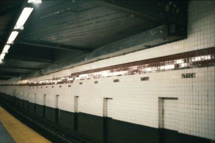
Archer Avenue/Southeast Queens Line[edit]
Southeast Queens Line | ||||||||||||||||||||||||||||||||||||||||||||||||||||||||||||||||||||||||||||||||||||||||||||||||||||||||||||||||||||||||||||||||||||||||||||||||||||||||||||||||||||||||||||||||||||||||||||||||||||||||||||||||||||||||||||||||||||||||||||||||||||||||||||||||||||||||||||||||||||||||||||||||||||||||||||||||||||||||||||||||||||||||||||||||||||||||||||||||||||||||||||||||||||||||||||||||||||||||||||||||||||||
|---|---|---|---|---|---|---|---|---|---|---|---|---|---|---|---|---|---|---|---|---|---|---|---|---|---|---|---|---|---|---|---|---|---|---|---|---|---|---|---|---|---|---|---|---|---|---|---|---|---|---|---|---|---|---|---|---|---|---|---|---|---|---|---|---|---|---|---|---|---|---|---|---|---|---|---|---|---|---|---|---|---|---|---|---|---|---|---|---|---|---|---|---|---|---|---|---|---|---|---|---|---|---|---|---|---|---|---|---|---|---|---|---|---|---|---|---|---|---|---|---|---|---|---|---|---|---|---|---|---|---|---|---|---|---|---|---|---|---|---|---|---|---|---|---|---|---|---|---|---|---|---|---|---|---|---|---|---|---|---|---|---|---|---|---|---|---|---|---|---|---|---|---|---|---|---|---|---|---|---|---|---|---|---|---|---|---|---|---|---|---|---|---|---|---|---|---|---|---|---|---|---|---|---|---|---|---|---|---|---|---|---|---|---|---|---|---|---|---|---|---|---|---|---|---|---|---|---|---|---|---|---|---|---|---|---|---|---|---|---|---|---|---|---|---|---|---|---|---|---|---|---|---|---|---|---|---|---|---|---|---|---|---|---|---|---|---|---|---|---|---|---|---|---|---|---|---|---|---|---|---|---|---|---|---|---|---|---|---|---|---|---|---|---|---|---|---|---|---|---|---|---|---|---|---|---|---|---|---|---|---|---|---|---|---|---|---|---|---|---|---|---|---|---|---|---|---|---|---|---|---|---|---|---|---|---|---|---|---|---|---|---|---|---|---|---|---|---|---|---|---|---|---|---|---|---|---|---|---|---|---|---|---|---|---|---|---|---|---|---|---|---|---|---|---|---|---|---|---|---|---|---|---|---|---|---|---|---|---|---|---|---|---|---|---|---|---|---|---|---|---|---|---|---|---|---|---|
| ||||||||||||||||||||||||||||||||||||||||||||||||||||||||||||||||||||||||||||||||||||||||||||||||||||||||||||||||||||||||||||||||||||||||||||||||||||||||||||||||||||||||||||||||||||||||||||||||||||||||||||||||||||||||||||||||||||||||||||||||||||||||||||||||||||||||||||||||||||||||||||||||||||||||||||||||||||||||||||||||||||||||||||||||||||||||||||||||||||||||||||||||||||||||||||||||||||||||||||||||||||||
| ||||||||||||||||||||||||||||||||||||||||||||||||||||||||||||||||||||||||||||||||||||||||||||||||||||||||||||||||||||||||||||||||||||||||||||||||||||||||||||||||||||||||||||||||||||||||||||||||||||||||||||||||||||||||||||||||||||||||||||||||||||||||||||||||||||||||||||||||||||||||||||||||||||||||||||||||||||||||||||||||||||||||||||||||||||||||||||||||||||||||||||||||||||||||||||||||||||||||||||||||||||||
Background[edit]
Description[edit]
Hillside Avenue Connector
Jamaica El Removal
This would have used an existing provision east of Jamaica Center, and necessitated the installation of two dedicated subway tracks, construction of new stations and/or the conversion of existing facilities along the right-of-way.[1][2][3]
The Southeast Queens portion of the line would split from the IND Queens Boulevard Line using pre-existing bellmouths at Briarwood, would go to Springfield Boulevard in southeastern Queens using the LIRR Atlantic Branch, with a transfer to the LIRR at Jamaica. This Southeast Queens extension, which would have used the upper level of the planned bi-level Archer Avenue subway, was the most important of several proposed lines along LIRR branches; it was originally intended to extend to the Laurelton LIRR station.[4][5][6][7][8][9] While the upper level of the Archer Avenue subway would serve Queens Boulevard trains to Southeast Queens, the lower level for the BMT, which was to be built as part of Phase 2 as Route 133, would extend under Archer Avenue to 188th Street in Hollis.[5][6][7][8][9] Both lines were only built to Jamaica Center; a LIRR extension would have necessitated the construction of new stations or the conversion of existing facilities along the right-of-way, as well as added additional capacity on which to run trains.[7][9][10]
History[edit]
Cutback to Parsons–provision for line and Railroad Park

The Archer Avenue Subway was initially conceived as part of the 63rd Street Line and planned "Southeast Queens" subway, as well as the planned Jamaica El replacement.[11]
Construction on the Archer Avenue subway began on October 23, 1973 at 159th Street and Beaver Road, just south of Archer Avenue, paving the way for the southeast Queens subway line and the demolition of the Jamaica Avenue Elevated from 129th Street to the 168th Street terminal.[12] The first tunnel between the Jamaica Avenue Elevated and the Archer Avenue subway was holed through in October 1977. The second tunnel connection holing through of the Archer Avenue subway tunnels occurred in December 1977. In October 1979, groundbreaking for a 1,300 feet (396 m) cut-and-cover section of the Archer Avenue line occurred, which would connect the line with the IND Queens Boulevard Line. This section also included the Jamaica–Van Wyck station. Most of the project was constructed via cut-and-cover methods, with portions of the lines excavated with tunneling shield methods.[13]
On November 7, 1974, the MTA announced that five subway expansion projects, including the Archer Avenue Line and the Southeast Queens Line would delayed due to the inflation of costs, the unavailability of public funds, and environmental considerations. The IND Archer Avenue Line's completion to Springfield Boulevard was expected to be completed in 1980 or 1981, and the BMT Archer Avenue Line was expected to open in 1982 or 1983.[14] Completion of the project was put at more risk when the project ran out of funding due to the 1975–1976 fiscal crisis that affected the city,[15] and the project's scope had to be reduced.[16] At the time, the MTA did not have a consistent funding source; its five-year Capital Programs were implemented in 1982 due to further decline in the subway after 1975–1976.[17] The MTA's proposed "40 miles of new subway" in Queens was reduced to 15 miles of tracks,[18] and at the end, only three lines were even constructed: the 63rd Street Line, Archer Avenue Line, and portions of the SAS.[15] By May 1976, the Archer Avenue segment was projected to be completed in 1983.[19]
The Jamaica elevated between Queens Boulevard and 168th Street was closed in September 1977.[20]
In October 1980, the MTA considered stopping work on the line, due to its budget crisis and the bad state of the existing subway system.[21] Originally set to be opened in 1980, the line kept getting delayed, and by the late 1970s, the opening was delayed to 1983, then to 1985 or 1986.[22] Progress of the Archer Avenue Line temporarily stopped in March 1982, when on March 5, part of the tunnel caved in around the vicinity of Archer Avenue and 138th Street, where one construction worker was killed, and three others narrowly escaped injury.[23]
In addition, the line was also delayed to disagreements over the quality of concrete and the leakage of water into the tunnels, the speed of construction, and the federal Urban Mass Transportation Administration's reluctance to provide funding for the line based on the tunnels' condition. Still, construction was completed a year ahead of schedule, in 1983.[24] Due to the city's fiscal crisis, the planned subway line was truncated to Jamaica Center–Parsons/Archer,[25] with provisions existing for the planned extension of the upper level along the LIRR Locust Manor right-of-way.[26][27] The line opened on December 11, 1988, at a cost of nearly five times its original budgeted cost, and severely cut back to a length of 2 miles (3 km).[25][28] Since the line had been abridged to Jamaica Center, the "modern terminal" at Springfield Gardens had not been built, severely reducing train capacity on both levels to twelve trains per hour.[25]
Later plans[edit]
Select Bus Service
References[edit]
- ^ * "New Line May Get Double Trackage: Transit Unit Studies Shift on Queens Super-Express". The New York Times. February 21, 1971. Retrieved September 26, 2015.
- Program for Action maps from thejoekorner.com
- "1968 NYCTA Expansion Plans (Picture)". Second Avenue Sagas. Retrieved October 31, 2016.
- ^ * "Full text of "Metropolitan transportation, a program for action. Report to Nelson A. Rockefeller, Governor of New York."". Internet Archive. November 7, 1967. Retrieved October 1, 2015.
- "1970s NYC Subway Map That Never Was – Business Insider". Business Insider. June 18, 2013.
- Burks, Edward C. (March 20, 1970). "Board Approves Downtown Subway Route and East Side Loop". The New York Times. Retrieved September 26, 2015.
- Queens Subway Options Study, New York: Environmental Impact Statement. United States Department of Transportation, Metropolitan Transportation Authority, Urban Mass Transit Administration. May 1984. pp. 83–. Retrieved July 10, 2016.
- ^ Burks, Edward C. (October 24, 1973). "Work Begun on Queens Subway Extension". The New York Times. Retrieved September 26, 2015.
- ^ "Regional Transportation Program" (PDF). Metropolitan Transportation Authority. Retrieved July 26, 2016.
- ^ a b "1968 NYCTA Expansion Plans (Picture)". Second Avenue Sagas. Retrieved December 1, 2013.
- ^ a b Feinman, Mark. "The New York Transit Authority in the 1970s". nycsubway.org. Retrieved April 23, 2015.
- ^ a b c Joseph B. Raskin (November 1, 2013). The Routes Not Taken: A Trip Through New York City's Unbuilt Subway System. Fordham University Press. ISBN 978-0-8232-5369-2. Retrieved August 12, 2015.
- ^ a b Johnson, Kirk (December 9, 1988). "Big Changes For Subways Are to Begin". The New York Times. Retrieved July 14, 2015.
- ^ a b c "New Line May Get Double Trackage: Transit Unit Shift on Queens Super-Express". The New York Times. February 21, 1971. Retrieved September 26, 2015.
- ^ Burks, Edward C. (October 24, 1973). "Work Begun on Queens Subway Extension". The New York Times. Retrieved September 26, 2015.
- ^ "New Line May Get Double Trackage: Transit Unit Shift on Queens Super-Express". The New York Times. February 21, 1971. Retrieved September 26, 2015.
- ^ Burks, Edward C. (October 24, 1973). "Work Begun on Queens Subway Extension". The New York Times. Retrieved September 26, 2015.
- ^ Archer Ave Route (proposed) Construction, Queens: Environmental Impact Statement. Urban Mass Transit Administration, United States Department of Transportation. August 1973. Retrieved August 6, 2016.
- ^ Montgomery, Paul L. (November 8, 1974). "5 M.T.A. PROJECTS POSTPONED TO '87". The New York Times. ISSN 0362-4331. Retrieved December 25, 2016 – via New York Times Archive.
- ^ a b Feinman, Mark. "The New York Transit Authority in the 1970s". nycsubway.org. Retrieved April 23, 2015.
- ^ Joseph B. Raskin (November 1, 2013). The Routes Not Taken: A Trip Through New York City's Unbuilt Subway System. Fordham University Press. ISBN 978-0-8232-5369-2. Retrieved August 12, 2015.
- ^ Seaman, Mark; de Cerreño, Allison L. C.; English-Young, Seth. "From Rescue to Renaissance: The Achievements of the MTA Capital Program 1982 - 2004" (PDF). nyu.edu. Rudin Center for Transportation Policy & Management. Retrieved October 14, 2016.
- ^ Lichtenstein, Grace (May 9, 1978). "Planned 40-Mile Queens Subway, Cut to 15, is Costly and Behind Time". The New York Times. p. 68. Retrieved October 20, 2011.
- ^ Burks, Edward C. (July 29, 1976). "New Subway Line Delayed 5 or 6 Years". The New York Times. p. 35. Retrieved October 20, 2011.
- ^ Dembart, Lee (September 9, 1977). "A Sentimental Journey on the BMT..." The New York Times. Retrieved July 2, 2015.
- ^ Andelman, David A. (October 11, 1980). "Tunnel Project, Five Years Old, Won't Be Used". The New York Times. p. 25. Retrieved October 20, 2011.
- ^ "Jamaica Subway Under Way". The New York Times. July 8, 1973.
- ^ "Dies in Cave-In: Sand Avalanche Buries Worker in Queens IND," New York Daily News, March 5, 1982, page 3.
- ^ Schmalz, Jeffrey (August 18, 1985). "U.S. HOLDS UP AID FOR SUBWAY WORK". The New York Times. Retrieved October 1, 2015.
- ^ a b c Johnson, Kirk (December 9, 1988). "Big Changes For Subways Are to Begin". The New York Times. Retrieved July 14, 2015.
- ^ Burks, Edward C. (October 24, 1973). "Work Begun on Queens Subway Extension". The New York Times. Retrieved September 26, 2015.
- ^ Burks, Edward C. (March 9, 1975). "Building Progresses On Subway In Jamaica". The New York Times. Retrieved September 27, 2015.
- ^ "New Subway Line Finally Rolling Through Queens," Newsday, December 11, 1988, page 7.
External Links[edit]
- Engineering News-record, Volume 209, Issues 9-14
- Planning and Implementing Bus Route Changes To Serve New Rapid Transit Lines: The Archer Avenue Experience in New York
LaGuardia Airport Subway Extension[edit]
Background[edit]
History of transportation to LaGuardia
AirTrain Plan from LGA – JFK – Manhattan
Deal
Description[edit]
Planned routes to the airport
History[edit]
LaGuardia Airport Subway Access Study[edit]
In July 1998, the Metropolitan Transportation Authority (MTA), the Port Authority of New York and New Jersey, and the offices of the Governor, Mayor, and Queens Borough President signed a Memorandum of Agreement to improve airport access to LaGuardia Airport. As part of the agreement, a study, the LaGuardia Airport Subway Access Study (LASA), was initiated to examine subway alternatives which could provide a one-seat ride between LaGuardia Airport and Manhattan's Central Business District, reduce travel times to the airport, and to increase transit ridership.[5]
The state agreed to spend $100 million on the project. Four possible routes for extending the BMT Astoria Line (N train) were outlined at a public meeting in September 1998. Two of the proposals would have extended the N from its terminal, Astoria–Ditmars Boulevard. The first option would have extended the line underneath Ditmars Boulevard to the airport. The second would have extended the elevated structure north along 31st Street, before turning east on 19th Avenue to reach the airport. The two other options would have been constructed as branches of the Astoria Line. One would have branched off of the Astoria Line at Astoria Boulevard, and then run along the Grand Central Parkway to the airport. The final route would have branched at off east of Queensboro Plaza, running through Sunnyside Yard, along the Amtrak Hell Gate Line, and then alongside St. Michael's Cemetery to the Grand Central Parkway. This option would not stop at Marine Air Terminal. The MTA chose the N as the route to extend to the airport because the BMT Astoria Line has an unused third track which would allow service to LaGuardia to bypass many stops during rush hours. In addition, the N would provide one-seat rides from the airport to Midtown and Lower Manhattan. In July 1998, the MTA planned to produce a Draft Environmental Impact Study by December 15, 1998, with a Final Environmental Impact Study ready in March 2000.[6]
On March 30, 1999, a notice of intent to start an Alternative Analysis/Draft Environmental Impact Statement for the project was filed.[5][7] Two subway extensions were initially considered. The 19th Avenue alternative would have extended the BMT Astoria Line north along 31st Avenue to 20th Avenue, before curving east over ConEdison property to 19th Avenue, along which it would run until 45th Street, where the line would turn north and enter a tunnel. The line would then have a station at the Marine Air Terminal, pass around the runway at the western side of the airport, and continue on an aerial guideway, with a stop at the Central Terminal Building, and a stop to serve both the USAir and Delta terminals. The Sunnyside Yard alternative would branch off the BMT Astoria Line at Queensboro Plaza, and run over the north side of Sunnyside Yard on an aerial guideway, before passing over and then running alongside the eastern side of the Hell Gate Line, part of the Northeast Corridor. The line would turn east at about 30th Avenue, and run along the north side of that avenue before heading north along the Brooklyn-Queens Expressway. The alignment would then enter an open cut as it continues on the southern side of the Grand Central Parkway, and cross over the parkway to enter the airport, with stations at the Central Terminal Building and a joint USAir/Delta terminals station.[8]
In April 1999, the MTA issued a Scoping Memorandum for the LASA study, and eliminated two of the four considered options. The two remaining options were the elevated extension of the Astoria Line from Ditmars Boulevard, and the option running through Sunnyside Yard. Though $100 million was pledged by the state for the project, additional funding was required to build either of the two remaining options. The 19th Avenue option was estimated to cost $1.04 billion, while the Sunnyside Yard alignment would have cost $1.8 billion.[9]
Since all four proposed extensions of the N to LaGuardia were strongly opposed by local residents, the MTA expanded its list of alternative ways to improve transportation to the airport that it would study in the EIS to 22. These options were released in the final scoping document in August 2000. These included four options for people movers, one for guided busways, one for Metro-North, one for ferries, one for buses, three for the Long Island Rail Road (LIRR), and eleven for the subway. Two new alignments considered included an extension of the E or 7 via the LIRR Main Line, the Brooklyn-Queens Expressway and the Grand Central Parkway to the Airport's Central Terminal, and a line connecting to the 7 or the Port Washington Branch of the LIRR by looping around Willets Point into the airport's eastern-most terminal.[5] The study's options were expected to be narrowed in fall 2000.[10]
On September 30, 1999, the MTA Board approved the agency's $17.5 billion 2000—2004 Capital Program, which included $645 million in funding for the extension of the Astoria Line to LaGuardia Airport.[11] The inclusion of the extension was done at the request of Mayor Rudolph Guiliani, who included funding for the project in the city's budget for fiscal year 2000. In 1999, he proposed using $945 million of the city's contribution to the 2000—2004 and 2005—2009 Capital Programs for the LaGuardia extension, diverting funding that would have been used for state of good repair work.[12] The funding would have covered preliminary engineering, final design, the construction of the line outside of the airport, and a portion of the cost for the line in the airport. Stations would have been provided at the Marine Air Terminal, the Central Terminal, and the East End terminals. The acquisition of additional subway cars and the completion of the line were to take place after 2004.[13]
In March 2000, the AA/DEIS was expected to be completed in Spring 2001, with a preferred alternative to be selected in fall 2001. The MTA had submitted an application to the Federal Transit Administration for federal funding for the selected alternative from the New Starts program.[14]
In June 2001, the MTA narrowed the alternatives to extensions of the N to the airport, the construction of a people mover from Ditmars Boulevard, and a guided busway via the Queensboro Bridge and the Grand Central Parkway. Extensions of the N were three of the four top rated alternatives, with the other one being a people mover option. Other options were eliminated since they were reliant on subway and rail lines already at capacity, or as they did not provide a one-seat ride to Lower Manhattan. The MTA at the time had $50 million allocated for the project's environmental review and engineering, and planned to spend $585 million on the line's construction in 2004.[15]
Following the September 11 attacks, the MTA redirected its focus to projects to rebuild Lower Manhattan, and deprioritized the extension to LaGuardia Airport.[16] In July 2004, the project was formally killed, allowing funding for the project to be redistributed.[17]
Suspension of plan[edit]
The LaGuardia Airport Subway Access (LASA) alternatives analysis study being conducted by the Metropolitan Transportation Authority (MTA) has been suspended.
Community Opposition[19][20][21][22][23]
Later Plans[edit]
LaGuardia Link bus service[edit]
In 2009, under the Phase II of the city's Select Bus Service (SBS) program, faster bus service to LaGuardia Airport was recommended as a primary need.[24][25][26] Under the LaGuardia Airport Access Alternatives Analysis study, another SBS study which was conducted by NYCDOT in partnership with MTA Bus, New York City Transit, and the Port Authority of New York and New Jersey in 2011-2012, it was recommended that a bus route should connect the central terminals of LaGuardia and transit hubs in Jackson Heights and Woodside. At these transit hubs, transfers could be made to the subway, Long Island Rail Road and buses from the new connector route.[24][27][28][29] The reason for the creation of the study was the slow bus service on the M60, Q33, Q47, Q48, and Q72, which all went to LaGuardia Airport.[24][27][28][29]
The Q70 limited-stop bus between Woodside and LaGuardia Airport via the Jackson Heights–Roosevelt Avenue/74th Street station was implemented on September 8, 2013, replacing the portion of the Q33 local bus that went to LaGuardia Airport.[30] The Q33 was subsequently cut back to 95th Street and Ditmars Boulevard.[31][32] Although the Q70 was intended as a bus rapid transit project, for its first three years of service it was not branded as Select Bus Service (SBS) and did not employ most SBS elements, lacking ticket machines, all-door boarding, branded buses, and dedicated bus lanes.[33][34][35] The route was implemented as a limited-stop route instead, because there were regulatory issues preventing SBS implementation. It was also thought that in the interim, the combination of highway use and widely spaced stops would provide sufficient benefits.[31]
AirTrain LaGuardia[edit]
Governor Andrew Cuomo's Plan for AirTrain LaGuardia
See also[edit]
References[edit]
- ^ "It Takes Years to Get to J.F.K." The New York Times. December 26, 1992. ISSN 0362-4331. Retrieved September 6, 2017.
- ^ Macfarquhar, Neil (March 13, 1997). "Agency Says J.F.K. Rail Plan Is Ready, but Mayor Balks". The New York Times. ISSN 0362-4331. Retrieved September 6, 2017.
- ^ La Guardia International Airport and John F. Kennedy International Airport, Port Authority of New York and New Jersey Airport Access Program, Automated Guideway Transit System (NY, NJ): Environmental Impact Statement. 1994.
- ^ JFK International Airport Light Rail System: Environmental Impact Statement. 1997.
- ^ a b c "LASA Study Final Scoping Memorandum". New York City Transit. August 2000. Retrieved May 28, 2020.
{{cite web}}: CS1 maint: url-status (link) - ^ "MTR 187, One Seat Ride to La Guardia Proposed". tstc.org. Tri-State Transportation Campaign. September 4, 1998. Archived from the original on September 17, 2017. Retrieved September 3, 2017.
- ^ Manhattan East Side Transit Alternatives Study (MESA): Major Investment Study/Draft Environmental Impact Statement. United States Department of Transportation, Metropolitan Transportation Authority. August 1999. pp. 1–10.
- ^ Federal Register. Office of the Federal Register, National Archives and Records Service, General Services Administration. March 29, 1999. pp. 15197–15200.
- ^ "MTR 216, Two Ways To LaGuardia". www.tstc.org. Tri-State Transportation Campaign. April 16, 1999. Archived from the original on September 17, 2017. Retrieved September 3, 2017.
- ^ "MTR 282, Transit Planning, NY-style". www.tstc.org. Tri-State Transportation Campaign. August 21, 2000. Archived from the original on September 17, 2017. Retrieved September 3, 2017.
- ^ Lueck, Thomas J. (October 3, 1999). "M.T.A.'s Capital Plan Goes Beyond Second Ave. Subway". The New York Times. ISSN 0362-4331. Retrieved September 6, 2017.
- ^ "Transit Brief: New York City Transit's Fiscal Condition". ibo.nyc.ny.us. New York City Independent Budget Office. August 18, 1999. Retrieved May 28, 2020.
{{cite web}}: CS1 maint: url-status (link) - ^ "MTA - Capital Program Network Expansion Projects". mta.info. Metropolitan Transportation Authority. 2000. Archived from the original on June 23, 2003. Retrieved September 3, 2017.
- ^ Annual Report on New Starts: Proposed Allocations of Funds for Fiscal Year ... : Report of the Secretary of Transportation to the United States Congress Pursuant to 49 U.S.C. 5309(o)(1). Federal Transit Administration. 2000. pp. B-40.
- ^ "MTR 322, MTA Refines LaGuardia Rail Options". tstc.org. Tri-State Transportation Campaign. June 18, 2001. Archived from the original on September 17, 2017. Retrieved September 3, 2017.
- ^ Donohue, Pete (July 14, 2003). "MTA puts breaks on LaG train: Other projects favored". New York Daily News. p. 7. Retrieved May 28, 2020.
{{cite news}}: CS1 maint: url-status (link) - ^ Donohue, Pete (July 9, 2004). "MTA eying 20B fixup down tracks". New York Daily News. p. 6. Retrieved May 28, 2020.
{{cite news}}: CS1 maint: url-status (link) - ^ "LaGuardia-Manhattan link considered unlikely by MTA". TimesLedger. Retrieved September 6, 2017.
- ^ "Flashback To 1999 | www.qgazette.com | Queens Gazette". Archived from the original on August 24, 2010. Retrieved September 6, 2017.
- ^ "Marshall Favors Willets Pt. Route To LaGuardia Over 31st St. | www.qgazette.com | Queens Gazette". Retrieved September 6, 2017.
- ^ Toscano, John (July 8, 1999). "Vallone Says 'No' To N Train Extension To LaGuardia Airport". Queens Gazette. Archived from the original on March 27, 2014. Retrieved September 6, 2017.
- ^ "Revisiting an N train extension to Laguardia". Second Ave. Sagas. February 6, 2014. Retrieved September 6, 2017.
- ^ Toscano, John (December 18, 2002). "Mayor Would Bring Air Train To Manhattan". Queens Gazette. Retrieved September 6, 2017.
{{cite news}}: CS1 maint: url-status (link) - ^ a b c "Transit & Bus Committee Meeting June 2016" (PDF). www.mta.info. Metropolitan Transportation Authority. June 17, 2016. Retrieved June 17, 2016.
- ^ "Introduction to BUS RAPID TRANSIT PHASE II" (PDF). New York City Department of Transportation, Metropolitan Transportation Authority. 2009.
- ^ "BUS RAPID TRANSIT PHASE II: Future Corridors" (PDF). New York City Department of Transportation, Metropolitan Transportation Authority. June 2010. Retrieved January 1, 2016.
- ^ a b "LaGuardia Airport Access Alternatives Analysis Public Meeting #1" (PDF). nyc.gov. Metropolitan Transportation Authority, New York City Department of Transportation, Port Authority of New York and New Jersey. June 22, 2011. Retrieved December 24, 2015.
- ^ a b "LaGuardia Airport Access: Improvement Summary" (PDF). Metropolitan Transportation Authority, New York City Department of Transportation, Port Authority of New York and New Jersey. 2013. Retrieved December 26, 2015.
- ^ a b Cole, Marine (December 15, 2013). "LaGuardia bus finally takes off: Zippy new Q70 brings relief after decades of slow slog on Q33". Crain's New York Business. Retrieved June 19, 2016.
- ^ "MTA | news | Plans Follow Last Week's Announcement of Rebranding of Q70 Airport Bus Service". www.mta.info. Retrieved June 29, 2016.
- ^ a b "Transit & Bus Committee Meeting June 2013" (PDF). Metropolitan Transportation Authority. June 2013. Archived from the original on September 28, 2013. Retrieved March 9, 2016.
{{cite web}}: CS1 maint: unfit URL (link) - ^ "Revisions to LaGuardia Airport Service". Metropolitan Transportation Authority. September 8, 2013. Retrieved December 16, 2015.
- ^ "Select Bus Service" (PDF). New York City Department of Transportation, MTA New York City Transit Authority. November 2013. Retrieved December 13, 2015.
- ^ Newman, Phillip (September 16, 2013). "Take 15-minute ride to LaGuardia Airport on Q70". TimesLedger. Retrieved December 13, 2015.
- ^ "Q70: Limited-Stop Service to LaGuardia Airport". Metropolitan Transportation Authority. Retrieved December 13, 2015.
External Links[edit]
- Airport alignment rendering
- Bouduva and Associates
- Appendix B Additional Studies and Projects Authorized in TEA-21
- As of November 1998
- LaGuardia Airport Subway Access Study Interactive Elements Incorporated
- Contract Modification for engineering study July 2000
- Pols Angry Over Being Barred From MTA Meeting On N Train July 26, 2001
- March 25, 1999 Alternatives Analysis/Environmental Impact Statement of the Extension of Subway Service From Manhattan to LaGuardia Airport
- November 13, 1998 PUBLIC MEETINGS FOR LAGUARDIA AIRPORT ACCESS
- Scoping Meetings on LaGuardia Airport Subway Access May 1999
- Second Avenue Subway in the Borough of Manhattan, New York County: Environmental Impact Statement, Volume 1
- http://www.tstc.org/bulletin/pdf/mtr282.pdf
- Appendix O: Response to Comments Received on the 1999 DEIS
- Annual Report on Funding Recommendations Fiscal Year 2000
- Annual Report on Funding Recommendations Fiscal Year 2002
- Finance Committee Action Items July 2000
- MTA Board Action Items July 2000
- http://www.tstc.org/bulletin/pdf/mtr333.pdf
- http://www.tstc.org/bulletin/pdf/mtr113.pdf
East River Crossing Major Investment Study/Brooklyn-Manhattan Access[edit]
Remedy to the problems on the Manhattan Bridge-long-term solution in case the bridges couldn't be used any more
https://nysl.ptfs.com/awweb/pdfopener?md=1&did=53903#page=402
Background[edit]
|
Before 1986
1986–1988
1988–2001
|
2001–2004
2004–2013, 2014–present
2013–2014
| ||||||||||||||||||||||||||||||||||||||||||||||||||||||||||||||||||||||||||||||||||||||||||||||||||||||||||||||||||||||||||||||||||||||||||||||||||
Problems on the Manhattan Bridge
Since the tracks are on the outer part of the bridge, passing trains caused the structure to tilt and sway. The wobble worsened as train cars became longer and heavier. Eventually over years, when one train moved over the bridge one side would be 3 feet lower than the other side, severely damaging the structure. In 1956 at a cost of $30 million, a repair program was begun. Trains still crossed the bridge, but many times one of the tracks had to be closed with both routes single-tracking, further restricting the number and size of the trains crossing.[1]


Concurrent with the building of the Chrystie Street Connection (opened November 26, 1967) to connect to the north tracks, the south tracks were rerouted to the BMT Broadway Line connection, and the connecting tracks to the BMT Nassau Street Line were severed. The connection, and its related projects, opened two new stations (Grand Street and, in July 1968, 57th Street – Sixth Avenue) and added express service on the IND Sixth Avenue Line. The IND B train was extended via this new connection to the BMT West End Line in Brooklyn to replace the TT while the D was rerouted from the IND Culver Line to the BMT Brighton Line via the bridge. The N (BMT Sea Beach Line) and Q (BMT Brighton Line) trains now use the south side of the bridge for service to Broadway.[2]
Even after the 1956 repairs, the New York City Department of Transportation failed to maintain the bridge properly, and a major repair program began in 1984. Because of the large scope of these repairs, there was limited train access to the bridge, reducing the number of trains that could cross the span. The north tracks, which had been more heavily used, were closed first. This split B and D service into two sections: trains from the Bronx and upper Manhattan terminated at 34th Street – Herald Square, thus suspending express service on Sixth Avenue, while trains from Brooklyn were rerouted to the BMT Broadway Line express via the south side of the bridge. The N was rerouted via the Montague Street Tunnel.
The north tracks were reopened and the south tracks were closed simultaneously in December 1988, merging again the B and D services, rerouting the Q train to Sixth Avenue, and suspending, and returning express service on the Broadway, and Sixth Avenue Lines, respectively. After an 18-month delay of procurements, the New York City Transit Authority and politicians pressured the DOT to resume N train service on the bridge's south side on September 30, 1990, despite warnings from engineers that the structure was unsafe and major repairs still had to be made.[3][4] On December 27, state inspectors forced south side service to be rerouted via the tunnel again after discovery of corroded support beams and missing steel plates.[3] Following the controversial firing of the city's deputy commissioner for bridges, David Steinberger and his administrative assistant David Bronstein by Transportation Commissioner Lucius Riccio after this closing, the New York City Council's Transportation committee held an inquiry into the decision to restore subway service on the Manhattan Bridge south side (as well as the safety of all New York City bridges) with reluctance from Riccio and Mayor David Dinkins.[4][5][6][7] They found that the Transportation Department and Transit Authority's lack of cooperative inspection were a major contributor for the deteriorating conditions.[8][9][10]
A projection for a reopening date was initially made for 1995.[11] That year, the north side was closed during off-peak hours for six months, rerouting the Q to Broadway and cutting D service from Brooklyn and B service from Manhattan. The south side finally reopened on July 22, 2001, whereby the north side was again closed, returning the Q to Broadway (thus returning express service on the Broadway Line), introducing the new W train (which ran on the West End Line), and cutting B and D service from Brooklyn. The south side was closed on weekends from April to November 2003, rerouting the Q via the Montague Street Tunnel.[12] On February 22, 2004, the north side reopened, and all four tracks were in service simultaneously for the first time in 18 years. B and D trains returned to Brooklyn, but switched southern routes (B to the BMT Brighton Line, and D to the BMT West End Line), the N train once again used the bridge for travel, and the W train no longer ran in Brooklyn.[13][14][15]
1982–1986 Random closures
1986–1988 North Side Closure
1988–1990 South Side Closure
1990 Brief Reopening
1990–1995 South Side Closure
1995 Midday and Weekends Closure
1995-2001 South Side Closure
2001–2004 North Side Closure
Problems on the Williamsburg Bridges –
1988 – sudden outage
1999 – planned outage
Describe outages and service patterns
Problems with bridges
Impact on Broadway service – no express, Canal Street, decreased ridership
Montague Tunnel/Nassau Service
Description[edit]
Rutgers Street Tunnel–DeKalb Avenue Track Connection[edit]
In 1953, when the bridge was suffering structurally from the stress of the passing subway trains, and needing major repairs, the newly created New York City Transit Authority proposed to construct a connecting tunnel from the DeKalb Avenue station's local tracks, and running them directly under Tillary Street, connecting them to the IND Subway's Rutgers Street Tunnel Subway Line before reaching the York Street Station in Brooklyn. However this project was cancelled since they could not raise the $27 million dollars needed for this project at the time.
Transfers[edit]
Other alternatives[edit]
A draft NYC Transit Authority study on subway service between Brooklyn and Manhattan says the constant heavy-duty maintenance required to keep the Manhattan Bridge useable makes it imperative for Transit to make optimal use of East River subway tunnels. The "East River Crossing Study" recommends that a track connection be built beneath Brooklyn to permit trains now routed over the Manhattan Bridge to run through the Rutgers St. subway tunnel, now used only by the F-line subway. The study argues that straphangers will be served best if such a connection is accompanied by a variety of shifts in service that better organize use of the five Brooklyn-Lower Manhattan subway tunnels. These would include new connections/transfers between the Lawrence Street and Jay Street stations in downtown Brooklyn, and between B, D and Q trains and uptown Lexington Ave. subways at Manhattan's Broadway-Lafayette station. The study says that, in addition to improving Brooklyn-Manhattan subway service overall, the measures would also provide important capacity and flexibility in the event of future partial or full Manhattan Bridge closures. The study appears to regard the likelihood of such closures as high.
The Metropolitan Transportation Authority (MTA) and New York City Transit (NYCT) have completed a Major Investment Study to examine the preliminary operating and engineering options for improving the capacity and flexibility of subway services crossing the East River. The distribution among the subway lines crossing the East River is uneven and some crossings are congested while others have unused capacity. One of the major goals of the study was to provide alternatives to current NYCT subway service over the aging Williamsburg and Manhattan bridges. The MIS reviewed approximately 68 strategies and ultimately recommended Manhattan Bridge Alternative 5 (MBA 5) as the preferred alternative to be advanced for further analysis. The full MBA5 Alternative has an estimated capital cost of approximately $600 million, and an estimated operating cost of $0.4 million. The MBA5 Alternative is comprised of five components. These include: Rutgers Street Tunnel-DeKalb Avenue Track Connection; Lawrence Street-Metro Tech to Jay Street Transfer; Broadway-Lafayette and Bleecker Street Transfer; Revise Existing Service Pattern on the D/Q/N lines; and lengthen the No. 3 line trains. The MBA5 Alternative also recommended adding approximately 12 additional passenger trains per hour. These components are important to NYCT system improvements. However, the Rutgers Street-DeKalb Avenue Track Connection provides the major benefits of the MBA5 Alternative and its ability to provide critically needed system flexibility and additional capacity. In addition, it should be noted that while the study has been completed and a recommended alternative identified, the MTA/NYCT is focusing on the engineering of the Broadway-Bleecker Street and Jay Street transfers as distinct components. These activities have been programmed into the MTA’s FY 2000 Capital Program.
History[edit]
Initiation of study
A $622,733 contract was awarded to LS Transit and URS Consultants for the study.[16]
Reduction of options
Reduced Plan
Results[edit]
As a result of this study, NYCT has begun design work for the Broadway-Bleecker Street passenger transfer, as well as the rehabilitation of the Bleecker Street Station, which will make the complex ADA compliant. Construction is expected to cost approximately $50 million and is scheduled for inclusion in MTA’s 2005-2009 Capital Program. NYCT has also begun work for the Jay Street-Lawrence Street passenger transfer, as well as the rehabilitation of both stations to make both stations ADA compliant. Construction is expected to cost approximately $165 million and is scheduled for inclusion in MTA’s 2005-2009 Capital Program.
Broadway Lafayette/Bleecker Street Transfer[edit]
This station had a unique feature in the system in that a transfer to the Lexington Avenue line from the IND platform was only possible in the southbound direction until late September 2012.[17] A free transfer passageway from the downtown IRT platform to the IND platform opened on May 19, 1957 after the IRT station's platforms were lengthened.[18][19] This "one-way" transfer existed for about 50 years, as the connection from the IND platforms to the downtown IRT platform was purely coincidental, and was not originally intended when first built.[19] A large offset of that station's platforms could not permit the construction of a full transfer to both platforms of the Bleecker Street station, when the free transfer was created in 1957. As a result, a free transfer was not available to the northbound platform and access to it required a one-block walk north to Bleecker Street and payment of an additional fare except to Unlimited-Ride MetroCard holders.[20]
A transfer between the IND platforms and the uptown IRT platform had been planned since 1989.[20] However, it was not built until the Metropolitan Transportation Authority's 2005–2009 capital program allocated $50 million to renovate the complex, which included installation of ADA-accessible elevators and a free transfer to the uptown IRT platform. Prior to the reconstruction, the Broadway–Lafayette Street station only connected only to the southbound platform of Bleecker Street at the extreme south end.[17] On March 26, 2012, the uptown platform was shifted 300 feet south to the newly constructed extension and the 1950s northern extension closed at the same time. On the same day, the MTA had stated that the transfer project to the uptown Bleecker Street platform would be completed at the end of June.
The uptown transfer did not fully open until September 25, 2012. The overall cost of the rehabilitation project had climbed to US$135 million.[21] On the same day, an escalator connected the uptown platform of the Broadway-Lafayette Street station with a new transfer mezzanine that connected riders to the uptown platform of the Bleecker Street station. In addition, elevators were installed to connect the various platforms of the IND station, and those of Bleecker Street.[22][23][24] The transfer boasted new elevators and escalators to the IND station below. The street-level elevator accesses the southbound IRT platform directly, while four other elevators in the station connect each IND platform with each IRT platform.[25]
Jay Street–Lawrence Street Transfer[edit]
The complex consists of two distinct, perpendicular stations, formerly known as Jay Street–Borough Hall and Lawrence Street–MetroTech, which used to be unconnected. As part of a station renovation completed in 2010, the Metropolitan Transportation Authority built a passageway to connect the two stations and made the complex fully ADA-accessible.
In March 2007, a contract was finally awarded for the renovation of the station.[26] The MTA constructed a 175-foot (53 m) transfer passageway as part of its 2005–2009 Capital Program.[27] The $164.5 million project also brought the stations into compliance with the Americans with Disabilities Act of 1990[26][28] and cosmetically improved the upper mezzanine.[27] With the opening of the transfer on December 10, 2010, the complex was given its present name.[26][29][30][31] The transfer was projected to benefit an estimated 35,000 daily passengers.[26]
References[edit]
- ^ "First Aid For An Ailing Bridge." Popular Mechanics, February 1956, pp. 126-130.
- ^ "www.nycsubway.org".
- ^ a b Hevesi, Dennis (December 28, 1990). "Hazards Halt Manhattan Bridge Subway Line". The New York Times. Retrieved March 18, 2010.
- ^ a b Sims, Calvin (January 8, 1991). "New York Reopened Bridge Subway Line In Spite of Warnings". The New York Times. Retrieved March 18, 2010.
- ^ Sims, Calvin (January 11, 1991). "New York Dismisses Official Who Attacked Bridge Cuts". The New York Times. Retrieved March 18, 2010.
- ^ Sims, Calvin (January 12, 1991). "2d Official In Bridge Unit Is Discharged". The New York Times. Retrieved May 22, 2010.
- ^ Stanley, Alessandra; Sims, Calvin (January 14, 1991). "Bridge Battle: Clashes and Flurry of Memos". The New York Times. Retrieved May 22, 2010.
- ^ Lee, Felicia R. (January 30, 1991). "Council Given Data It Sought, Deputy Mayor Says". The New York Times. Retrieved March 18, 2010.
- ^ Sims, Calvin (January 31, 1991). "Memos Not Released by Dinkins Are Said to Call Bridges Unsafe". The New York Times. Retrieved March 18, 2010.
- ^ Sims, Calvin (March 1, 1991). "Bridge Troubles Are Linked To a Lack of Coordination". The New York Times. Retrieved March 18, 2010.
- ^ "Update: Those Weeklong Repairs May Be Done by '95". The New York Times. May 17, 1992. Retrieved March 18, 2010.
- ^ Manhattan Bridge Service Changes - The New York Times
- ^ Four-track Service Returns To Manhattan Bridge, MTA Employee Newsletter.
- ^ "The JoeKorNer Brochures".
- ^ "B D M N Q R W Weekday Service Manhattan Bridge Map" (PDF). mta.info. Metropolitan Transportation Authority. February 2004. Archived from the original (PDF) on February 5, 2004. Retrieved September 18, 2016.
- ^ NYC Transit Committee Agenda June 1994. New York City Transit. June 10, 1994. pp. C-1.
- ^ a b With connection to No 6 line, a Manhattan transfer is coming New York Times Retrieved August 2, 2006
- ^ "Passage Links Subways". Retrieved October 10, 2016.
- ^ a b Chan, Sewell (May 7, 2005). "With Connection on No. 6 Line, a Manhattan Transfer Is Coming". The New York Times. Retrieved April 27, 2011.
- ^ a b The New York Transit Authority in the 1980s
- ^ "Bleecker Street Platform Shifts". MTA.info. March 26, 2012. Retrieved March 27, 2012.
- ^ Redwine, Tina (September 25, 2012). "Transfers At Bleecker Street Are No Longer A Bleak Situation". NY1. Archived from the original on January 30, 2013. Retrieved September 26, 2012.
- ^ Matt Flegenheimer (September 24, 2012). "A Vexing Flaw in the Subway Is Finally Fixed". New York Times. pp. A18–A19. Retrieved September 28, 2012.
- ^ http://www.wai.com/project.aspx?type=300&cat=320&id=1729
- ^ "Bleecker Street Platform Shifts". MTA.info. March 26, 2012. Retrieved March 27, 2012.
- ^ a b c d "Welcome to the New Jay Street/MetroTech Station!". mta.info. Metropolitan Transportation Authority. December 10, 2010. Retrieved August 19, 2016.
- ^ a b Schlanger, Zoe. "Photos: New Jay St.-Metro Tech Station Links A/C/F to the R". Gothamist. Retrieved August 19, 2016.
- ^ Campbell, Andy (October 13, 2010). "Jay Street to drop 'Boro Hall' and add 'Metrotech'". New York Post. Archived from the original on October 16, 2010.
- ^ Mancini, John (December 10, 2010). "MTA Unveils New Jay Street/MetroTech Station In Downtown Brooklyn". NY1. Archived from the original on March 4, 2011. Retrieved December 12, 2010.
- ^ John Mancini (December 3, 2010). "Long-Awaited Subway Transfers To Open In Brooklyn, Queens". NY1. Archived from the original on March 7, 2012. Retrieved December 12, 2010.
- ^ "Introducing Jay St-MetroTech Station". MTA.info YouTube page. December 10, 2010. Retrieved December 12, 2010.
External Links[edit]
- ENR, Volume 232, Issues 1-12
- New York State Contract Reporter, Volume 5
- http://www.tstc.org/bulletin/19970829/mtr14010.htm
- Proceedings of the Seventh TRB Conference on the Application of Transportation Planning Methods March 1999
- http://www.pcac.org/wp-content/uploads/2014/09/1997-Comparitive-Study-MTA-Financing.pdf
- Appendix B Additional Studies and Projects Authorized in TEA-21
- BRIDGE TRAINS MAY MAKE TRACKS
- Erictb.info
Lower Manhattan Access Study[edit]
Lower Manhattan Access Alternatives MIS/DEIS
The study looked at three corridors to Lower Manhattan-on Manhattan's east side from the Grand Central Terminal area, the west side from the Penn Station/Port Authority Bus Terminal area, and from Atlantic Terminal in downtown Brooklyn.
The alternatives would include "high quality shuttle" service from Jamaica or Grand Central Terminal, such as by using the BMT Broadway Line or the Atlantic Branch, new subway service, including the Second Avenue Subway, and extended commuter rail service from Grand Central and/or Jamaica.
Initially, two new subway options were looked at.
Short-term alternatives studied included new connections between major activity centers and transit stations.
The construction of the Second Avenue Subway was found to be the best way to improve access to Lower Manhattan for suburban commuters.
http://web.mta.info/capital/sas_docs/feis/appendixa.pdf
http://web.mta.info/capital/sas_docs/final_summary_report.pdf
A spur to GCT from SAS was evaluated in the study and was found to attract few riders from the Lexington Avenue Line.
http://web.mta.info/capital/sas_docs/feis/chapter23.pdf
As a result of the study, the MTA developed ways to maximize service on the Lexington Avenue Line.
http://www.renewnyc.com/plandesdev/transportation/pdf/chapter3.pdf
One of the TSM alternatives in the study was the construction of the Dey Street Passageway
http://web.mta.info/capital/fc_docs/feis/chapters/references.pdf
The study was initiated in November 1997. The analysis and recommendations of the study were incorporated in the Second Avenue Subway's SDEIS in 2003, and one of the TSM proposals, the Dey Street Passageway, was incorporated into the Fulton Street Transit Center project.
The transit center idea came out of the study.
The project website was lowermanhattan.com
Project schedulehttp://web.archive.org/web/20000819123236/http://www.mta.nyc.ny.us:80/planning/lmas/studyschedule.html
The top 5 alternatives were a commuter rail extension from Grand Central Terminal to Flatbush Terminal via Lower Manhattan, a Second Avenue Subway line with a shuttle to Grand Central and a branch to Brooklyn, converting the Atlantic Branch to rapid transit, a commuter rail extension from Grand Central Terminal to Flatbush Terminal via Lower Manhattan, and a shuttle from Grand Central Terminal to Lower Manhattan and Flatbush Terminal
Alternative LL1 — Grand Central Terminal through running service to Lower Manhattan
Alternative LL2 — Full-length Second Avenue Subway with links to Grand Central Terminal to Brooklyn via Williamsburg Bridge, Montague Street Tunnel or other crossing
Alternative LL3 — Convert the Atlantic Branch to subway operation
Alternative LL4 — This was a shuttle alternative
Alternative LL5 — Another commuter rail alternative to Lower Manhattan
Alternative LL8 — Metro-North trains via the BMT Broadway express tracks to Lower Manhattan (eliminated due to the lack of capacity on the Broadway Line due to competition from the reopening of the Manhattan Bridge, a branch of the SAS, the LaGuardia Airport link)
There was an alternative to connect the Second Avenue Subway with a tunnel under the East River, connecting to the Atlantic Branch
Transportation Systems Management alternatives
TSM 12 Bringing C service back to the Bronx
TSM 28 Utica Avenue Branch of Eastern Parkway IRT
There was a TSM description for the Bay Ridge Branch
- TSM because it was less expensive than build alternatives
8 potential sites were found for possible station sites in Lower Manhattan, and four were eliminated. Two more sites were eliminated, limiting them to the sites at Water Street and the WTC-1 site. There was a New York Stock Exchange site that had major issues.
Background[edit]
Improve service to Lower Manhattan
History[edit]
References[edit]
External Links[edit]
- Major Investment Study/Environmental Impact Statement on the Lower Manhattan Access Alternatives Study June 1998
- LMAS Factsheet July 1998
- Lower Manhattan Access News AUGUST 1998 BULLETIN #2
- LMAS Study Documents
- Lower Manhattan Access News March 1999 BULLETIN #3
- Public Scoping Meetings LMAS DEIS
- https://web.archive.org/web/20000915213229/http://www.mta.nyc.ny.us:80/planning/lmas/pdf/bulletin4.pdf
- https://web.archive.org/web/20000915213237/http://www.mta.nyc.ny.us:80/planning/lmas/pdf/goals.pdf
- https://web.archive.org/web/20000915213646/http://www.mta.nyc.ny.us:80/planning/lmas/pdf/longlist.pdf
- https://web.archive.org/web/20000915213249/http://www.mta.nyc.ny.us:80/planning/lmas/pdf/pacminutes1.pdf
- https://web.archive.org/web/20000915213328/http://www.mta.nyc.ny.us:80/planning/lmas/pdf/pacminutes4.pdf
- https://web.archive.org/web/20000915213359/http://www.mta.nyc.ny.us:80/planning/lmas/pdf/altsub1summary.pdf
- https://web.archive.org/web/20000915213415/http://www.mta.nyc.ny.us:80/planning/lmas/pdf/altsub2summary.pdf
- https://web.archive.org/web/20000915213448/http://www.mta.nyc.ny.us:80/planning/lmas/pdf/altsub3summary.pdf
- https://web.archive.org/web/20000915213509/http://www.mta.nyc.ny.us:80/planning/lmas/pdf/altsub4summary.pdf
- https://web.archive.org/web/20000915213523/http://www.mta.nyc.ny.us:80/planning/lmas/pdf/altsub5summary.pdf
- https://web.archive.org/web/20000915213535/http://www.mta.nyc.ny.us:80/planning/lmas/pdf/altsub6summary.pdf
- https://web.archive.org/web/20000915213544/http://www.mta.nyc.ny.us:80/planning/lmas/pdf/jointalt1summary.pdf
- https://web.archive.org/web/20000819123115/http://www.mta.nyc.ny.us:80/planning/lmas/pdf/sd1summary.pdf
- https://web.archive.org/web/20000915213625/http://www.mta.nyc.ny.us:80/planning/lmas/pdf/sd2summary.pdf
- Meeting Minutes PAC Public Involvement Subcommittee Meeting, April 8, 1999
- Study Schedule
- Planning Index
- Problems and Concepts
- Hard to read planning map
North Shore Railroad Study[edit]
Merge into North Shore Branch page upon completion
Background[edit]
Elimination of passenger service 1953
Elimination of freight service 1991
History[edit]
The Rehabilitation of the North Shore Railroad Line project involves conducting an Alternatives Analysis/Draft Environmental Impact Statement (AA/DEIS) to examine the feasibility of reestablishing passenger rail service along the North Shore Rail line located on Staten Island, New York. Originally, the line went from Cranford, New Jersey to the St. George Ferry terminal on Staten Island. The current project only considers the section between the Arlington Rail Yards and St. George, Staten Island, a distance of approximately 5.2 miles. This effort is part of a larger project to improve intermodal connections between New York and New Jersey to transport freight from ocean-going ships and trucks as well as passengers to a new industrial work site, the Howland Hook Marine Terminal on Staten Island. This project is also expected to stimulate economic development on Staten Island. The study will evaluate a range of alternatives including No-build, bus rapid transit, commuter rail and diesel multiple unit technology. Phases 1 and 2 of the rehabilitation project have been completed. Phase 3 consists of revitalizing the remaining portion of the rail corridor for passenger service and implementing the AA/DEIS study. Currently, the project is not in the Transportation Improvement Program/State Transportation Improvement Program. However, the North Shore Railroad Line project is part of the Corridor Level Options discussion in the draft Regional Transportation Plan for the New York City urbanized area.
Reactivation of freight service[edit]
2007
Bus Rapid Transit[edit]
References[edit]
External Links[edit]
- Feasibility Study of the Staten Island North Shore Railroad Right-of-Way PROJECT ASSESSMENT REPORT March 2004
- Staten Island Bridges Program, Modernization and Capacity Enhancement Project: Environmental Impact Statement, Volume 3 1997
Lower Montauk Branch[edit]
The westernmost portion of the Montauk Branch in Queens, known as the "Lower Montauk", runs from Long Island City to Jamaica, mostly at street level with grade crossings, passing through the neighborhoods of Maspeth, Ridgewood, Glendale, Middle Village, and Richmond Hill. This portion had nine stations, four of which were closed by 1940. The remaining five stations (Richmond Hill, Glendale, Fresh Pond, Haberman, and Penny Bridge) were closed on March 13, 1998,[1] due to low ridership and incompatibility with then-new C3 bi-level coach cars that can only use high platforms (only Richmond Hill had an actual platform, the other four stations' platforms were just pavement strips beside the tracks).
History[edit]
Early history[edit]
The Flushing Railroad was incorporated on March 3, 1852 to build from the East River in Kings County to Flushing. The line ended up being constructed to Hunters Point in Queens County after failing to gain access to Greenpoint and Williamsburgh. The line opened on June 26, 1854, including the portion of the Lower Montauk Branch west of what is now 48th Street. One station on the line, at Penny Bridge, was opened to serve Calvary Cemetery.[2]
The South Side Rail Road of Long Island was incorporated on March 23, 1860 with the intention of building from Brooklyn to Islip. On July 18, 1868, service on the South Side Rail Road was extended west to Bushwick, including the portion of the Lower Montauk Branch east of Fresh Pond.[3]
At the beginning, the South Side was looking at the New York and Flushing Railroad for access to Long Island City, but the LIRR bought it on July 13, 1867 and forced the South Side to build to Williamsburg.[4] It was then sold to the Flushing and North Side Railroad on August 11, 1868, and the New York and Flushing Railroad was operated by the Flushing and North Side until their line was completed between Winfield and Long Island City on October 8, 1869. Service between Winfield and Long Island City via Penny Bridge was abandoned on November 14, 1869.[2][5] The Hunters Point and South Side Railroad was incorporated on January 5, 1870 to connect Fresh Pond on the South Side with the East River,[6] and opened in 1872 to a point on the New York and Flushing.[7] Penny Bridge reopened as part of the South Side on August 6, 1870 when the new route began running to the old depot at 54th Avenue and 5th Street.[8] It was taken over by the South Side Railroad on September 14, 1872.[9] The South Side thus gained a new freight terminal at Long Island City by rebuilding part of the old New York and Flushing, but passenger service continued to operate to Williamsburg.[5]
The South Side entered receivership on November 9, 1873,[10] and was sold on September 16, 1874 to the Poppenhusens, who also controlled the Flushing, North Shore and Central Railroad. The South Side was reincorporated as the Southern Railroad of Long Island on September 25, 1874.[11][12]
On January 26, 1876, the Poppenhusens acquired the LIRR. The line beyond Bushwick to Williamsburg was abandoned February 26, making the line to Bushwick a branch; passenger trains operated over a new connection into the LIRR's Long Island City terminal. The LIRR leased the Southern on May 3, 1876. In June, the Southern became the main passenger route from Long Island City to Jamaica; most passenger trains on the Southern from Jamaica east to Springfield Gardens were rerouted to the LIRR's Springfield Branch.[13]
The line was double-tracked by the Brooklyn and Montauk Railroad in 1880.[9] The LIRR installed the block signal system between Long Island City and Jamaica in 1892.[14]
Freight service and the end of passenger service[edit]
In May 1974, one of the Long Island City-bound trains was cut on the Lower Montauk Branch, leaving only one round-trip going via the line.[15]
A 25-year decline in freight on Long Island led to the MTA selling the Long Island Rail Road's Freight operations to the New York and Atlantic Railway, a subsidiary of the Anacostia & Pacific, on May 11, 1997.[16] The MTA had decided that having an outside company might help bring back freight traffic, and it decided that the transfer would allow the LIRR to focus more on its passenger service.[17][18]
More capital improvement projects took place during the late 1990s. In 1998, the railroad began to replace its aging diesel and parlor car fleet, which dated from the 1940s and 1950s, by purchasing new bi-level coaches. In doing so the railroad also began to install the rest of its stations with completely ADA-accessible high-level platforms. Some of these stations were closed rather than upgraded due to low patronage.
On March 16, 1998, the LIRR closed ten stops with low ridership rather than modify them for access for people with disabilities and to accommodate the new double-decker trains. The last day of service was on March 13, the preceding Friday. Five stations were on the Lower Montauk Branch (Glendale, Penny Bridge, Haberman, Fresh Pond and Richmond Hill), and five others were in Nassau and Suffolk Counties (Holtsville, Mill Neck, Center Moriches, Quogue, and Southampton Campus). The stations in Nassau and Suffolk had between 12 and 20 passengers per day, while the stations on the Lower Montauk had daily ridership between 1 and 5 passengers.[19] Trains to Long Island City continued to operate via the Lower Montauk, but instead bypassed the stations. The trains to Long Island City ran via the Lower Montauk until November 12, 2012, when the Lower Montauk was leased to and controlled by the New York and Atlantic Railway, which from then on has used the line exclusively for freight operation. In order to keep the Lower Montauk in service, the LIRR would have had to install the expensive Positive Train Control systems along the entire length of the Lower Montauk for just one train a day. As a result, the LIRR decided that it was not worh the expense and just shifted the one passenger and couple deadhead trains to the Mainline instead. The NY&A downgraded the branch to a secondary track.[20][21][better source needed] In 2017, about two freight trains use the train every day.[22]
Reuse[edit]
[23]INSERT INFORMATION ABOUT QUEENS BYPASS PLAN
USE STUDY DOCUMENTS THAT I OWN.
As part of the Final Environmental Impact Study that was conducted in 2001 for the expansion of Long Island Rail Road service into Grand Central, an alternative option that was dismissed involved the Lower Montauk Branch. This option would have connected the Lower Montauk Branch instead of the Main Line to the 63rd Street Tunnel route. This would have required the electrification of part of the branch, and the construction of an 8,000-foot elevated structure near Sunnyside Yard.[27]
Plan for light rail[edit]
In 2015, New York City Council Member Elizabeth Crowley proposed a study that would evaluate the possible reimplementation of rail service on the Lower Montauk Branch, as well as exploring development potential to allow for passenger service, while at the same time allowing freight service along the line to continue. On December 9, 2015, Community Board 5 overwhelmingly backed her plan for rail service with a 34–6 vote. At the time, the line was planned to terminate at Atlas Park on its eastern end.[28] On February 23, 2016, Queens Borough President Melinda Katz showed her support for the plan in her writing a letter to then-MTA Chairman and CIO Thomas Prendergast.[29] On June 14, 2016, Community Board 6 voted in support of the light rail study.[30] $500,000 in funding[31] was secured for the study in June 2016,[32] and it was initiated in December 2016. The final study will be released in late summer 2017. The study is being conducted by AECOM and managed by the NYC DOT.[33] The western portion of the line is mainly used for industrial purposes, while the eastern part is used for parks and cemeteries. Due to the mix in land use and large open areas, there low population density around the line. The corridor is out of reach of subway and Long Island Rail Road service, but has several bus routes run though it.[22] The line could be in service by 2025,[34] with an expected cost of $50 million.[28]
There are multiple issues that would need to be resolved if passengers service is going to be restored to the line. Parts of the line are single-tracked or don't have adequate space for additional tracks, and the line is used by freight. Additional tracks and yard space would be needed for the two operations to coincide. There is continuous freight movement at Fresh Pond Yard, and many train movements at Maspeth Yard, and a way would have to be determined so that passengers service would not interfere with the freight movements. Passenger trains would be subjected to Federal Railroad Administration regulations which require that passenger trains meet its crashworthiness guidelines so that they can jointly operate with freight equipment. Otherwise, the two operations would have to be separated: either by time of day, or by not operating on the same tracks with greater physical track separation when operating on adjacent tracks. The line also has eleven at-grade crossings which present safety concerns and delays on road use if the line has increased service.[35]
There are multiple options for possible rail vehicles to use the lines. The initially recommended option is the use of Diesel Multiple Units (DMUs) which are self-propelled, avoid the cost of electrification, lessens the environmental impacts than those of diesel locomotives, while being FRA-compliant and requiring a limited crew. However, there would be a slightly slower deceleration and acceleration than light rail vehicles. Another option is to have electric light rail vehicles use the line, which would have to be electrified with catenary. While there would be multiple FRA compliance issues with this option, there would be good acceleration, a pollution-free operation, and small vehicles. The other two options are used for Long Island Rail Road service. The first is for Electrical Multiple Unites (EMUs) which are FRA-compliant self-propelled cars. These cars would require the installation of third rail along the line, and would have high capacity. The second would be for diesel locomotives pulling passenger cars. This would result in air and noise pollution, as well as having slower acceleration.[35]
There are two possible types of rail service that can be implemented on the corridor: regional rail service and light rail service. Currently, there are ten possible stations being considered to be built along the line. These stations are Long Island City, Greenpoint Avenue, Haberman, Grand Avenue/Flushing Avenue, Fresh Pond, Metro Mall, 80th Street, Woodhaven Boulevard, Richmond Hill, and Jamaica. Two former stations, Penny Bridge and Glendale, are not being considered for reactivation. Stations would be 200 feet long and within the existing right-of-way. The platforms would be high-level and would be ADA-accessible.[35]
A new bridge over the Newtown Creek would be required as the existing one is no longer in good repair.[34]
Concerns have been raised by people alongside the line due to vibrations resulting from the increased number of trains using the line, and the possible change of character of the neighborhoods that would result from increased transportation access.[31][34]
Stations[edit]
References[edit]
- ^ Sengupta, Somini (March 15, 1998). "End of the Line for L.I.R.R.'s 10 Loneliest Stops". New York Times. Retrieved December 24, 2007.
After 122 years, Glendale saw its last train on Friday.
- ^ a b "PENNY BRIDGE STATION". arrts-arrchives.com. Retrieved May 28, 2017.
- ^ "SOUTH SIDE RAILROAD". arrts-arrchives.com. Retrieved May 28, 2017.
- ^ "PRR Chronology, 1867" (PDF). (98.3 KiB), June 2004 Edition
- ^ a b Peter Ross, A History of Long Island From its Earliest Settlement to the Present Time, History of the Long Island Railroad, 1903
- ^ "PRR Chronology, 1870" (PDF). (57.0 KiB), January 2005 Edition
- ^ "PRR Chronology, 1872" (PDF). (86.1 KiB), February 2005 Edition
- ^ Stadler, Derek (May 4, 2014). "The History of Long Island City: Details of its Short-Lived Days as Both an Incorporated Municipality and the Major Western Terminus of the Long Island Rail Road". Retrieved May 29, 2017.
- ^ a b "THE HUNTERS POINT and SOUTH SIDE RAILROAD PHELPS - DODGE - LAUREL HILL - HABERMAN - MASPETH THE LONG ISLAND RAIL ROAD COMPANY". arrts-arrchives.com. Retrieved May 28, 2017.
- ^ "PRR Chronology, 1873" (PDF). (100 KiB), February 2005 Edition
- ^ Peter Ross, A History of Long Island From its Earliest Settlement to the Present Time, History of the Long Island Railroad, 1903
- ^ "PRR Chronology, 1874" (PDF). (95.9 KiB), March 2005 Edition
- ^ "PRR Chronology, 1876" (PDF). (116 KiB), April 2005 Edition
- ^ "FRESH POND STATION BUSHWICK JUNCTION STATION". arrts-arrchives.com. Retrieved May 28, 2017.
- ^ Stadler, Derek (April 9, 2016). "Poignant Memories of another Day: History of Rail Service to Richmond Hill and the Former Communities of Clarenceville and Morris Park". Retrieved May 29, 2017.
- ^ New York & Atlantic Railway
- ^ NY &A
- ^ "New York & Atlantic Railway". www.trainsarefun.com. Retrieved May 8, 2016.
- ^ Sengupta, Somini (March 15, 1998). "End of the Line for L.I.R.R.'s 10 Loneliest Stops". The New York Times. ISSN 0362-4331. Retrieved May 13, 2016.
- ^ gregorygrice (April 10, 2013), RARE! LIRR SW1001 Hauls Overheated Montauk Train From LIC & Back (DE30AC #411), retrieved May 13, 2016
- ^ The LIRR Says Goodbye to the Lower Montauk (The LIRR Today; March 15, 2013) (registration required)
- ^ a b "LOWER MONTAUK BRANCH RAIL STUDY Public Stakeholder Outreach January 23, 2017" (PDF). nyc.gov. New York City Department of Transportation. January 23, 2017. Retrieved May 26, 2017.
- ^ New York Affairs. Urban Periodicals, Incorporated. 1981.
- ^ Queens Subway Options Study, New York: Environmental Impact Statement. 1992.
- ^ JFK International Airport Light Rail System: Environmental Impact Statement. 1997.
- ^ La Guardia International Airport and John F. Kennedy International Airport, Port Authority of New York and New Jersey Airport Access Program, Automated Guideway Transit System (NY, NJ): Environmental Impact Statement. 1994.
- ^ East Side Access in New York, Queens, and Bronx Counties, New York, and Nassau and Suffolk Counties, New York: Environmental Impact Statement. Metropolitan Transportation Authority. 2001. pp. A-4.
- ^ a b Giudice, Anthony (December 11, 2015). "Community Board 5 supports western Queens light rail concept - QNS.com". qns.com. Retrieved May 26, 2017.
- ^ Giudice, Anthony (March 7, 2016). "Borough president pens letter to MTA in support of western Queens light rail plan - QNS.com". qns.com. Retrieved May 26, 2017.
- ^ O'Reilly, Anthony (June 16, 2016). "Excitement, approval on light rail study". Queens Chronicle. Retrieved May 26, 2017.
- ^ a b Giudice, Anthony (May 17, 2017). "Glendale residents raise concerns over proposed light rail line through their community - QNS.com". qns.com. Retrieved May 26, 2017.
- ^ Giudice, Anthony (June 14, 2016). "Western Queens light rail plan gets $500K for engineering study - QNS.com". qns.com. Retrieved May 26, 2017.
- ^ "Lower Montauk Branch Rail Study". www.nyc.gov. New York City Department of Transportation. 2017. Retrieved May 26, 2017.
- ^ a b c Cronin, Jonr (May 19, 2017). "LIC/Jamaica Light Rail Study Has Residents Concerned". queenstribune.com. Retrieved May 26, 2017.
- ^ a b c "LOWER MONTAUK BRANCH RAIL STUDY Public Meeting May 16, 2017" (PDF). nyc.dot. New York City Department of Transportation. May 16, 2017. Retrieved May 26, 2017.
- ^ Station pages linked from LIRR Stations
- ^ a b c d e Sengupta, Somini (March 15, 1998). "End of the Line for L.I.R.R.'s 10 Loneliest Stops". New York Times. Retrieved December 24, 2007.
After 122 years, Glendale saw its last train on Friday.
External Links[edit]
Fantasy Track Map[edit]
Cite error: There are <ref group=lower-alpha> tags or {{efn}} templates on this page, but the references will not show without a {{reflist|group=lower-alpha}} template or {{notelist}} template (see the help page).