User:Richardguk/imagemaptest

From Wikipedia, the free encyclopedia

Template usage: {{User:Richardguk/imagemaptest|map=...|size=...|align=...}}

  • |map= can be any UK postcode area ("AB" to "ZE", with or without the suffix " postcode area") or "LONDON" or "London" (with or without either of the suffixes " post town" or " postal district"). Defaults to LONDON post town.
  • |size=...px specifies the maximum height and/or width size. Must end in "px" (see Wikipedia:Extended image syntax#Size for syntax details). Defaults to 750x750px.
  • |align=... specifies the thumbnail alignment (wrapping right-aligned = right, wrapping left-aligned = left, non-wrapping centre-aligned = center; non-wrapping left-aligned = none). Defaults to none.
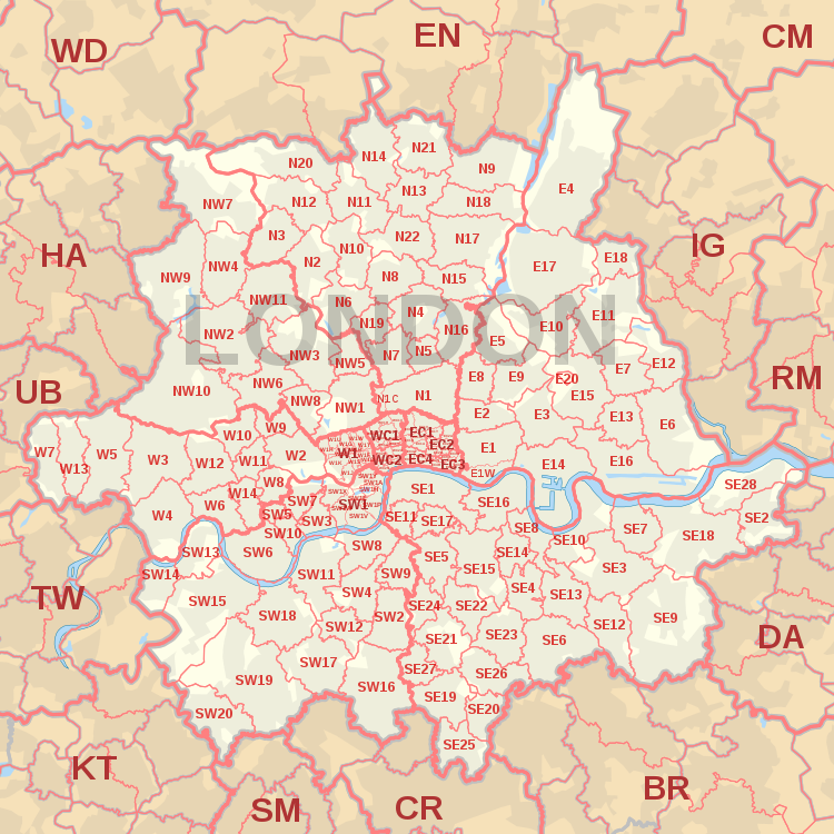
LONDON post town map, showing postcode districts, post towns and neighbouring postcode areas.AL postcode areaBR postcode areaCM postcode areaCR postcode areaDA postcode areaE postcode areaEC postcode areaEN postcode areaHA postcode areaIG postcode areaKT postcode areaN postcode areaNW postcode areaRM postcode areaSE postcode areaSM postcode areaSW postcode areaTW postcode areaUB postcode areaW postcode areaWC postcode areaWD postcode area
LONDON post town map, showing postcode districts in red and post towns in grey for E, EC, N, NW, SE, SW, W and WC London postcode areas, with links to nearby BR, CM, CR, DA, EN, HA, IG, KT, RM, SM, TW, UB and WD postcode areas.