User:Rupert Clayton/List of historic and archaeological sites threatened by the Ilısu Dam

From Wikipedia, the free encyclopedia

This is a list of historic and archaeological sites expected to be damaged or destroyed by the construction of the Ilısu Dam in southeast Turkey and the filling of the reservoir behind it. When complete, the reservoir is expected to have a normal water level of 525 m (1,722 ft) above sea level and a maximum operating level of 526.8 m (1,728 ft). Filling of the dam is due to begin during 2014 and take between 5 and 27 months.

The list is divided into two sections. The first list covers historic sites in the lower part of the town of Hasankeyf, which were largely constructed by the Artuqid and Ayyubid Islamic cultures of the 12th to 15th centuries. The second list covers archaeological sites in the wider area of 313 km2 (121 sq mi) that will be flooded by the dam's reservoir. These show evidence of permanent occupation as early as the Middle paleolithic period, about 100,000 years BP and cover almost every intervening period.

List of threatened historic sites in Hasankeyf[edit]

Name Image Location Date Period Patron Elevation (m) Proposed actionAdd note Work completedAdd note Refs
Base Top
Mausoleum of Zeynel Bey
Domed tomb of bricks with blue and turquoise tiled decoration.
37°42′52.2″N 41°24′29.7″E / 37.714500°N 41.408250°E / 37.714500; 41.408250 (Mausoleum of Zeynel Bey) 1474 Aq Qoyunlu Possible relocation unknown [1]
Old Bridge
Remains of two piers of a bridge in the Tigris river.
37°42′52″N 41°24′40″E / 37.71444°N 41.41111°E / 37.71444; 41.41111 (Old Bridge) 1147–72 Artuqid Sultan Fahrettin Karaaslan 460 505 none unknown [2][3]
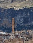
Al Rizk Mosque
Sandstone minaret with carved decoration on octagonal drum and square base.
37°42′49.5″N 41°24′41.5″E / 37.713750°N 41.411528°E / 37.713750; 41.411528 (Al Rizk Mosque) 1409 Ayyubid Sultan Süleyman 480 520 Possible relocation Photogrammetry (1991–2000), relocation planning (2001–2003) [2][4]
Kızlar Mosque 37°42′42.5″N 41°24′52″E / 37.711806°N 41.41444°E / 37.711806; 41.41444 (Kızlar Mosque) late 14th-early 15th century Ayyubid 499 504 [2][5]
Koç Mosque 37°42′43″N 41°24′48.5″E / 37.71194°N 41.413472°E / 37.71194; 41.413472 (Koç Mosque) 12th-13th century, restored 1326–1335 Artuqid and Ayyubid 502 509 [2][6]
Sultan Suleyman Mosque and Sehabeddin Gazi Madrasah
Sandstone minaret with missing top.
37°42′45.5″N 41°24′47.5″E / 37.712639°N 41.413194°E / 37.712639; 41.413194 (Sultan Suleyman Mosque) first quarter of 14th to second half of 15th century Ayyubid 500 540 [2][7]
Khan and shops 37°42′43.5″N 41°24′49.5″E / 37.712083°N 41.413750°E / 37.712083; 41.413750 (Khan and shops) second half of 14th century Ayyubid 502 504 [8]
Seven-arched structure 37°42′43.5″N 41°24′50.5″E / 37.712083°N 41.414028°E / 37.712083; 41.414028 (Seven-arched structure) unknown Artuqid 502 504 [9]
New Mosque 14th century Ayyubid [10]
Small Mosque 37°42′45″N 41°24′49.5″E / 37.71250°N 41.413750°E / 37.71250; 41.413750 (Small Mosque) 1378–1432 Ayyubid Sultan Süleyman [11]
Small Masjid 1 37°42′45″N 41°24′49.5″E / 37.71250°N 41.413750°E / 37.71250; 41.413750 (Small Masjid 1) unknown [12]
Small Masjid 37°42′46″N 41°24′40″E / 37.71278°N 41.41111°E / 37.71278; 41.41111 (Small Masjid) 1517 [13]
Small Kulliye 37°42′40″N 41°24′52″E / 37.71111°N 41.41444°E / 37.71111; 41.41444 (Small Kulliye) 12th-13th century Artuqid [14]
Unnamed Kulliye 37°42′37.5″N 41°24′54.5″E / 37.710417°N 41.415139°E / 37.710417; 41.415139 (Unnamed Kulliye) unknown [15]
Mevlana Mosque 37°42′36.5″N 41°24′58.5″E / 37.710139°N 41.416250°E / 37.710139; 41.416250 (Mevlana Mosque) late period [16]
Cami’u Mardinike/Riverbank Palace 37°42′51″N 41°25′10″E / 37.71417°N 41.41944°E / 37.71417; 41.41944 (Cami’u Mardinike) second half of 15th century [17]
Yamaç Kulliye 37°42′35″N 41°24′58″E / 37.70972°N 41.41611°E / 37.70972; 41.41611 (Yamaç Kulliye) unknown [18]
Yamaç Kulliye and Mosque 37°42′33″N 41°25′10″E / 37.70917°N 41.41944°E / 37.70917; 41.41944 (Yamaç Kulliye and Mosque) unknown Ottoman [19]
Pottery kilns 37°42′35″N 41°24′59″E / 37.70972°N 41.41639°E / 37.70972; 41.41639 (Pottery kilns) unknown [20]
First Castle Gate 490 490 [21]
Second Castle Gate 490 490 [21]
Third Castle Gate 510 517 [21]
Fourth Castle Gate
Remains of two piers of a bridge in the Tigris river.
550 556 Although this site will be above the water level, it is proposed to relocate the gate. [21]

List of threatened archaeological sites in the Ilısu Dam area[edit]

See also[edit]

List of World Heritage in Danger

Notes[edit]

  1. ^ Meinecke 1996, p. 78.
  2. ^ a b c d e EIAR 2005, p. 3–73.
  3. ^ Meinecke 1996, p. 58–60,80.
  4. ^ RAPFR 2005, p. 3/26–5/26.
  5. ^ RAPFR 2005, p. 5/26–6/26.
  6. ^ RAPFR 2005, p. 6/26–8/26.
  7. ^ RAPFR 2005, p. 8/26–10/26.
  8. ^ RAPFR 2005, p. 10/26–11/26.
  9. ^ RAPFR 2005, p. 11/26–12/26.
  10. ^ RAPFR 2005, p. 8/26–11/26.
  11. ^ RAPFR 2005, p. 13/26.
  12. ^ RAPFR 2005, p. 14/26.
  13. ^ RAPFR 2005, p. 14/26–15/26.
  14. ^ RAPFR 2005, p. 15/26–16/26.
  15. ^ RAPFR 2005, p. 16/26–17/26.
  16. ^ RAPFR 2005, p. 17/26–18/26.
  17. ^ RAPFR 2005, p. 18/26–19/26.
  18. ^ RAPFR 2005, p. 19/26–20/26.
  19. ^ RAPFR 2005, p. 20/26.
  20. ^ RAPFR 2005, p. 20/26–21/26.
  21. ^ a b c d RAPFR 2005, p. 3/26.

References[edit]

  • Ilısu Dam and HEPP: Environmental Impact Assessment Report (PDF), Ilısu Consortium, 31 July 2005 {{citation}}: Unknown parameter |city= ignored (|location= suggested) (help)
  • Ilısu Dam and HEPP Project: Update of Resettlement Action Plan, Final Report (PDF), Ilısu Consortium, September 2005 {{citation}}: Unknown parameter |city= ignored (|location= suggested) (help)
  • Archaeological Salvage Review of the EIAR for the Ilısu Dam and HEPP (PDF), The Berne Declaration, EcoWatch Austria and WEED (World Economy, Ecology and Development, February 2006
  • Meinecke, Michael (1996), "3. Hasankeyf/Ḥiṣn Kaifā on the Tigris: A Regional Center on the Crossroad of Foreign Influences", Patterns of Stylistic Changes in Islamic Architecture: Local Traditions Versus Migrating Artists, New York University Press