
User:Sengkang/Gallery/Jurong East Planning Area
< User:Sengkang | Gallery
This is a catalogue of photographs that I have taken of Singapore geographical features, infrastructure and buildings in my leisure time. All images shown may be used anywhere in Wikipedia. Do drop me a note at my talk page if you intend to use them for other purposes. Thanks!
Jurong East Planning Area[edit]
Jurong East Central[edit]
-
 The Enterprise
 -
 IMM Building
 -
 Jurong Entertainment Centre


Jurong East Bus Interchange[edit]


Jurong East MRT station[edit]


Jurong Regional Library[edit]


The JTC Summit[edit]


Pulau Damar Laut[edit]

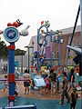
Singapore Science Centre[edit]
-

-

-

-

-

-

-

-

-

-

-

-

-

-
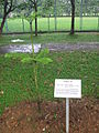
 Ecogarden
 -
 Ecogarden
 -
 Ecogarden
 -
 Ecogarden
 -
 Ecogarden
 -
 Ecogarden
 -
 Ecogarden
 -
 Ecogarden
 -
 Kinetic Garden
 -
 The Observatory
 -
 Omni-Theatre
 -
 Waterworks


