From Wikipedia, the free encyclopedia
This is a catalogue of panoramic photographs that I have taken of geographical features, infrastructure and buildings in my leisure time and on overseas trips. All images shown may be used anywhere in Wikipedia . Do drop me a note at my talk page if you intend to use them for other purposes. Thanks!
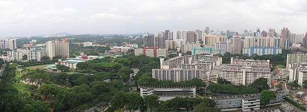
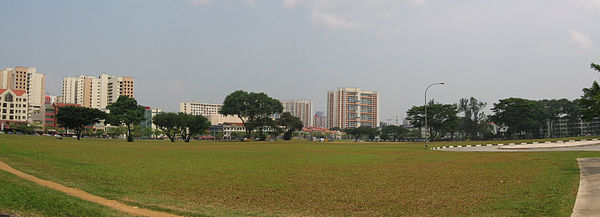
City skyline of Singapore from Marina Bay : 1 The Sail @ Marina Bay , 2 One Marina Boulevard , 3 One Raffles Quay North Tower , 4 UIC Building , 5 John Hancock Tower , 6 Hong Leong Building , 7 Ocean Building , 8 Clifford Centre , 9 Hitachi Tower , 10 Tung Centre , 11 HSBC Building , 12 Republic Plaza , 13 Singapore Land Tower , 14 Maybank Tower , 15 OUB Centre , 16 Bank of China Building , 17 6 Battery Road , 18 UOB Plaza Two , 19 UOB Plaza One , 20 OCBC Centre , 21 Pickering Operations Complex , 22 One George Street , 23 Pickering Operations Complex , 24 Esplanade Bridge , 25 The Fullerton Waterboat House , 26 The Fullerton Hotel Singapore , 27 One Fullerton , 28 Merlion , 29 Merlion Park , 30 The Arcade , 31 Asia Insurance Building , 32 Change Alley Aerial Plaza , 33 Clifford Pier , 34 Marina Bay .Asian Civilisations Museum , Empress Place Bedok Reservoir Bedok Reservoir File:Benjamin Sheares Bridge over Marina Bay, Dec 05.jpg Benjamin Sheares Bridge over Marina Bay .Panoramic view of Pulau Brani with Selat Sengkir (Sengkir Straits) in the foreground. Taken from Sentosa near the Visitor Arrival Centre. Panoramic view of new apartment blocks being built in Buangkok in Sengkang New Town . Panoramic view of undeveloped land beside Buangkok MRT Station . In the distant background lies the northern part of Hougang New Town . Panoramic view of the northern part of Bukit Merah Planning Area, showing from left to right: Hendersonville Housing Estate, Gan Eng Seng Secondary School and Bukit Ho Swee Housing Estate. The River Valley area of Tanglin Planning Area lies in the background. Pulau Bukom and Pulau Bukom Kechil , Western Islands, Singapore . Pulau Bukom Kechil lies to the left with the shorter grey cylindrical tanks, while Pulau Bukom, to the right, with the smaller white and grey but taller tanks and buildings. Pulau Anak Bukom is the small islet with vegetation under the cluster of chimneys at centre-left.Panoramic view of the southwestern part of Singapore, showing the southern parts of Queenstown (with Pasir Panjang Container Terminal ), and Clementi and Jurong . Mouth of Sungei Changi (Changi River), showing from left to right: Serangoon Harbour , Changi Beach Park , Sungei Changi, and Changi Point Coastal Walk . Sungei Changi (Changi River)Changi Beach Park Panorama of Singapore River , with Clarke Quay on the left (northern) bank and Riverside Point on the right (southern) bank. Photograph taken from Ord Bridge , which can be seen on the extreme right. Pulau Damar Laut , with Jurong Pier Flyover and Jurong Port in the foreground and Jurong Island in the background.East Coast Park Eco-lake at the Bukit Timah Core of the Singapore Botanic Gardens . Farrer Park Field Panoramic view of Fernvale neighbourhood in Sengkang New Town . Greendale Secondary School in Punggol New Town . Panoramic view of HarbourFront, Singapore , with Cruise Bay in the foreground. Taken from Sentosa Ferry Terminal. Panoramic view of HarbourFront to the left, and Keppel Harbour to the right. Taken from Imbiah Lookout on Sentosa . Institute of Technical Education Headquarters, Dover, Singapore .Institute of Technical Education Headquarters, Dover, Singapore .Jurong Industrial Estate , Jurong , Singapore , with Jurong Island in the background. The Jurong Pier Flyover and the island of Pulau Damar Laut , with Jurong Island Highway that leads to Jurong Island, can be seen on the left.Jurong Industrial Estate , with Jurong West New Town in the background.Kallang Basin , showing Singapore Indoor Stadium to the left, the condominiums of Tanjong Rhu in the background, and Nicoll Highway in the foreground.Rochor region of Kallang Planning Area, showing Crawford Court Housing Estate in the foreground, Kallang Basin and the condominiums of Tanjong Rhu in the background, Kallang River and Rochor River on the left, Marina Centre on the right, and the Central Business District to the far right.Panoramic view of Keppel Harbour . Taken near Underwater World on Sentosa . Panoramic view of Little India . Taken from Farrer Park View Housing Estate. Panoramic view of Marina Bay , showing, from left to right, Marina Centre , Benjamin Sheares Bridge , Marina South and Clifford Pier . Marina Bay and Marina Centre .Panoramic view of HarbourFront from Mount Faber Park . National Stadium, Singapore National Stadium, Singapore Panoramic view of the grounds of National University of Singapore , Singapore , showing (the buildings in the background from left to right) the Faculty of Science, University Hall, Ridge View Residences, and the spectator stand in front of the running track. The green expanse in the foreground are multi-purpose fields. Panoramic view of Novena, Singapore . In the foreground lie Farrer Park Gardens and Kampong Java Housing Estates in Kallang Planning Area. Palawan Beach , Sentosa , Singapore .Parliament House, Singapore Panoramic view of Sungei Punggol (Punggol River), towards Fernvale in Sengkang New Town . Panoramic view of Sungei Punggol (Punggol River), towards Fernvale in Sengkang New Town . Lake at Punggol Park , Hougang , Singapore .Panoramic view showing the Sengkang LRT Line . Renjong LRT Station lies to the left, and the North East MRT Line (NEL) Sengkang Depot to the right. In the distant background lies Hougang New Town . Pulau Semakau , Western Islands, Singapore . View of Phase 2 wet cell of the Semakau Landfill from the western rock bund .Pulau Semakau , Western Islands, Singapore . View of the gap between the eastern and western rock bunds , separating the Phase 2 wet cell of the Semakau Landfill from the sea .Pulau Semakau , Western Islands, Singapore . View of Phase 2 wet cell of the Semakau Landfill from the western rock bund .Pulau Semakau , Western Islands, Singapore . View of the sea from the western rock bund . Pulau Sudong is the island in the distance.Sengkang Town Centre . The building complexes are, from left to right, Sengkang Community Hub , Compass Point Shopping Centre , Sengkang NEL , LRT and Bus Interchange , and Compass Heights Condominium.Panoramic view of Sentosa , with Cruise Bay in the foreground. Taken from VivoCity at HarbourFront . Sungei Serangoon , with Rivervale neighbourhood of Sengkang New Town on its west bank in the background.Siloso Beach , Sentosa , Singapore .Panoramic view of Telok Blangah from Mount Faber . Panoramic view of Tongkang LRT Station , with Sengkang Depot to the right. Jetty at Pulau Ubin , Singapore .Mangrove Boardwalk , Chek Jawa , Pulau Ubin , Singapore .Mangrove Boardwalk , Chek Jawa , Pulau Ubin , Singapore .Seagrass Lagoon , Chek Jawa , Pulau Ubin , Singapore .Seagrass Lagoon , Chek Jawa , Pulau Ubin , Singapore .Seagrass Lagoon , Chek Jawa , Pulau Ubin , Singapore .Coastal Boardwalk , Chek Jawa , Pulau Ubin , Singapore .Coastal Boardwalk and Floating Pontoon , Chek Jawa , Pulau Ubin , Singapore .Coastal Forest , Rocky Shore and Coastal Boardwalk , Chek Jawa , Pulau Ubin , Singapore .VivoCity 's rooftop, which features a wading pool .The southernmost of the Western Islands, Singapore . Panoramic view of Pulau Satumu (Raffles Lighthouse ), Pulau Biola , Pulau Senang , Pulau Pawai and Pulau Sudong , from Pulau Semakau . Panoramic view of West Region, Singapore , from the look-out tower on Jurong Hill . Jurong Industrial Estate lies in the foreground. Panoramic view of Aberdeen Harbour , Hong Kong Island , Hong Kong , from Ocean Park . The island at the centre is Ap Lei Chau . Aberdeen Harbour is located between Ap Lei Chau and the town of Aberdeen to the right. Panoramic view of the hills near Ocean Park , Hong Kong Island , Hong Kong . The buildings in the background are located in the town of Aberdeen . Panoramic view of the amusement park facilities at Ocean Park , Hong Kong Island , Hong Kong . Spring and Autumn Pavilions on Lotus Lake , from Dragon and Tiger Pagodas , in Kaohsiung , Taiwan .


