| [2]
|
Landmark name[3]
|
Image
|
Date listed[3]
|
Location[3]
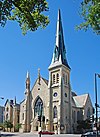
|
Neighborhood
|
Description
|
| 1
|
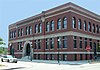
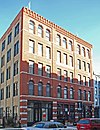
7th District Police Station
|
|
May 2, 1996
|
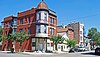
943-949 W. Maxwell Street
41°51′52″N 87°39′2″W / 41.86444°N 87.65056°W / 41.86444; -87.65056 (7th District Police Station)
|
Near West Side
|
Romanesque style police station that served in pacifying the "Bloody Maxwell" area from 1888 to 1988.
|
| 2
|
Austin Historic District
|
|
August 8, 1985
|
Roughly bounded by W. Ohio Street, N. Waller Avenue, N. Parkside Avenue, W. West End Avenue, & N. Mayfield Avenue & W. Corcoran Place
41°53′12″N 87°46′12″W / 41.88667°N 87.77000°W / 41.88667; -87.77000 (Austin Historic District)
|
Austin
|
|
| 3
|
Austin Town Hall Park Historic District
|

|
November 15, 2006
|
Roughly bounded by W. Lake Street, N. Central Avenue, N. Parkside Avenue, and W. Race Avenue
41°53′18″N 87°45′57″W / 41.88833°N 87.76583°W / 41.88833; -87.76583 (Austin Town Hall Park Historic District)
|
Austin
|
|
| 4
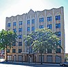
|
Automatic Electric Company Building
|

|
November 20, 2002
|
1001 W. Van Buren Street
41°52′42″N 87°39′8″W / 41.87833°N 87.65222°W / 41.87833; -87.65222 (Automatic Electric Company Building)
|
Near West Side
|
|
| 5
|
Building at 900 West Lake Street
|

|
February 12, 1999
|
900 W. Lake Street
41°53′9″N 87°39′0″W / 41.88583°N 87.65000°W / 41.88583; -87.65000 (Building at 900 West Lake Street)
|
Near West Side
|
|
| 6
|
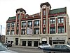
Central Park Theater
|
|
August 10, 2005
|
3531-39 W. Roosevelt Road
41°51′59″N 87°42′26″W / 41.86639°N 87.70722°W / 41.86639; -87.70722 (Central Park Theater)
|
North Lawndale
|
|
| 7
|
Chicago and North Western Railway Power House
|

|
October 12, 2004
|
211 N. Clinton Street
41°53′18″N 87°38′54″W / 41.88833°N 87.64833°W / 41.88833; -87.64833 (Chicago and North Western Railway Power House)
|
Near West Side
|
|
| 8
|
Chicago Telephone Company Kedzie Exchange
|
|
May 30, 2001
|
17 S. Homan Avenue
41°52′49″N 87°42′39″W / 41.88028°N 87.71083°W / 41.88028; -87.71083 (Chicago Telephone Company Kedzie Exchange)
|
East Garfield Park
|
|
| 9
|
Church of the Epiphany
|

|
February 5, 1998
|
201 S. Ashland Avenue
41°52′43″N 87°39′59″W / 41.87861°N 87.66639°W / 41.87861; -87.66639 (Church of the Epiphany)
|
Near West Side
|
|
| 10
|
Columbus Park
|
|
May 20, 1991
|
500 S. Central Avenue
41°52′28″N 87°46′10″W / 41.87444°N 87.76944°W / 41.87444; -87.76944 (Columbus Park)
|
Austin
|
|
| 11
|
Cook County Hospital Administration Building
|

|
November 8, 2006
|
1835 W. Harrison Street
41°52′33″N 87°40′22″W / 41.87583°N 87.67278°W / 41.87583; -87.67278 (Cook County Hospital Administration Building)
|
Near West Side
|
|
| 12
|
Dawson Brothers Plant
|
|
February 14, 1985
|
517-519 N. Halsted Street
41°53′31″N 87°38′50″W / 41.89194°N 87.64722°W / 41.89194; -87.64722 (Dawson Brothers Plant)
|
West Town
|
|
| 13
|
East Village Historic District
|

|
December 8, 2009
|
Bounded by W. Division Street, W. Chicago Avenue, N. Hermitage Avenue and N. Damen Avenue
41°53′58.68″N 87°40′25.61″W / 41.8996333°N 87.6737806°W / 41.8996333; -87.6737806 (East Village Historic District)
|
West Town
|
|
| 14
|
First Congregational Church of Austin
|

|
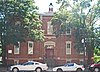
November 17, 1977
|
5701 W. Midway Park
41°53′19″N 87°46′5″W / 41.88861°N 87.76806°W / 41.88861; -87.76806 (First Congregational Church of Austin)
|
Austin
|
|
| 15
|
Jennie Foley Building
|

|
June 19, 1985
|
626-628 S. Racine Avenue
41°52′24″N 87°39′25″W / 41.87333°N 87.65694°W / 41.87333; -87.65694 (Foley, Jennie, Building)
|
Near West Side
|
|
| 16
|
Garfield Park
|
|
August 31, 1993
|
100 N. Central Park Avenue
41°53′11″N 87°42′58″W / 41.88639°N 87.71611°W / 41.88639; -87.71611 (Garfield Park)
|
East Garfield Park
|
|
| 17
|
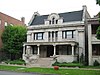
Abraham Groesbeck House
|

|
February 4, 1993
|
1304 W. Washington Boulevard
41°52′59″N 87°39′36″W / 41.88306°N 87.66000°W / 41.88306; -87.66000 (Groesbeck, Abraham, House)
|
Near West Side
|
|
| 18
|
Guyon Hotel
|
|
May 9, 1985
|
4000 W. Washington Boulevard
41°52′55″N 87°43′35″W / 41.88194°N 87.72639°W / 41.88194; -87.72639 (Guyon Hotel)
|
West Garfield Park
|
|
| 19
|
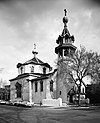
Holy Trinity Russian Orthodox Cathedral and Rectory
|
|
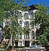
March 16, 1976
|
1117-1127 N. Leavitt Street
41°54′7″N 87°40′55″W / 41.90194°N 87.68194°W / 41.90194; -87.68194 (Holy Trinity Russian Orthodox Cathedral and Rectory)
|
West Town
|
|
| 20
|
Home Bank and Trust Company
|

|
February 21, 2007
|
1200 N. Ashland Avenue
41°54′14″N 87°40′5″W / 41.90389°N 87.66806°W / 41.90389; -87.66806 (Home Bank and Trust Company)
|
West Town
|
|
| 21
|
Hull House
|

|
October 15, 1966
|
800 S. Halsted Street
41°52′17″N 87°38′49″W / 41.87139°N 87.64694°W / 41.87139; -87.64694 (Hull House)
|
Near West Side
|
|
| 22
|
Humboldt Park
|

|
February 20, 1992
|
Roughly bounded by N. Sacramento Boulevard and W. Augusta Boulevard, and N. Kedzie Avenue, W. North Avenue and N. California Avenue and W. Division Street
41°54′12″N 87°42′10″W / 41.90333°N 87.70278°W / 41.90333; -87.70278 (Humboldt Park)
|
West Town
|
|
| 23
|
International Tailoring Company Building
|

|
April 18, 2008
|
847 W. Jackson Boulevard
41°52′39.74″N 87°38′56.91″W / 41.8777056°N 87.6491417°W / 41.8777056; -87.6491417 (International Tailoring Company Building)
|
Near West Side
|
|
| 24
|
Jewish People's Institute
|
|
November 15, 1978
|
3500 W. Douglas Boulevard
41°51′47″N 87°42′47″W / 41.86306°N 87.71306°W / 41.86306; -87.71306 (Jewish People's Institute)
|
North Lawndale
|
|
| 25
|
K-Town Historic District
|
|
September 9, 2010
|
Bounded on the north by W. Cullerton Street; on the south by W. Cermak Road, on the west by S. Kostner Avenue, and on the east by S. Pulaski Road (Chicago)
41°51′11″N 87°43′47″W / 41.85306°N 87.72972°W / 41.85306; -87.72972 (K-Town Historic District)
|
South Lawndale
|
|
| 26
|
Patrick J. King House
|
|
February 10, 1983
|
3234 W. Washington Boulevard
41°52′58″N 87°42′27″W / 41.88278°N 87.70750°W / 41.88278; -87.70750 (King, Patrick J., House)
|
East Garfield Park
|
|
| 27
|
Henry E. Legler Regional Branch of the Chicago Public Library
|

|
November 6, 1986
|
115 S. Pulaski Road
41°52′46″N 87°43′31″W / 41.87944°N 87.72528°W / 41.87944; -87.72528 (Legler, Henry E., Regional Branch of the Chicago Public Library)
|
West Garfield Park
|
|
| 28
|
Lindemann and Hoverson Company Showroom and Warehouse
|
|
November 26, 2008
|
2620 W. Washington Boulevard
41°52′58.6″N 87°41′31.4″W / 41.882944°N 87.692056°W / 41.882944; -87.692056 (Lindemann and Hoverson Company Showroom and Warehouse)
|
East Garfield Park
|
|
| 29
|
Logan Square Boulevards Historic District
|

|
November 20, 1985
|
W. Logan Boulevard, Logan Square, N. Kedzie Boulevard, Palmer Square, and N. Humboldt Boulevard
41°55′12″N 87°41′58″W / 41.92000°N 87.69944°W / 41.92000; -87.69944 (Logan Square Boulevards Historic District)
|
Logan Square
|
Three boulevards connected by two parks, on both the North Side and West Sides.
|
| 30
|
Lou Mitchell's Restaurant
|

|
May 5, 2006
|
565 W. Jackson Boulevard
41°52′38″N 87°38′30″W / 41.87722°N 87.64167°W / 41.87722; -87.64167 (Lou Mitchell's Restaurant)
|
Near West Side
|
|
| 31
|
Midwest Athletic Club
|
|
October 18, 1984
|
6 N. Hamlin Avenue
41°52′52″N 87°43′16″W / 41.88111°N 87.72111°W / 41.88111; -87.72111 (Midwest Athletic Club)
|
West Garfield Park
|
|
| 32
|
Notre Dame de Chicago
|

|
March 7, 1979
|
1338 W. Flournoy Street
41°52′24″N 87°39′39″W / 41.87333°N 87.66083°W / 41.87333; -87.66083 (Notre Dame de Chicago)
|
Near West Side
|
|
| 33
|
Otis Elevator Company Factory Building
|

|
November 26, 2008
|
1435 W. 15th Street and 1501 S. Laflin Street
41°51′41.2″N 87°39′44.2″W / 41.861444°N 87.662278°W / 41.861444; -87.662278 (Otis Elevator Company Factory Building)
|
Near West Side
|
|
| 34
|
Pilsen Historic District
|
|
February 1, 2006
|
Roughly bounded by W. 16th Street, W. Cermak Road, S. Halsted Street and S. Western Avenue
41°51′14″N 87°40′13″W / 41.85389°N 87.67028°W / 41.85389; -87.67028 (Pilsen Historic District)
|
Lower West Side
|
|
| 35
|
Produce Terminal Cold Storage Company Building
|

|
June 22, 2003
|
1550 S. Blue Island Avenue
41°51′42″N 87°39′28″W / 41.86167°N 87.65778°W / 41.86167; -87.65778 (Produce Terminal Cold Storage Company Building)
|
Near West Side
|
|
| 36
|
Pulaski Park and Fieldhouse
|

|
August 13, 1981
|
1419 W. Blackhawk Street
41°54′21″N 87°39′47″W / 41.90583°N 87.66306°W / 41.90583; -87.66306 (Pulaski Park and Fieldhouse)
|
West Town
|
|
| 37
|
Jacob A. Riis Park
|

|
April 20, 1995
|
6100 W. Fullerton Avenue
41°55′33″N 87°46′44″W / 41.92583°N 87.77889°W / 41.92583; -87.77889 (Riis, Jacob A., Park)
|
Belmont Cragin
|
|
| 38
|
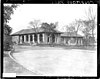
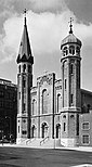
St. Ignatius College
|
File:SICP Main Bldg.jpg
|
November 17, 1977
|
1076 W. Roosevelt Road
41°52′3″N 87°39′6″W / 41.86750°N 87.65167°W / 41.86750; -87.65167 (St. Ignatius College)
|
Near West Side
|
|
| 39
|
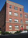
St. Matthew Evangelical Lutheran School
|
|
January 27, 2000
|
2101-2107 W. 21st Street
41°51′13″N 87°40′43″W / 41.85361°N 87.67861°W / 41.85361; -87.67861 (St. Matthew Evangelical Lutheran School)
|
Lower West Side
|
|
| 40
|
St. Patrick's Roman Catholic Church
|
|
July 15, 1977
|
718 W. Adams Street
41°52′45″N 87°38′40″W / 41.87917°N 87.64444°W / 41.87917; -87.64444 (St. Patrick's Roman Catholic Church)
|
Near West Side
|
|
| 41
|
Schoenhofen Brewery Historic District
|

|
December 27, 1978
|
Roughly bounded by W. 16th Street, W. 18th Street, S. Canal Street, and S. Clinton Street
41°51′31″N 87°38′22″W / 41.85861°N 87.63944°W / 41.85861; -87.63944 (Schoenhofen Brewery Historic District)
|
Lower West Side
|
|
| 42
|
Sears, Roebuck and Company Complex
|

|
June 2, 1978
|
925 S. Homan Avenue
41°52′10″N 87°42′42″W / 41.86944°N 87.71167°W / 41.86944; -87.71167 (Sears, Roebuck and Company Complex)
|
East Garfield Park
|
|
| 43
|
Shedd Park Fieldhouse
|
|
December 30, 1974
|
3660 W. 23rd Street
41°51′1″N 87°43′1″W / 41.85028°N 87.71694°W / 41.85028; -87.71694 (Shedd Park Fieldhouse)
|
South Lawndale
|
|
| 44
|
J. P. Smith Shoe Company Plant
|

|
November 14, 1985
|
671-699 N. Sangamon Avenue and 901-921 W. Huron Street
41°53′41″N 87°39′3″W / 41.89472°N 87.65083°W / 41.89472; -87.65083 (Smith, J. P., Shoe Company Plant)
|
West Town
|
|
| 45
|
South Water Market
|

|
August 20, 2004
|
Bounded by W. 14th Place, the 16th Street rail embankment, S. Racine Avenue, and S. Morgan Street
41°52′21″N 87°39′17″W / 41.87250°N 87.65472°W / 41.87250; -87.65472 (South Water Market)
|
Near West Side
|
|
| 46
|
Story-Camp Rowhouses
|
|
May 8, 1980
|
1526-1528 W. Monroe Street
41°52′48″N 87°39′57″W / 41.88000°N 87.66583°W / 41.88000; -87.66583 (Story-Camp Rowhouses)
|
Near West Side
|
|
| 47
|
Tri-Taylor Historic District
|
|
March 3, 1983
|
Roughly bounded by S. Claremont Avenue, W. Harrison Street, S. Oakley Avenue, W. Polk Street, W. Ogden Avenue, and W. Roosevelt Road; also roughly bounded on the north by Oakley, Harrison, and Claremont Streets, and on the southeast by Taylor and Oakley Streets
41°52′13″N 87°41′0″W / 41.87028°N 87.68333°W / 41.87028; -87.68333 (Tri-Taylor Historic District)
|
Near West Side
|
Second set of boundaries represents a boundary increase of February 3, 1988
|
| 48
|
Union Park Congregational Church and Carpenter Chapel
|
|
May 31, 2006
|
1613 W. Washington Boulevard
41°53′6″N 87°40′3″W / 41.88500°N 87.66750°W / 41.88500; -87.66750 (Union Park Congregational Church and Carpenter Chapel)
|
Near West Side
|
|
| 49
|
Union Park Hotel
|
|
June 7, 2010
|
1519-1521 W Warren Blvd.
41°52′55.62″N 87°39′58.02″W / 41.8821167°N 87.6661167°W / 41.8821167; -87.6661167 (Union Park Hotel)
|
Near West Side
|
|
| 50
|
United States Post Office-Chicago
|

|
August 16, 2001
|
433 W. Van Buren Street
41°52′34″N 87°38′19″W / 41.87611°N 87.63861°W / 41.87611; -87.63861 (United States Post Office--Chicago)
|
Near West Side
|
|
| 51
|
Seth Warner House
|
|
June 3, 1982
|
631 N. Central Avenue
41°53′31″N 87°45′54″W / 41.89194°N 87.76500°W / 41.89194; -87.76500 (Warner, Seth, House)
|
Austin
|
|
| 52
|
West Jackson Boulevard District
|
|
May 19, 1978
|
Roughly bounded by S. Laflin Avenue, S. Ashland Avenue, W. Adams Street, and W. Van Buren Street; also 1513 W. Adams Street
41°52′39″N 87°39′55″W / 41.87750°N 87.66528°W / 41.87750; -87.66528 (West Jackson Boulevard District)
|
Near West Side
|
Second set of boundaries represents a boundary increase of October 19, 1989
|
| 53
|
Wicker Park Historic District
|

|
June 20, 1979
|
Roughly bounded by N. Wood, W. Crystal and N. Caton Streets, N. Claremont and W. North Avenues
41°54′26″N 87°40′20″W / 41.90722°N 87.67222°W / 41.90722; -87.67222 (Wicker Park Historic District)
|
West Town
|
|


.jpg)


.jpg)


_House.jpg)


.jpg)


