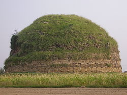
User:Unbenthatt99/Rawalpindi Assignment
Rawalpindi E-Gov Assignment[edit]
Rawalpindi district is in the north of the Punjab province with an area of 5,286 km2 (2,041 sq mi)[1].
Rawalpindi District
ضِلع راولپِنڈى | |
|---|---|
 Map of Punjab with Rawalpindi District highlighted Rawalpindi is located in the north of Punjab. | |
| Coordinates: 33°20′N 73°15′E / 33.333°N 73.250°E | |
| Country | |
| Province | |
| Division | Rawalpindi |
| Headquarter | Rawalpindi |
| Number of Tehsils | 5 |
| Government | |
| • Type | District Administration |
| • Deputy Commissioner | Hassan Waqar Cheema (BPS-18 PAS) |
| • District Police Officer (DPO) | Faisal Mukhtar (BPS-18 PSP) |
| • District Health Officer | N/A |
| Area | |
| • Total | 4,547 km2 (1,756 sq mi) |
| Highest elevation | 1,800 m (5,900 ft) |
| Lowest elevation | 300 m (1,100 ft) |
| Population (2017)[2] | |
| • Total | 5,050,068 |
| • Density | 1,100/km2 (2,900/sq mi) |
| Time zone | UTC+5 (PKT) |
| National Assembly Seats (2018) | Total 6
|
| Punjab Assembly Seats (2018) | Total (15)
|
| Website | rawalpindi |
Demographics[edit]
adsadadasdad
Relgion[edit]
asdadasdadadad
School h2[edit]
asdsadadadad
- ^ "District Profile | Rawalpindi". District Rawalpindi, Government of The Punjab. Retrieved Sunday, 29 October 2023.
{{cite web}}:|first=missing|last=(help); Check date values in:|access-date=(help)CS1 maint: multiple names: authors list (link) CS1 maint: url-status (link) - ^ Cite error: The named reference
2017censuswas invoked but never defined (see the help page).


