
Wikipedia:Graphics Lab/Map workshop/Archive/2017/May 2017
| This page is an archive. Do not edit the contents of this page. Please direct any additional comments to the current main page. |

Air route of Westray to Papa Westray flight in Orkney, Scotland
-
 A map showing the route of the Westray to Papa Westray flight, the shortest airline flight ever, between two Orkney islands.
 -
Description of second image (if needed)
-
Description of third image (if needed; don't request too many at once, though)

- Article(s)
- Westray to Papa Westray flight
- Request
- (I was not sure how I was supposed to fill in the above section, "IMAGE1.EXT")

- I would like a map showing the route of the flight featured in this article. (One editor requested a map, and I agree it would help the article.) Wikimedia has a map of Orkney, but even this is too large to show the route of the flight between the two airports. The two islands in the top-center of that image are Westray (larger island to the west) and Papa Westray (smaller, east). The two airports are at the points where the islands are closest together - the northernmost east-facing peninsula on Westray, and a point almost directly east of there on Papa Westray. I don't know if this image can somehow be adapted or if a new image should be created, but I do think the extreme shortness of the route (1.7 km) would be brought home by a good map, maybe yet another inset in the Orkney map? I think it's key to impress upon the viewer that it is very small on the scale of normal air routes. (The runway at Edinburgh Airport is longer than this entire flight.) I think an outline of the two short runways would help illustrate the scale. (I intend to put the map at the top with the lead and remove one of the other images in the article to keep it somewhat balanced.) Thank you! Dcs002 (talk) 03:29, 15 December 2016 (UTC)
- Graphist opinion(s)

@Dcs002: The map on the right is not exactly as requested. It uses {{OSM Location map}} so can frame any area of map you need, at various scales, and put symbols and so forth on it, but can't do long lines. On the other hand you do also get a link to a full screen zoom-able pan-able map with the key locations on it. You will see from the edit page that it is quite a chunk of template, so you can copy and paste it into your article if it is useful. RobinLeicester (talk) 00:03, 25 December 2016 (UTC)
- Thanks so much! I will see what I can do with this. I am completely unfamiliar with this mapping system, but it looks like something with a lot of flexibility and clarity. Thanks!
- I would like to keep this open for now in case I have questions about using this type of map, if that's ok? Dcs002 (talk) 23:01, 29 December 2016 (UTC)
Chile expansion map
-
 Map Example
 -
 Map Example 2
 -
 Map Example 3


- Article(s)
- Chilean expansionism
- Request
- Please, can someone help me create a map (svg, png, or whichever file format you deem best) of Chile's territorial expansion (see this image [1] for reference). I would like to add it to the "consequences" section of the article on Chilean expansionism. The files listed above are just some examples of the type of map format that could be made; other options can be found at Commons ([2]). Thanks! -- MarshalN20 Talk 05:22, 18 December 2016 (UTC)
- Graphist opinion(s)
- @MarshalN20: I'd like to take this request, but I really don't want to just base it off a Wikipedia article as I know nothing about the subject. Can you tell me what year each territory was taken in, and what modern day Chilean state its borders correspond with (if none, I'm going to need some other way of getting a rough idea of its borders). Psiĥedelisto (talk) 12:06, 7 February 2017 (UTC)
- @MarshalN20: reping due to my forgotten sig Psiĥedelisto (talk) 12:09, 7 February 2017 (UTC)
- Thank you Psiĥedelisto! Looking at the Administrative divisions of Chile, Chile officially acquired the Chiloé Archipelago in 1826, the southern Magallanes Region (see Punta Arenas) in 1843, the northern Magallanes, Strait of Magellan, and Aysén Region in 1881, the Araucanía Region in 1883, the Tarapacá Region in 1883, the Easter Island in 1888, the Antofagasta Region in 1884, the Arica y Parinacota Region in 1929, the Chilean Antarctic Territory in 1940. Perhaps the map at General Captaincy of Chile can also be of help to visualize the expansion. Thanks again!--MarshalN20 ✉🕊 15:16, 9 February 2017 (UTC)
- @MarshalN20: No problem!
 So I thought I'd clue you in on some of my current progress. My workflow is like this, I find a public domain shapefile of what I need, and then I do as much as I can in QGIS and then do the rest in InkScape. For some other maps, like street maps, I sometimes use OpenStreetMap data, but on my end this is considerably more time consuming. This topic is actually quite interesting, you know, I guess I never really thought about how the long skinny country that cuts South America off from the Pacific came into being, but now that I have its shape makes a lot more sense. So right now I've found the shapefiles for the provinces of Chile, now I'm working on getting the shapefile for Chile's slice of Antarctica, then I'll piece it together into a coherent map. Right now I've just got this random rainbow color scheme going on [3], but I'm thinking that I will show the oldest territories in grey and then the Antarctic slice will be red, with the provinces captured in the middle on a gradient from grey to red, and everything labeled. Since we're talking about this huge area here maybe even some lat/long lines, even though I typically leave those out on the maps that I make. I'm going to bed now but if you see this let me know what you think about these ideas. Psiĥedelisto (talk) 15:05, 10 February 2017 (UTC)
- @MarshalN20: No problem!
- Thank you Psiĥedelisto! Looking at the Administrative divisions of Chile, Chile officially acquired the Chiloé Archipelago in 1826, the southern Magallanes Region (see Punta Arenas) in 1843, the northern Magallanes, Strait of Magellan, and Aysén Region in 1881, the Araucanía Region in 1883, the Tarapacá Region in 1883, the Easter Island in 1888, the Antofagasta Region in 1884, the Arica y Parinacota Region in 1929, the Chilean Antarctic Territory in 1940. Perhaps the map at General Captaincy of Chile can also be of help to visualize the expansion. Thanks again!--MarshalN20 ✉🕊 15:16, 9 February 2017 (UTC)
- @MarshalN20: reping due to my forgotten sig Psiĥedelisto (talk) 12:09, 7 February 2017 (UTC)
Fantastic! Yes, Chile's territorial expansion is very interesting. It's a thalassocracy of sorts. I also tried to make a map of this, but was also struggling with the size. At first it might seem as if it is a simple line of sorts, but Easter Island and Antarctica amplify the picture (perhaps there are other ways to include them in the picture without causing too much of a distortion?). Thanks again!--MarshalN20 ✉🕊 22:42, 10 February 2017 (UTC)
- @MarshalN20: So, good news and bad news. The good news: I'm really close to finishing this map! The bad news: It looks like the data you've given me is incomplete, or my understanding of it is incomplete, there are unexplained illogical gaps in the map's timeline. Please take a look at this file: [4]. Note that this map is a rough draft just to show you what I mean, and that the labels on the final version won't look like this at all but will instead be separated from the landmasses they represent. Also, the Antarctic "slice" will be labeled properly in the final version, and Magallanes province will be properly split into North and South, and the islands will be represented in pop-out maps using the same legend. So, I realize that everything between the Antofagasta Region and the Araucanía Region are the "original" Chile, but significant areas in the southern portion of the country are unaccounted for as to when they were annexed/assimilated. If you could help me fill in these gaps in the map, it will be ready for your use shortly! Psiĥedelisto (talk) 12:46, 23 February 2017 (UTC)
- @Psiĥedelisto: Thank you! The unaccounted southern portions should be dated to the 1881 treaty with Argentina (please see the Boundary Treaty of 1881 between Chile and Argentina). As for the unaccounted area around Chiloe, it seems that the Chiloé Province also held control of the mainland surrounding it, so that should also be considered part of the 1826 acquisition. Regards.--MarshalN20 ✉🕊 16:50, 23 February 2017 (UTC)
- @MarshalN20: OK, I think I have all the data correct now. Here are the maps zoomed in so you can see the provinces better to double check: [5]
- @Psiĥedelisto: Thank you! The unaccounted southern portions should be dated to the 1881 treaty with Argentina (please see the Boundary Treaty of 1881 between Chile and Argentina). As for the unaccounted area around Chiloe, it seems that the Chiloé Province also held control of the mainland surrounding it, so that should also be considered part of the 1826 acquisition. Regards.--MarshalN20 ✉🕊 16:50, 23 February 2017 (UTC)
- And here is a table of the data as I have it:
NOM_REG NOM_PROV CLAIMED Región de Aysén del Gral.Ibañez del Campo Coyhaique 1881 Región de Antofagasta Antofagasta 1884 Región de Antofagasta El Loa 1884 Región de Antofagasta Tocopilla 1884 Región de Atacama Chañaral Región de Atacama Copiapó Región de Atacama Huasco Región del Libertador Bernardo O'Higgins Cachapoal Región del Libertador Bernardo O'Higgins Cardenal Caro Región del Libertador Bernardo O'Higgins Colchagua Región de Coquimbo Choapa Región de Coquimbo Elqui Región de Coquimbo Limarí Región de La Araucanía Cautín 1883 Región de La Araucanía Malleco 1883 Región de Los Lagos Chiloe 1826 Región de Los Lagos Llanquihue 1826 Región de Los Lagos Osorno 1826 Región de Los Lagos Palena 1826 Región de Los Ríos Valdivia 1826 Región de Los Ríos Ranco 1826 Región de Magallanes y Antártica Chilena Magallanes 1843 Región de Magallanes y Antártica Chilena Ultima Esperanza 1881 Región de Arica y Parinacota Arica 1929 Región de Tarapacá Tamarugal 1883 Región de Arica y Parinacota Parinacota 1929 Región de Valparaíso Los Andes Región de Valparaíso Petorca Región de Valparaíso Quillota Región de Valparaíso San Antonio Región de Valparaíso San Felipe Región de Valparaíso Marga Marga Región del Bío-Bío Arauco Región del Bío-Bío Bío-Bío Región del Bío-Bío Concepción Región del Bío-Bío Ñuble Región del Maule Cauquenes Región del Maule Curicó Región del Maule Linares Región del Maule Talca Región Metropolitana de Santiago Chacabuco Región Metropolitana de Santiago Cordillera Región Metropolitana de Santiago Maipo Región Metropolitana de Santiago Melipilla Región Metropolitana de Santiago Santiago Región Metropolitana de Santiago Talagante Región de Magallanes y Antártica Chilena Antártica Chilena 1843 Región de Magallanes y Antártica Chilena Tierra del Fuego 1843 Región de Aysén del Gral.Ibañez del Campo General Carrera 1881 Región de Aysén del Gral.Ibañez del Campo Capitán Prat 1881 Región de Aysén del Gral.Ibañez del Campo Aysén 1881 Región de Tarapacá Iquique 1883 Región de Valparaíso Isla de Pascua 1888 Región de Valparaíso Valparaíso Región de Valparaíso Valparaíso
- If you see any errors, please feel free to just edit the table above and ping me.
 If not, please let me know that too, so I can finish up this project and give you the finished map (finally). Psiĥedelisto (talk) 06:11, 24 February 2017 (UTC)
- @Psiĥedelisto: Nice! Sorry for the delay in responding; I'm currently working on a project about Mexican cinema and gender (and, as a result, have been busy reading). Just a few minor corrections to help with refining the awesome map:
- If you see any errors, please feel free to just edit the table above and ping me.
NOM_REG NOM_PROV CLAIMED Región de Magallanes y Antártica Chilena Tierra del Fuego 1881 Región de Magallanes y Antártica Chilena Antártica Chilena 1881 Región de Los Ríos Valdivia 1820 or no date Región de Los Ríos Ranco 1820 or no date Región de Los Lagos Osorno 1820 or no date
- The old province of Valdivia was acquired in 1820, after the Chilean assault of the Valdivian Fort System. However, it seems that this territory was deemed by Chile as an integral part of its national territory based on the old borders of the General Captaincy of Chile; maybe having it as a grey area might be the best option. Osorno used to be part of the old Valdivia Province (which is basically most of modern "Region Los Rios"). As for the Magallanes territories, most of them were delimited in the 1881 treaty with Argentina. However, the actual Chilean Antarctic Territory (the territory not in South America) was claimed in 1940. Thanks!--MarshalN20 ✉🕊 05:09, 26 February 2017 (UTC)
Oslo, Norway
- Article(s)
- Ammerud
- Request
- This article uses a map of Oslo in the infobox, but the location of Ammerund is shown outside the boundary of the map because that map is actually just the metro area or some portion of Oslo. See this discussion Wikipedia_talk:WikiProject_Norway#Ammerud. An alternate map of the entire city would fix this. MB 04:57, 13 January 2017 (UTC)
- Graphist opinion(s)


MB By using {{OSM Location map}} you can put a map such as the one here into the article. It doesn't integrate with the infobox. (If you remove 'Oslo' from the infobox 'pushpin_map=' entry it will remove the one that is there), and then paste this one below the infobox template. With the widths the same it looks well enough. You can use the zoom parameter to change the scale, and the lat and lon figures denote the map centre, so you can include whatever is needed - anywhere in the world. You can cut and paste the template and its parameters, and if you wanted to add in more map features, there are 9 further locator dots/labels available. It is very easy to re-use or adapt it for any other places in the locality. RobinLeicester (talk) 00:37, 21 January 2017 (UTC)

- Article(s)
- Wikipedia:Systemic bias
- Request
- please complete map to include New Zealand, Finland...… -- Kintetsubuffalo (talk) 06:34, 13 January 2017 (UTC)
- Graphist opinion(s)
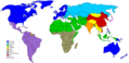
- That one isn't used in any articles, File:InternetPenetrationWorldMap.svg already exists and is in use on the Systemic bias article, is something wrong with it? Kmusser (talk) 20:51, 23 January 2017 (UTC)
Last Mountain Lake Bird Sanctuary
- Article(s)
- Last Mountain Lake Bird Sanctuary
- Request
- Please create a map to highlight this migratory bird sanctuary. For reference, see Last Mountain Lake Migratory Bird Sanctuary (Canadian Wildlife Service), specifically this map. I would prefer a map with greater north-south coverage, and a little bit less east-west, with text moved to a legend. If possible, multiple maps could be created, one for the National Wildlife Area, one for the bird sanctuary, and one with both. Mindmatrix 16:56, 21 January 2017 (UTC)
- Graphist opinion(s)
Maps for Conventions relating to Refugees and Internally Displaced Persons in Africa
- Article(s)
- Convention Governing the Specific Aspects of Refugee Problems in Africa
- Kampala Convention
- Request
It would be great if somebody could create maps for the pages Convention Governing the Specific Aspects of Refugee Problems in Africa and Kampala Convention that show which countries have signed and ratified them (the same design as it is done for Convention Relating to the Status of Refugees - but for Africa only using e.g.File:BlankMap-Africa.svg from Wikimedia Commons). The websites where the information can be found are http://www.achpr.org/instruments/refugee-convention/ for the Convention Governing the Specific Aspects of Refugee Problems in Africa and http://www.internal-displacement.org/sub-saharan-africa/kampala-convention/ for Kampala Convention. Many thanks Michtrich (talk) 19:14, 24 January 2017 (UTC)
Map of Yugoslavia with the indication of the Jewish communities
This website (link) contains very useful map (link) which could be used in plenty of articles about Jews in Yugoslavia.--Antidiskriminator (talk) 14:22, 29 January 2017 (UTC)
Map of Washington, D.C.
-
 Location map Washington, D.C. central.svg
 -
 Dccirculator.png


- Article(s)
- Dozens, see list of embeds on file page
- Request
- This map is supposed to show location in downtown D.C. for major US national monuments/buildings, but it looks more like the fibers of a blanket with its overemphasis on streets. Any ideas for how this can be cleaned up to look more like a map with identifiable landmarks? Smaller streets and highways, clearer National Mall, etc. czar 19:55, 31 January 2017 (UTC)
- Graphist opinion(s)
- That file is over 20,000 lines of SVG, with no comments to explain what any of it does. It may be difficult to do anything at all with it. Maproom (talk) 22:57, 31 January 2017 (UTC)
- @Maproom, are there any other ready-made maps of the same region that you would recommend? I'm for any map as long as it's more legible czar 01:24, 1 February 2017 (UTC)
- There may well be something useful on Commons if you know how to search there. I don't. The best I've been able to find are these: https://commons.wikimedia.org/wiki/File:NIE_1905_Washington_(District_of_Columbia)_-_map.jpg https://commons.wikimedia.org/wiki/File:Location_map_Washington_DC.png
- Maproom (talk) 09:30, 1 February 2017 (UTC)
- @Maproom, would you be able to remove the Metro routes from File:Dccirculator.png? (And perhaps a closer crop, similar to the previous image?) That might make a good replacement. czar 06:32, 6 February 2017 (UTC)
- I have lived in the area for 70 years and have never heard of Peters Hill. Many places are more important than Logan Circle and the numbers and blue boxes have unknown meaning. A full replace would be better, but may not be worth the work. Benjamin Trovato (talk) 00:40, 2 February 2017 (UTC)
- In terms of making it worth the work, the image is used in over 150 infoboxes, if that's any consolation @Benjamin Trovato czar 06:32, 6 February 2017 (UTC)
- @Maproom, are there any other ready-made maps of the same region that you would recommend? I'm for any map as long as it's more legible czar 01:24, 1 February 2017 (UTC)
Telephone codes in North Carolina
-
 Base map of North Carolina.
 -
Map with extant information
-
 Done :-)
- Article(s)
- Area code 252, Area code 828, Area code 910, Area codes 336 and 743, Area codes 704 and 980, Area codes 919 and 984, List of North Carolina area codes
- Request
- The existing map is a poor-quality .gif file. Could you make an SVG with the same information? I suppose you can just take an extant North Carolina SVG, such as the "base map" that I've provided, and add the area-code boundaries and labels. Please do not reproduce all the labels — none of the maps I checked (area code lists for California, Kansas, Ohio, and Virginia) have any labels aside from the area codes' numbers and the names of adjacent states. Nyttend (talk) 00:06, 5 February 2017 (UTC)
- Graphist opinion(s)
 Done File:USA telephone area code map - North Carolina.svg
- @Nyttend: Now that I've helped you, I'm hoping you can help me. If I had not been bitten in December by Kbrose here, it is extremely unlikely you would have had to make this request, as I had plans to replace all area code maps across Wikipedia. I've been waiting for them to respond on that talk page since 16 January, and they've edited elsewhere, so really the response seems to be "I want it this way for my one pet article on my watchlist, and I don't really care if the maps across Wikipedia have any kind of similar scheme". I would appreciate your input on that talk page to help establish consensus for how these maps should look. The whole WP:BOLD, WP:BRD cycle does not work in this case, making these maps is a highly specialist task and I do not see how I can (1) make the maps consistent across Wikipedia (2) please editors like Kbrose. Psiĥedelisto (talk) 13:08, 7 February 2017 (UTC)
- Given your re-introduction of the new map into the article, and the lack of a response by Kbrose (either via discussion or via a reversion or modification of your latest edit), I don't see what there is to discuss. Thank you for creating the new map! Nyttend (talk) 02:37, 9 February 2017 (UTC)
- @Nyttend: The issue of the black borders is not at all resolved, because many of the telephone area code state maps here on Wikipedia show the area codes of areas outside the state, not just inside, e.g. List of California area codes. The scheme I've been using on NJ and NC won't work in this case, because everything outside the state is one color. This question was written twice on that talk page, including in bold towards the bottom. This is not just about the 609 page, but about making the maps coherent across Wikipedia, like I said on Talk:Area code 609. I'm beginning to question my own sanity given that with your quick dismissal, two editors have overlooked this question when asked about it. Psiĥedelisto (talk) 15:11, 10 February 2017 (UTC)
- My apology — somehow I completely missed the fact that Kbose had replied in that discussion. Nyttend (talk) 15:39, 10 February 2017 (UTC)
- @Nyttend: No problem. See also Talk:Area_code_252#Map_dispute_.C3.A0_la_Area_code_609 and [6]—Kbrose's disruption continues. Same MO as usual, no discussion, no attempt at some kind of middle ground via, for example, {{CSS image crop}}, just vague edit summaries alluding to a "proper dimension" (that is, any map that is not mine). What do you think of an RFC? Now that I've been on Wikipedia a little bit longer, I think that actually Kbrose should not be able to hold up improvements for a large number of articles just with his disruptive editing, and we should try to seek consensus for the style of unified SVG area code maps via RFC process, after which I can make them. Psiĥedelisto (talk) 07:32, 24 February 2017 (UTC)
- My apology — somehow I completely missed the fact that Kbose had replied in that discussion. Nyttend (talk) 15:39, 10 February 2017 (UTC)
- @Nyttend: The issue of the black borders is not at all resolved, because many of the telephone area code state maps here on Wikipedia show the area codes of areas outside the state, not just inside, e.g. List of California area codes. The scheme I've been using on NJ and NC won't work in this case, because everything outside the state is one color. This question was written twice on that talk page, including in bold towards the bottom. This is not just about the 609 page, but about making the maps coherent across Wikipedia, like I said on Talk:Area code 609. I'm beginning to question my own sanity given that with your quick dismissal, two editors have overlooked this question when asked about it. Psiĥedelisto (talk) 15:11, 10 February 2017 (UTC)
- Given your re-introduction of the new map into the article, and the lack of a response by Kbrose (either via discussion or via a reversion or modification of your latest edit), I don't see what there is to discuss. Thank you for creating the new map! Nyttend (talk) 02:37, 9 February 2017 (UTC)
Location maps
Does anyone can help me to create a location map? I want only a part of File:Cyprus adm location map.svg. Xaris333 (talk) 16:13, 12 February 2017 (UTC)
Royal Flying Corps Station Joyce Green
Can anyone help me I need a map for a forthcoming article I'm creating for Britain's first airbase. Active 1911-1919 in WWI.
Location Joyce Green, near Dartford, Kent, England |map_type=Kent |coordinates = 51°28′38″N 0°13′11″E / 51.4773°N 0.2197°E }} --BeckenhamBear (talk) 00:28, 18 February 2017 (UTC)
Inkscape map
Hello. Does anyone knows Inkscape or another svg edit software? I need help to make a map with the help of File:Cyprus adm location map.svg. Not something difficult. Xaris333 (talk) 12:24, 18 February 2017 (UTC)
- Hello Xaris333. This page is for requesting maps and several editors with experience producing them in Inkscape and other software watch it. However, please help us to help you by making a specific request in the same format as everyone else; to get started just click New request at the top of this page. – Joe (talk) 22:34, 18 February 2017 (UTC)
Cyprus Districts
- Article(s)
- Many articles about Cyprus Geography, sports, elections etc
- Request
- I just need location maps for the six district of Cyprus. The maps can be created by using File:Cyprus adm location map.svg or File:Cyprus adm (1960–1974) location map.svg. For example, I want a location map of Limassol District by cropping that area from the original map, with the correct coordinates. The map must be bigger than the original part and the small parts of the others district that are showing must have different color. Moreover, if it is possible, I want a small preview of the original map to the corner of the district map, showing which part of Cyprus the district map is showing. Like File:Malorita raion location map.svg. If I new how to use a svg edit software I would do it by myself. But I have spent so many hours trying it but I wasn't able to do it.-- Xaris333 (talk) 22:58, 18 February 2017 (UTC)
- Graphist opinion(s)
Done by a user. Xaris333 (talk) 16:46, 22 February 2017 (UT->
Catalan language

- Article(s)
- Catalan language
- Request
- please include modern borders for clarity… -- Kintetsubuffalo (talk) 13:19, 2 March 2017 (UTC)
- Graphist opinion(s)
The Ottoman Empire in 1683
- Article(s)
- Ottoman_Empire
- Request
- I would like a map for this page, but a globe version (where the Ottoman country would be filled in with green) Here's an example if you don't know what I mean. Also, sorry if I forgot any information, this is my first time requesting a map. https://upload.wikimedia.org/wikipedia/commons/d/dc/USA_orthographic.svg — Preceding unsigned comment added by AnythingG (talk • contribs) 21:12, 2 March 2017 (UTC)
- Graphist opinion(s)
Major Cultural Spheres and the Clash of Civilisations - It's a mess, and I am partially responsible. :-(
-
 World's major cultural spheres, created by me, User:Lommes, hereafter MCS.svg
 -
 World's major cultural spheres, created by User:Betoseha, hereafter MCS.png
 -
 Kulturblöcke der Erde, created by User:Hosseman, hereafter KDE.png
 -
 Clash of Civilizations Map, created by User:Kyle Cronan User:Olahus, herafter CCM.png


- Article(s)
- MCS.svg, the graphic i made is widely used, for example in Global governance, the template Template:World government and the dozens of pages the template is used in.
- Request
- I made MCS.svg in 2014 (when my username was DLommes) as SVG replacement for a widely used PNG graphic, which is MCS.png. After some away-time from commons i noticed Commons:Deletion requests/File:Major-Cultural-spheres.svg, where someone nominated the graphic for deletion. The request was rejected. The point is, looking into it, I kind of agree with the person, the graphic is "based on a single individual's fantasy, reductionist and with obvious inaccuracies". So I looked into it. It seems the graphic is converted to SVG (MCS.png) was itself based on KDE.png, a graphic from the German Wikipedia, created in 2004. This graphic has an attribution, namely the book Clash_of_Civilizations by Sam Huntington (a book I thoroughly dislike, by the way). The Wikipedia page for this book has another graphic, which is only very slightly different from mine, CCM.png - which needs an SVG replacement, as per tag......
So I am basically here asking for advice. What are we supposed to do here? I can do the graphics stuff myself, but I am unsure on how to proceed, and also not sure if I am impartial as to the matter. I made the graphic, and I hate the book. Can someone please give me some advice? -- Lommes (talk) 03:45, 5 March 2017 (UTC)
- Graphist opinion(s)
- @Lommes: There are a lot of bad graphics on Commons. I totally agree with you and the nominator, but I think it was right not to delete it, because just because a graphic is bad/misleading/based-on-a-terrible-racist book it doesn't mean it won't be useful (e.g. to illustrate the article on said terrible racist book). Similarly I don't see how we can improve these maps because (unfortunately) that book does exist and (unfortunately) that is what it says. The issue seems to be more of an editorial one here on en-wiki, i.e. the use of the graphic in inappropriate places. In that case I'd advise simply removing it from articles with the rationale you've given here. You could also update the descriptions of the images on Commons to make it clear that these are, as the IP editor over on Commons so eloquently put it, "based on a single individual's fantasy, reductionist and with obvious inaccuracies" and not a general purpose map. – Joe (talk) 20:17, 5 March 2017 (UTC)
- @Joe Roe: thank you very much. but the problem is not that it is used to illustrate the article on the book, but it is (a) modified from what the book says, and (b) used on a great number of other articles, and it is used in the template for Global Governance, where noone will even suspect any connection to the book... Do you think I should merge the graphics (I mean MCS.svg and CCM.png)? This way, at it is based on the book (and not an arbitrary modification), plus those who click through to Commons will know that it is based on the book...--Lommes (talk) 20:30, 5 March 2017 (UTC)
Iranian Plateau
- Article(s)
- Iranian Plateau
- Request
- The Caspian Sea is absent from the topographic rendering. It is located in what appears here as the flatland depression directly north of the Persian Gulf at the border of the Alborz mountain range. Please correct or create corrected png version, without unnecessary pixellated coordinates… -- Kintetsubuffalo (talk) 10:32, 12 March 2017 (UTC)
- Graphist opinion(s)
- @Kintetsubuffalo: It looks like there are a few alternatives already on Commons, can any of them be used? – Joe (talk) 11:04, 12 March 2017 (UTC)


- Note: it looks like the original map is a copyright violation (taken from [7]) and I've nominated it for deletion on Commons. – Joe (talk) 11:15, 12 March 2017 (UTC)
- Thanks for your legwork, Joe Roe! The good thing about the longer map is its connection to the Himalayas-any way that can be shown?--Kintetsubuffalo (talk) 11:36, 12 March 2017 (UTC)
- @Kintetsubuffalo: No problem, I'll make a new topographic map with the same extents as the one above.
 Request taken by – Joe (talk) 12:30, 12 March 2017 (UTC)..
- @Kintetsubuffalo: No problem, I'll make a new topographic map with the same extents as the one above.
- Thanks for your legwork, Joe Roe! The good thing about the longer map is its connection to the Himalayas-any way that can be shown?--Kintetsubuffalo (talk) 11:36, 12 March 2017 (UTC)
- Done I've created a new image using our current conventions for topographic maps that has roughly the same extents. Will this work? – Joe (talk) 14:48, 12 March 2017 (UTC)

![[1]](http://image.slidesharecdn.com/expansionterritorialyeconomicadechilesigloxix-120910080542-phpapp02/95/expansion-territorial-y-economica-de-chile-siglo-xix-6-728.jpg?cb=1347264515)
_-_map.jpg)
_location_map.svg)
- Great, thanks!--Kintetsubuffalo (talk) 15:46, 4 May 2017 (UT