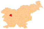
Četena Ravan
Četena Ravan | |
|---|---|
 | |
| Coordinates: 46°10′2.1″N 14°11′5.77″E / 46.167250°N 14.1849361°E | |
| Country | |
| Traditional region | Upper Carniola |
| Statistical region | Upper Carniola |
| Municipality | Gorenja Vas–Poljane |
| Area | |
• Total | 0.59 km2 (0.23 sq mi) |
| Elevation | 895 m (2,936 ft) |
| Population (2020) | |
• Total | 50 |
| • Density | 85/km2 (220/sq mi) |
| [1] | |
Četena Ravan (pronounced [tʃɛˈteːna ɾaˈʋaːn]) is a small settlement in the Municipality of Gorenja Vas–Poljane in the Upper Carniola region of Slovenia.[2]
Name
[edit]Četena Ravan was attested in historical sources as Seteneraun in 1291, Tanawren and Zeta Nawren in 1453, and Czetenorawen in 1500, among other spellings.[3] The name is derived from the verb črtati 'to clear (land)', and thus means 'cleared plateau'.[4] The common noun ravan 'flatland, plateau' is relatively common in Slovene toponyms.[5]
Church
[edit]
The local church is dedicated to Saint Brice (Slovene: sveti Brikcij). It is a late Gothic structure with a five-sided apse and a square nave. Although it was extended in the late 18th century, early 16th-century frescos, some painted by Jernej of Loka, survive in the sanctuary. The main altar dates to the late 17th century with 16th-century statues.[6]
References
[edit]- ^ Statistical Office of the Republic of Slovenia
- ^ Gorenja Vas–Poljane municipal site
- ^ "Četena Ravan". Slovenska historična topografija. ZRC SAZU Zgodovinski inštitut Milka Kosa. Retrieved August 13, 2020.
- ^ Bezlaj, France (1977). Etimološki slovar slovenskega jezika. Vol. 1: A-J. Ljubljana: Mladinska knjiga. pp. 89–90.
- ^ Snoj, Marko (2009). Etimološki slovar slovenskih zemljepisnih imen. Ljubljana: Modrijan. p. 348.
- ^ Cultural Heritage in the Municipality of Gorenja Vas–Poljane (in Slovene)
External links
[edit] Media related to Četena Ravan at Wikimedia Commons
- Četena Ravan on Geopedia


