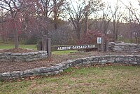
Albert Oakland Park
Appearance
| Albert Oakland Park | |
|---|---|
 | |
 | |
| Location | Columbia, Missouri |
| Coordinates | Maps 38°58′58″N 92°18′31″W / 38.98278°N 92.30861°W |
| Area | 81.5 acres (330,000 m2) |
| Operated by | Columbia Parks and Recreation |
Albert Oakland Park is an 81.5-acre (330,000 m2) park in Columbia, Missouri, in the United States. The park is located at 1900 Blue Ridge Road next to Oakland Junior High School.
History
[edit]The southern 20 acres (81,000 m2) of the park was donated to the City of Columbia in 1964 and is known as the C.M. Albert Memorial Park.
Activities in the park
[edit]Facilities
[edit]- Albert-Oakland Family Aquatic Center
- Reservable Shelters - three total with drinking fountains, power outlets, BBQ grills, and restroom access.
Sports
[edit]
- Baseball/Softball fields - two
- Basketball court - one
- Disc Golf course - two
- Playgrounds - two
- Soccer fields - two
- Tennis courts - three
- Sand Volleyball courts - two
Trails
[edit]Several trails wind through the park:
- Bear Creek Trail - (4.8 miles). This limestone gravel trail runs along Bear Creek and connects the park to the 533-acre (2,160,000 m2) Columbia Cosmopolitan Recreation Area.
- Fitness Trail - (1 Mile). A hard surface trail with eighteen exercise stations.
