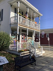
Altamont Historic District
Altamont Historic District | |
| Location | Main St. between Thacher Dr. and the RR station, Altamont, New York |
|---|---|
| Coordinates | 42°42′6″N 74°1′51″W / 42.70167°N 74.03083°W |
| Area | 11 acres (4.5 ha) |
| Architectural style | Greek Revival, Federal, Colonial Revival |
| MPS | Guilderland MRA |
| NRHP reference No. | 82001054[1] |
| Added to NRHP | November 10, 1982 |
The Altamont Historic District is a 11-acre (4.5 ha) historic district in Altamont, New York. It was listed on the National Register of Historic Places in 1982, at which time it included 18 contributing buildings.[1]
The district includes Delaware and Hudson Railroad Passenger Station (Altamont, New York), a train station that was individually listed on the National Register already.[2]


Incomplete reference for Altamont HD, needs checking[3]
References[edit]
- ^ a b "National Register Information System". National Register of Historic Places. National Park Service. March 13, 2009.
- ^ Larson, Neil G. (June 14, 1982), National Register of Historic Places Multiple Property Documentation: Guilderland Town Multiple Resource Area (pdf), National Park Service (incomplete copy, missing many continuation pages in section 8)
- ^ Larson, Neil G. (June 14, 1982). "Historic Resources of Guilderland: Altamont Historic District". New York State Office of Parks, Recreation and Historic Preservation. Retrieved March 22, 2010. (pages 3-9 of section 8 of Guilderland MRA document, plus map of district) and Accompanying 11 photos from 1980
Categories:
- Houses on the National Register of Historic Places in New York (state)
- Federal architecture in New York (state)
- Historic districts in Albany County, New York
- Historic districts on the National Register of Historic Places in New York (state)
- National Register of Historic Places in Albany County, New York
- Albany County, New York Registered Historic Place stubs


