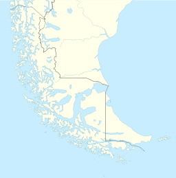
Bahía Lomas, Dawson Island
Appearance
| Bahía Lomas | |
|---|---|
| Bahía Lomas (Spanish) | |
 Small bay off Dawson Island near Cape Froward | |
| Location | Magallanes Region, Chile |
| Coordinates | 53°50′00″S 70°40′00″W / 53.83333°S 70.66667°W[1] |
| Type | Bay |
| Part of | Strait of Magellan |
| Ocean/sea sources | South Pacific |
| Max. length | 12 km (7.5 mi)[2] |
| Max. width | 6 km (3.7 mi)[2] |
Bahía Lomas (or Lomas Bay) is a small bay located on the western coast of Dawson island, Magallanes Region of Chile.
Description
[edit]Bahía Lomas is a bay on the west of Dawson island near the southern tip of South America. The bay is located in southern part of Chile, inside the vast archipelago of Tierra del Fuego, and opens onto the Strait of Magellan. There is a larger bay nearby with the same name. This further complicates the location of the events of Ferdinand Magellan's expedition during his passage from the Atlantic to the Pacific Ocean.[3][4]
References
[edit]- ^ "Bahía Lomas". Australian Antarctic Data Centre. Retrieved 2024-08-22.
- ^ a b "Limits in the Seas" (PDF). The Geographer, Bureau of Intelligence and Research of the Departament of State. 1978-11-15. Retrieved 2024-08-22.
- ^ "Detailed Description of The Straits of Magellan by the Pilot Martin de Uriarte". Whalesite.org. Retrieved 2024-08-22.
- ^ Bergreen, Laurence (2003). Over the Edge of the World: Magellan's Terrifying Circumnavigation of the Globe. HarperCollins e-books. p. 182. ISBN 978-0-06-163396-6.

