Balline Station
Balline Station is a pastoral lease that operates as a sheep station in Western Australia.
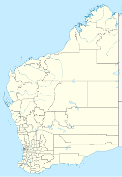
It is located approximately 40 kilometres (25 mi) north-west of Northampton and 40 km (25 mi) south of Kalbarri in the Mid West region of Western Australia. The property has coastal frontage and is found between Lynton Station and the mouth of the Murchison River. The shearing shed is largely built from spars and planks washed ashore at nearby Lucky Bay.[1]
John Thomas acquired the property some time prior to his death in 1895.[2] He was among the first squatters in the area.[3]
The property and surrounding area were shaken by an earthquake in 1909.[4] Later the same year, a bushman named Palmer was taken to Geraldton Hospital and placed in isolation with a suspected case of bubonic plague, from which he later died.[5][6]
Bushfires swept through the area in 1913, leaving little feed for stock.[7]
The 40,000-acre (16,187 ha) property stocked with 3,000 sheep was put up for auction by C. H. Counsel[8] in 1924[9] and sold for £10,000.[10]
The Forrester family owned the property in 1930 when they built the heritage-listed residence, known as Stone House, in the town of Northampton.[11] They remained at Balline until at least 1943.[12] By 1945 the Hose brothers had acquired the property.[13]
In 2004 the lease was held by R.J. & H.M. Hose and Sons.[14]
See also[edit]
References[edit]
- ^ "Handy to sea and beach". The Daily News. Vol. LVI, no. 19, 764. Western Australia. 30 July 1938. p. 8 (Supplement to The Daily News). Retrieved 26 February 2017 – via National Library of Australia.
- ^ "Thomas/Owens". 12 December 2016. Retrieved 26 February 2017 – via PressReader.
- ^ "A Northampton Pioneer". Geraldton Guardian and Express. Vol. VIII, no. 1, 326. Western Australia. 24 March 1936. p. 2. Retrieved 26 February 2017 – via National Library of Australia.
- ^ "Farm and Station". Western Mail. Vol. XXIV, no. 1, 218. Western Australia. 1 May 1909. p. 4. Retrieved 26 February 2017 – via National Library of Australia.
- ^ "Bubonic Plague". Geraldton Guardian. Vol. III, no. 350. Western Australia. 11 May 1909. p. 2. Retrieved 26 February 2017 – via National Library of Australia.
- ^ "Death of Mr Chas Palmer". Geraldton Express. Vol. XXXI. Western Australia. 7 June 1909. p. 3. Retrieved 26 February 2017 – via National Library of Australia.
- ^ "Country". The West Australian. Vol. XXIX, no. 3, 392. Western Australia. 25 February 1913. p. 10. Retrieved 26 February 2017 – via National Library of Australia.
- ^ "Northampton notes". Geraldton Guardian. Vol. XVIII, no. 4452. Western Australia. 2 July 1925. p. 1. Retrieved 26 February 2017 – via National Library of Australia.
- ^ "Advertising". Geraldton Guardian. Vol. XVII, no. 4357. Western Australia. 6 November 1924. p. 3. Retrieved 26 February 2017 – via National Library of Australia.
- ^ "Agents' reports". Sunday Times (Perth). No. 1405. Western Australia. 14 December 1924. p. 8. Retrieved 26 February 2017 – via National Library of Australia.
- ^ "Stone House". InHerit. Heritage Council of Western Australia. Retrieved 26 February 2017.
- ^ "Wool Appraisement". Northern Times. Vol. 39, no. 65. Western Australia. 26 March 1943. p. 3. Retrieved 26 February 2017 – via National Library of Australia.
- ^ "District stock sales". Geraldton Guardian and Express. Vol. XVII, no. 2591. Western Australia. 10 February 1945. p. 1. Retrieved 26 February 2017 – via National Library of Australia.
- ^ "Brand 0DA0". Department of Agriculture and Food, Western Australia. 19 October 2015. Retrieved 26 February 2017.

