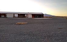
Battle Mountain Airport
Battle Mountain Airport | |||||||||||||||
|---|---|---|---|---|---|---|---|---|---|---|---|---|---|---|---|
 | |||||||||||||||
| Summary | |||||||||||||||
| Airport type | Public | ||||||||||||||
| Operator | Lander County | ||||||||||||||
| Serves | Battle Mountain, Nevada | ||||||||||||||
| Location | Lander County, near Battle Mountain, Nevada | ||||||||||||||
| Elevation AMSL | 4,532 ft / 1,381 m | ||||||||||||||
| Coordinates | 40°35′59″N 116°52′34″W / 40.59972°N 116.87611°W | ||||||||||||||
 | |||||||||||||||
| Runways | |||||||||||||||
| |||||||||||||||
| Helipads | |||||||||||||||
| |||||||||||||||

Battle Mountain Airport (IATA: BAM, ICAO: KBAM, FAA LID: BAM), also known as Lander County Airport, is 3 miles (5 km) southeast of Battle Mountain, Nevada, United States. This general aviation airport is owned by Lander County and operated by the Battle Mountain Airport Authority.
History
[edit]The airport was built by the United States Army Air Forces about 1942, and was known as Battle Mountain Flight Strip. It was an emergency landing airfield by the Reno Army Air Base for military aircraft on training flights. It was also designated as a CAA Intermediate Field for civil aircraft emergency use. It was closed after World War II, and was turned over for local government use by the War Assets Administration (WAA).[2]
Facilities
[edit]The airport covers 1,066 acres (431 ha) and has two runways and two helipads:
- 3/21: 7,299 x 150 ft (2,225 x 46 m), surface: asphalt
- 12/30: 7,300 x 100 ft (2,225 x 30 m), surface: asphalt
- Helipad H1: 60 x 60 ft (18 x 18 m), surface: concrete
- Helipad H2: 60 x 60 ft (18 x 18 m), surface: concrete
Organizations
[edit]
BAM is home to the Battle Mountain Air Attack Base, which is run by the Bureau of Land Management.[3] The Air Attack Base provides air tanker support for fire suppression in northern Nevada.[4] The Nevada Division of Forestry also operates an air tanker base at BAM.[5]
Displays
[edit]Several aerospace exhibits are available at the airport.[6][7]
Popular culture
[edit]The airstrip at Battle Mountain was used as a setting by novelist Dale Brown in his techno-thriller novel Battle Born.
See also
[edit]References
[edit]- ^ FAA Airport Form 5010 for BAM PDF
- ^ "Army and Air Force Flying Fields in the USA". 2008-10-07. Retrieved 19 December 2008.
- ^ "AIR ATTACK BASE OPEN HOUSE AND SMOKEY'S 60TH BIRTHDAY CELEBRATION". Bureau of Land Management. 2004-07-30. Archived from the original on 17 October 2008. Retrieved 19 December 2008.
- ^ "Battle Mountain Fire Program". Bureau of Land Management. Archived from the original on 7 February 2009. Retrieved 19 December 2008.
- ^ "Aviation". Nevada Division of Forestry. Archived from the original on 16 June 2011. Retrieved 27 June 2011.
- ^ "US Navy and US Marine Corps BuNos". Archived from the original on 30 December 2008. Retrieved 19 December 2008.
- ^ "1966 USAF Serial Numbers". Archived from the original on 7 January 2009. Retrieved 19 December 2008.
Other sources
[edit] This article incorporates public domain material from the Air Force Historical Research Agency
- Shaw, Frederick J. (2004), Locating Air Force Base Sites History's Legacy, Air Force History and Museums Program, United States Air Force, Washington DC, 2004.
- Brown, Dale (1999) Battle Born, 416 pp.(hardcover). Bantam Books, New York, NY, 1999.
External links
[edit]- "Diagram of Battle Mountain Airport (BAM)" (PDF). Archived from the original (PDF) on 2012-02-13. from Nevada DOT
- FAA Terminal Procedures for BAM, effective December 26, 2024
- Resources for this airport:
- FAA airport information for BAM
- AirNav airport information for KBAM
- ASN accident history for BAM
- FlightAware airport information and live flight tracker
- SkyVector aeronautical chart for KBAM
- Airports in Nevada
- Buildings and structures in Lander County, Nevada
- Flight Strips of the United States Army Air Forces
- Airfields of the United States Army Air Forces in Nevada
- World War II airfields in the United States
- Transportation in Lander County, Nevada
- Airports established in 1942
- 1942 establishments in Nevada
