Bayonville
Bayonville | |
|---|---|
 Bayonville village | |
| Coordinates: 49°23′48″N 5°00′23″E / 49.3967°N 5.0064°E | |
| Country | France |
| Region | Grand Est |
| Department | Ardennes |
| Arrondissement | Vouziers |
| Canton | Vouziers |
| Intercommunality | Argonne Ardennaise |
| Government | |
| • Mayor (2020–2026) | Philippe Etienne[1] |
| Area 1 | 16.19 km2 (6.25 sq mi) |
| Population (2021)[2] | 70 |
| • Density | 4.3/km2 (11/sq mi) |
| Time zone | UTC+01:00 (CET) |
| • Summer (DST) | UTC+02:00 (CEST) |
| INSEE/Postal code | 08052 /08240 |
| Elevation | 181–305 m (594–1,001 ft) (avg. 245 m or 804 ft) |
| 1 French Land Register data, which excludes lakes, ponds, glaciers > 1 km2 (0.386 sq mi or 247 acres) and river estuaries. | |
Bayonville is a commune in the Ardennes department in the Grand Est region of northern France.[3]
The inhabitants of the commune are known as Bayonvillois or Bayonvilloises.[4]
Geography[edit]
Bayonville is located some 40 km south by south-east of Charleville-Mézières and 15 km south-west of Stenay. Access to the commune is by the D12 road from Buzancy in the north-west which passes through the centre of the commune and the village and continues south-east to Bantheville - changing to the D15 at the departmental border. Another D15 comes from Tailly in the north-east and goes south through the commune and the village continuing to Imécourt in the south-west. The D55 goes south from the village to Landres-et-Saint-Georges. Apart from the village there are the hamlets of Chennery and Landreville. The commune is mostly farmland with some forest in the east and north.[5][6]
The Agron river flows through the south-east of the commune from north-east to south-west where it continues a meandering path to join the Aire south-west of Saint-Juvin. The Ruisseau du Wassieux flows south-west through the commune and continues south-west to join the Agron near Imécourt. The Furba rises in the north-east of the commune and flows south-west to join the Agron at Landreville.[5][6]
Toponymy[edit]
Bayonville was attested in the Latinised form Baionis villa in 960. The derivation is undoubtedly from the "Domain of Baio", a Germanic personal name (cf. Bayonvillers)
Bayonville appears as Bayonville on the 1750 Cassini Map[7] and the same on the 1790 version.[8]
History[edit]
In 1828 the communes of Chennery and Landreville were merged with the commune of Bayonville. In 1864 Landreville had 80 inhabitants.
Administration[edit]
| From | To | Name |
|---|---|---|
| 1995 | 2026 | Philippe Etienne |
Demography[edit]
In 2017 the commune had 99 inhabitants.
|
| ||||||||||||||||||||||||||||||||||||||||||||||||||||||||||||||||||||||||||||||||||||||||||||||||||||||||||||
| |||||||||||||||||||||||||||||||||||||||||||||||||||||||||||||||||||||||||||||||||||||||||||||||||||||||||||||
| Source: EHESS[10] and INSEE[11] | |||||||||||||||||||||||||||||||||||||||||||||||||||||||||||||||||||||||||||||||||||||||||||||||||||||||||||||
Culture and heritage[edit]


Civil heritage[edit]
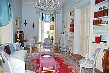
- The Chateau of Landreville (1567)
 is registered as an historical monument.[12] The interior decor (16th century)
 is registered as an historical object.[13]
Religious heritage[edit]

- Bayonville Church
Notable people linked to the commune[edit]
- Claude-François de Maillard first Marquis of Landreville in 1760
See also[edit]
References[edit]
- ^ "Répertoire national des élus: les maires" (in French). data.gouv.fr, Plateforme ouverte des données publiques françaises. 13 September 2022.
- ^ "Populations légales 2021". The National Institute of Statistics and Economic Studies. 28 December 2023.
- ^ INSEE commune file
- ^ Inhabitants of Ardennes (in French)
- ^ a b c Bayonville on Google Maps
- ^ a b Bayonville on the Géoportail from National Geographic Institute (IGN) website (in French)
- ^ Bayonville on the 1750 Cassini Map
- ^ Bayonville on the 1790 Cassini Map
- ^ List of Mayors of France (in French)
- ^ Des villages de Cassini aux communes d'aujourd'hui: Commune data sheet Bayonville, EHESS (in French).
- ^ Population en historique depuis 1968, INSEE
- ^ Ministry of Culture, Mérimée PA08000001 Chateau of Landreville (in French)
- ^ Ministry of Culture, Palissy PM08000685 Interior Decor (in French)


