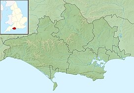
Beaminster Down
Appearance
| Beaminster Down | |
|---|---|
 Beaminster Down viewed from the Monarch's Way looking southwest | |
| Highest point | |
| Elevation | 244 m (801 ft)[1] |
| Listing | Hills of Dorset |
| Coordinates | 50°49′42″N 2°43′02″W / 50.8283°N 2.71711°W |
| Geography | |
Dorset, England | |
| Parent range | Dorset Downs |
| OS grid | ST493033 |
| Topo map | OS Landranger No. 194 |
At 244 metres, Beaminster Down is one of the highest hills in West Dorset, England.
Location
[edit]Beaminster Down is common land on the Dorset Downs and overlooks the steep scarp slope above the town of Beaminster,[2] which is about a mile and a half to the southwest. The hill is crossed by two long-distance trails, two minor roads and several other tracks.[1]
History
[edit]There is evidence of prehistoric settlement on in the form of tumuli to the northeast.[1] Grenade practice took place in the sandbagged, zig-zag trenches on Beaminster Down during the Second World War.[3]
References
[edit]- ^ a b c Ordnance Survey 1:50,000 Landranger series.
- ^ "Beaminster Down". common-land.com. Retrieved 29 March 2013.
- ^ "Beaminster at war". dorsetlife.co.uk. Retrieved 29 March 2013.

