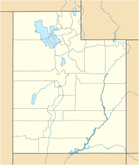
Beaver Municipal Airport (Utah)
Beaver Municipal Airport | |||||||||||||||
|---|---|---|---|---|---|---|---|---|---|---|---|---|---|---|---|
 Asphalt (dark black) runway and dirt (white) runway on left. USGS image (1999). | |||||||||||||||
| Summary | |||||||||||||||
| Airport type | Public | ||||||||||||||
| Owner | Beaver City | ||||||||||||||
| Serves | Beaver, Utah | ||||||||||||||
| Elevation AMSL | 5,863 ft / 1,787 m | ||||||||||||||
| Coordinates | 38°13′50″N 112°40′32″W / 38.23056°N 112.67556°W | ||||||||||||||
| Website | BeaverUtah.net/... | ||||||||||||||
| Map | |||||||||||||||
| Runways | |||||||||||||||
| |||||||||||||||
| Statistics (2010) | |||||||||||||||
| |||||||||||||||
Beaver Municipal Airport (FAA LID: U52) is a public use airport in Beaver County, Utah, United States. It is owned by the city of Beaver and located four nautical miles (5 mi, 7 km) southwest of its central business district.[1] This airport is included in the National Plan of Integrated Airport Systems for 2011–2015, which categorized it as a general aviation facility.[2]
History[edit]
The airport was opened in May 1944.[3]
In 1992, the airport received federal funding to extend and rehabilitate their runway, as well as install a visual approach system. [4] A fence, to keep both wildlife and unauthorized people out of the airport grounds, was funded in 2007.[5]
Facilities and aircraft[edit]
Beaver Municipal Airport covers an area of 841 acres (340 ha) at an elevation of 5,863 feet (1,787 m) above mean sea level. It has two runways: 13/31 is 4,984 by 75 feet (1,519 x 23 m) with an asphalt surface and 7/25 is 2,150 by 50 feet (655 x 15 m) with a dirt surface.[1]
For the 12-month period ending December 31, 2010, the airport had 1,958 aircraft operations, an average of 163 per month: 97% general aviation and 3% air taxi. At that time there were 9 aircraft based at this airport: 56% single-engine and 44% ultralight.[1]
Instrument approach procedure (IAP): RNAV (GPS)-A [6]
See also[edit]
References[edit]
- ^ a b c d FAA Airport Form 5010 for U52 PDF. Federal Aviation Administration. effective May 31, 2012.
- ^ "2011–2015 NPIAS Report, Appendix A" (PDF). National Plan of Integrated Airport Systems. Federal Aviation Administration. October 4, 2010. Archived from the original (PDF, 2.03 MB) on 2012-09-27.
- ^ "Funds will help nature-made, man-made birds". Deseret News. November 20, 1992. Retrieved September 6, 2009.
- ^ "Beaver airport gets wildlife-fence grant". Deseret News. May 12, 2007. Retrieved September 6, 2009.
- ^ RNAV (GPS)-A (PDF), effective 18 Apr 2024
External links[edit]
- Official website

- Aerial image as of June 1999 from USGS The National Map
- FAA Terminal Procedures for U52, effective April 18, 2024
- Resources for this airport:
- FAA airport information for U52
- AirNav airport information for U52
- FlightAware airport information and live flight tracker
- SkyVector aeronautical chart for U52

