Berlin-Wilhelmsruh station
Berlin-Wilhelmsruh | ||||||||||||||||
|---|---|---|---|---|---|---|---|---|---|---|---|---|---|---|---|---|
| Bf | ||||||||||||||||
 | ||||||||||||||||
| General information | ||||||||||||||||
| Location | Reinickendorf, Reinickendorf borough, Berlin Germany | |||||||||||||||
| Line(s) | Northern Railway ( Berlin–Groß Schönebeck Railway (unconnected since 1961) | |||||||||||||||
| Construction | ||||||||||||||||
| Architect | Ernst Schwartz | |||||||||||||||
| Other information | ||||||||||||||||
| Station code | 0567 | |||||||||||||||
| DS100 code | BWM | |||||||||||||||
| Category | 4 | |||||||||||||||
| Fare zone | VBB: Berlin B/5656[1] | |||||||||||||||
| History | ||||||||||||||||
| Opened | 10 July 1877 | |||||||||||||||
| Electrified | 5 June 1925 | |||||||||||||||
| Previous names | 1877-1891 Rosenthal 1891-1893 Reinickendorf (Rosenthaler Straße) 1893-1937 Reinickendorf-Rosenthal | |||||||||||||||
| Key dates | ||||||||||||||||
| 1908-1910 | embankment and new station built | |||||||||||||||
| 1945, late April - June 10 | operation interrupted | |||||||||||||||
| 1984, 9 January - 30 September | operation interrupted | |||||||||||||||
| Services | ||||||||||||||||
| ||||||||||||||||
| ||||||||||||||||
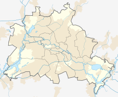
Berlin-Wilhelmsruh (in German S-Bahnhof Berlin-Wilhelmsruh) is a railway station in the neighbourhood of Reinickendorf, right adjacent to the locality of Wilhelmsruh, in the city of Berlin, Germany. Until the 1938 administrative border shift, the station happened to be within the boundaries of Wilhelmsruh. It is served by the Berlin S-Bahn and a local bus. The reconnection of the station with the Berlin–Groß Schönebeck Railway is planned.
The railway station also represented the junction of two abandoned branches of the Prussian Northern Railway and the Heidekraut Railway (operated by the Niederbarnimer Eisenbahn). Due to its position outside the Wall (in Reinickendorf), from 1961 to 1989 the S-Bahn station was usable only for West Berlin,[2] at the southern entrance.[3] The Heidekraut rail terminal was instead moved to Rosenthal station, now abandoned.
References
[edit]- ^ "Der VBB-Tarif: Aufteilung des Verbundgebietes in Tarifwaben und Tarifbereiche" (PDF). Verkehrsbetrieb Potsdam. Verkehrsverbund Berlin-Brandenburg. 1 January 2017. Archived from the original (PDF) on 27 October 2020. Retrieved 25 November 2019.
- ^ Berliner rail network map after 1961 Archived 2010-04-09 at the Wayback Machine
- ^ Historical notes and picture of Wilhelmsruh station
External links
[edit]![]() Media related to Berlin-Wilhelmsruh station at Wikimedia Commons
Media related to Berlin-Wilhelmsruh station at Wikimedia Commons
- Station information (in German)

