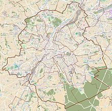
Boulevard Émile Jacqmain
 | |
| Location | City of Brussels, Brussels-Capital Region, Belgium |
|---|---|
| Quarter | Marais–Jacqmain Quarter |
| Coordinates | 50°51′15″N 4°21′15″E / 50.85417°N 4.35417°E |
| Construction | |
| Completion | 1868–1871 |
| Other | |
| Designer | Léon Suys |
The Boulevard Émile Jacqmain (French) or Émile Jacqmainlaan (Dutch) is a central boulevard in Brussels, Belgium. It was created following the covering of the river Senne (1867–1871), and bears the name of Émile Jacqmain, a former Alderman for Public Education.
The Boulevard Émile Jacqmain connects the Place de Brouckère/De Brouckèreplein to the Boulevard du Jardin botanique/Kruidtuinlaan and the Boulevard d'Anvers/Antwerpselaan, in the extension of the Boulevard Anspach/Anspachlaan.[1] This area is served by the metro and premetro (underground tram) stations De Brouckère (on lines 1, 3, 4 and 5) and Rogier (on lines 2, 3, 4 and 6). Its northern section from the Boulevard Baudouin/Boudewijnlaan to the Place Gaucheret/Gaucheretplein was renamed the Boulevard du Roi Albert II/Koning Albert II-laan in 1999.[2]
History
[edit]The Boulevard Émile Jacqmain was built between 1868 and 1871, as part of the Central Boulevards, which were created after the covering of the river Senne.[3][4] The boulevard was originally named the Boulevard de la Senne/Zennelaan ("Senne Boulevard") because it follows the course of the river.[5] In 1919, it was renamed in honour of the liberal politician and Alderman for Public Education, Émile Jacqmain (1860–1933),[5][1] who had been arrested and subsequently deported by the Germans in 1917.
During the 20th century, the offices of many daily newspapers were located on the Boulevard Émile Jacqmain[6] (including De Standaard, Het Laatste Nieuws and Het Nieuwsblad). There was also journalistic activity at the back in the Rue Saint-Pierre/Sint-Pietersstraat, with La Libre Belgique and La Dernière Heure, among others. In the 1980s, the Flemish newspapers left, and in 2006, La Libre Belgique was the last to leave the Boulevard Émile Jacqmain.
See also
[edit]References
[edit]Citations
[edit]- ^ a b "Boulevard Emile Jacqmain – Inventaire du patrimoine architectural". monument.heritage.brussels (in French). Retrieved 12 September 2024.
- ^ "Boulevard Roi Albert II – Inventaire du patrimoine architectural". monument.heritage.brussels (in French). Retrieved 12 September 2024.
- ^ Demey 1990, p. 65.
- ^ Map of Suys' proposal. City Archives of Brussels: p.p. 1.169
- ^ a b Eggericx 1997, p. 5.
- ^ Eggericx 1997, p. 34.
Bibliography
[edit]- Demey, Thierry (1990). Bruxelles, chronique d'une capitale en chantier (in French). Vol. I: Du voûtement de la Senne à la jonction Nord-Midi. Brussels: Paul Legrain/CFC. OCLC 44643865.
- Demey, Thierry (2013). Bruxelles, des remparts aux boulevards (in French). Brussels: Badeaux. ISBN 978-2-930609-02-7.
- Eggericx, Laure (1997). Les Boulevards du Centre. Bruxelles, ville d'Art et d'Histoire (in French). Vol. 20. Brussels: Centre d'information, de Documentation et d'Etude du Patrimoine.
- Le Patrimoine monumental de la Belgique: Bruxelles (PDF) (in French). Vol. 1A: Pentagone A-D. Liège: Pierre Mardaga. 1989.
External links
[edit] Media related to Boulevard Émile Jacqmain/Émile Jacqmainlaan, Brussels at Wikimedia Commons


