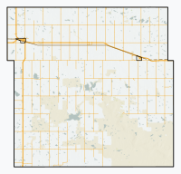
Bracken, Saskatchewan
Bracken | |
|---|---|
| Village of Bracken | |
 Looking down railway tracks towards the grain elevator in Bracken. | |
| Coordinates: 49°10′46″N 108°05′38″W / 49.1795°N 108.094°W | |
| Country | Canada |
| Province | Saskatchewan |
| Region | Southwest |
| Rural municipality | Lone Tree No. 18 |
| Government | |
| • Type | Municipal |
| • Governing body | Bracken Village Council |
| • Mayor | Steve Dueck |
| • Administrator | Monique Fehr |
| • MLA | Dave Marit |
| • MP | Jeremy Patzer |
| Area | |
• Total | 0.60 km2 (0.23 sq mi) |
| Population (2016) | |
• Total | 25 |
| • Density | 33.5/km2 (87/sq mi) |
| Time zone | UTC-6 (CST) |
| Postal code | S0N 0G0 |
| Area code | 306 |
| Highways | |
| Railway | Great Western Railway |
Bracken (2016 population: 20) is a village in the Canadian province of Saskatchewan within the Rural Municipality of Lone Tree No. 18 and Census Division No. 4. The village is named after John Bracken, Premier of Manitoba and leader of the Progressive Conservative Party of Canada, who was a professor at the University of Saskatchewan. The small village is located approximately 160 km south of the city of Swift Current on Highway 18, directly north of Grasslands National Park, and approximately 20 km north of the Montana–Saskatchewan border.
History
[edit]Bracken incorporated as a village on January 4, 1926.[1]
Demographics
[edit]In the 2021 Census of Population conducted by Statistics Canada, Bracken had a population of 20 living in 11 of its 14 total private dwellings, a change of 0% from its 2016 population of 20. With a land area of 0.63 km2 (0.24 sq mi), it had a population density of 31.7/km2 (82.2/sq mi) in 2021.[4]
In the 2016 Census of Population, the Village of Bracken recorded a population of 20 living in 9 of its 13 total private dwellings, a -50% change from its 2011 population of 30. With a land area of 0.6 km2 (0.23 sq mi), it had a population density of 33.3/km2 (86.3/sq mi) in 2016.[5]
Education
[edit]Students in Bracken are bused to Frontier, which has a school that covers kindergarten through grade 12 in the Chinook School Division.
See also
[edit]References
[edit]- ^ "Urban Municipality Incorporations". Saskatchewan Ministry of Government Relations. Archived from the original on October 15, 2014. Retrieved June 1, 2020.
- ^ "Saskatchewan Census Population" (PDF). Saskatchewan Bureau of Statistics. Archived from the original (PDF) on September 24, 2015. Retrieved May 31, 2020.
- ^ "Saskatchewan Census Population". Saskatchewan Bureau of Statistics. Retrieved May 31, 2020.
- ^ "Population and dwelling counts: Canada, provinces and territories, census divisions and census subdivisions (municipalities), Saskatchewan". Statistics Canada. February 9, 2022. Retrieved April 1, 2022.
- ^ "Population and dwelling counts, for Canada, provinces and territories, and census subdivisions (municipalities), 2016 and 2011 censuses – 100% data (Saskatchewan)". Statistics Canada. February 8, 2017. Retrieved May 30, 2020.


