Cullingford Field
Cullingford Field | |||||||||||
|---|---|---|---|---|---|---|---|---|---|---|---|
| Summary | |||||||||||
| Airport type | Closed | ||||||||||
| Owner/Operator | U.S. Fish & Wildlife Service | ||||||||||
| Location | Cabo Rojo, near Boquerón, Puerto Rico | ||||||||||
| Elevation AMSL | 14 ft / 4 m | ||||||||||
| Coordinates | 17°58′35″N 67°10′15″W / 17.97639°N 67.17083°W | ||||||||||
| Map | |||||||||||
 | |||||||||||
| Runways | |||||||||||
| |||||||||||
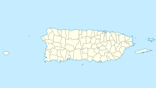
Cullingford Field (FAA LID: PR24) was an airstrip owned and operated by the United States Fish and Wildlife Service near Boquerón in the municipality of Cabo Rojo, Puerto Rico. Located within the Cabo Rojo National Wildlife Refuge, it was used exclusively by Fish and Wildlife personnel.
Google Earth Historical Imagery (3/27/2004) shows an east-west 1,760 feet (540 m) grass runway with a Quonset hangar midfield. The (10/31/2006) image shows the runway area divided into unfenced plots and being cultivated. By 2009 the runway had been returned to grass and usability. The (10/24/2010) image shows the runway usable, but the hangar being demolished. By (12/3/2011) the hangar is gone and brush is growing on the runway. Current imagery (11/29/2017) shows the airfield returned to nature.
See also
[edit]References
[edit]- ^ "Cullingford Field". Our Airports. Retrieved 5 June 2018.
- ^ "Cullingford Field". Google Maps. Google. Retrieved 5 June 2018.
External links
[edit]

