
Eulo, Queensland
| Eulo Queensland | |||||||||||||||
|---|---|---|---|---|---|---|---|---|---|---|---|---|---|---|---|
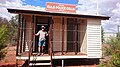
 Entry to Eulo, 2006 | |||||||||||||||
 Eulo | |||||||||||||||
| Coordinates | 28°09′34″S 145°02′51″E / 28.1594°S 145.0475°E | ||||||||||||||
| Population | 95 (2016 census)[1] | ||||||||||||||
| • Density | 0.01563/km2 (0.04048/sq mi) | ||||||||||||||
| Postcode(s) | 4491 | ||||||||||||||
| Elevation | 137 m (449 ft)[2] | ||||||||||||||
| Area | 6,078.0 km2 (2,346.7 sq mi) | ||||||||||||||
| Time zone | AEST (UTC+10:00) | ||||||||||||||
| Location |
| ||||||||||||||
| LGA(s) | Shire of Paroo | ||||||||||||||
| State electorate(s) | Warrego | ||||||||||||||
| Federal division(s) | Maranoa | ||||||||||||||
| |||||||||||||||
| |||||||||||||||
Eulo is an outback town and locality in the Shire of Paroo, Queensland, Australia.[3][4] In the 2016 census, Eulo had a population of 95 people.[1] It is known for its opal mining.
Geography[edit]

Eulo is 64 kilometres (40 mi) west of Cunnamulla and 887 kilometres (551 mi) west of Brisbane.
The town is located beside and to the east of the Paroo River which flows in a roughly north–south direction.
The Bulloo Developmental Road (part of the Adventure Way) connects Eulo to Cunnamulla to the east and Thargomindah to the west.
History[edit]
Prior to white settlement, Eulo was in the area of the Kalali tribe.[citation needed]
Margany (also known as Marganj, Mardigan, Marukanji, Maranganji) is an Australian Aboriginal language spoken by the Margany people. The Margany language region includes the landscape within the local government boundaries of the Quilpie Shire, taking in Quilpie, Cheepie and Beechal extending towards Eulo and Thargomindah, as well as the properties of Dynevor Downs and Ardoch.[5]
The town takes its name from a settlement on the Paroo River first appearing on an 1872 map of Queensland map.[3]
The post office opened on 6 September 1872; the first postmaster was the publican William Shearer.[3][6]
A town reserve was proclaimed in 1874 described as "near the Eulo waterhole".[3]
A police station was established about 1 January 1880.[7]
A Court of Petty Sessions was established on 18 August 1880 and operated until 31 December 1964.[8]
A telegraph office opened in 1881.[3]
Eulo Provisional School opened on 7 May 1888. On 1 January 1909 it became Eulo State School.[9][10]
The telephone exchange opened in 1923.[11]
St Francis' Anglican Church was dedicated by Archbishop Reginald Halse on 15 September 1957. Its closure on 12 June 2010 was approved by Archbishop Phillip Aspinall.[12]
In the 2006 census, Eulo had a population of 108.[13]
In the 2016 census, Eulo had a population of 95 people.[1]
Heritage listings[edit]
- 1929 Building of Eulo State School[14]
Facilities[edit]
Eulo has one pub and a small general store as well as Outback Petrol. The general store and fuel bowsers were destroyed by fire on 25 July 2011.[15] They have since been rebuilt.[16]
Education[edit]
Eulo State School is a government primary (Early Childhood-6) school for boys and girls on the southern corner of Leo Street and Emu Street (28°09′27″S 145°03′01″E / 28.1575°S 145.0504°E).[17][18] The enrolments between 2010 and 2012 have ranged from 11 to 16 students. In 2018, the school had an enrolment of 14 students with 2 teachers and 4 non-teaching staff (2 full-time equivalent).[19] Some students travel up to 130 kilometres (81 mi) each day to attend school, while other students live in the Eulo and District Hostel during the week in order to attend. After completing primary school in Eulo, most students attend a secondary boarding school in Brisbane or Toowoomba.[20]
Events[edit]

Eulo once hosted the World Lizard Racing Championships on their Paroo Track, but environmentalists put an end to that annual event.[21][dead link]
Notable residents[edit]

- Isabel Gray (better known as the Eulo Queen) was a publican, storekeeper and prostitute[22]
Gallery[edit]
-
 Police Cell
 -
 English Bore
 -
 General Store


References[edit]
- ^ a b c Australian Bureau of Statistics (27 June 2017). "Eulo (SSC)". 2016 Census QuickStats. Retrieved 20 October 2018.
- ^ "Summary statistics: Eulo Post Office". Bureau of Meteorology. Archived from the original on 2 September 2007. Retrieved 27 January 2008.
- ^ a b c d e "Eulo – town in Shire of Paroo (entry 11930)". Queensland Place Names. Queensland Government. Retrieved 30 June 2020.
- ^ "Eulo – locality in Shire of Paroo (entry 42654)". Queensland Place Names. Queensland Government. Retrieved 30 June 2020.
- ^ "Margany". State Library of Queensland. Retrieved 15 January 2020.
- ^ Premier Postal History. "Post Office List". Premier Postal Auctions. Retrieved 16 May 2014.
- ^ "Agency ID 1559, Police station, Eulo". Queensland State Archives. Retrieved 17 May 2014.
- ^ "Agency ID 698, Court of Petty Sessions, Eulo". Queensland State Archives. Retrieved 17 May 2014.
- ^ "Opening and closing dates of Queensland Schools". Queensland Government. Retrieved 16 May 2014.
- ^ Queensland Family History Society (2010), Queensland schools past and present (Version 1.01 ed.), Queensland Family History Society, ISBN 978-1-921171-26-0
- ^ "History". Eulo Queen Hotel. Archived from the original on 26 June 2014. Retrieved 16 May 2014.
- ^ Anglican Church of Southern Queensland. "Closed Churches". Archived from the original on 3 April 2019. Retrieved 3 April 2019.
- ^ Australian Bureau of Statistics (25 October 2007). "Eulo (Paroo Shire) (State Suburb)". 2006 Census QuickStats. Retrieved 27 January 2008.
- ^ "Paroo Shire Planning Scheme: Schedule 6 - Local Heritage Places". Paroo Shire Council. pp. 124–129. Retrieved 6 December 2022.
- ^ "Blaze claims historic general store". Australian Broadcasting Corporation. 26 July 2011. Archived from the original on 14 August 2011. Retrieved 5 August 2011.
- ^ "Community Website". Archived from the original on 26 January 2014. Retrieved 17 May 2014.
- ^ "State and non-state school details". Queensland Government. 9 July 2018. Archived from the original on 21 November 2018. Retrieved 21 November 2018.
- ^ "Eulo State School". Eulo State School. 29 November 2020. Retrieved 27 September 2023.
- ^ "ACARA School Profile 2018". Australian Curriculum, Assessment and Reporting Authority. Retrieved 28 January 2020.
- ^ "School Report" (PDF). Eulo State School. Archived from the original (PDF) on 17 May 2014. Retrieved 16 May 2014.
- ^ "Eulo". Paroo Shire Council. Archived from the original on 4 February 2014. Retrieved 16 May 2014.
- ^ Gill, J. C. H. "Gray, Isabel (1851–1929)". Australian Dictionary of Biography. National Centre for Biography, Australian National University. Archived from the original on 3 March 2017. Retrieved 16 May 2014.