Filatovo (lake)
Appearance
| Filatovo | |
|---|---|
| Филатово | |
 Sentinel-2 picture of the lake | |
| Location | Ishim Plain |
| Coordinates | 54°48′06″N 67°02′18″E / 54.80167°N 67.03833°E |
| Type | endorheic |
| Basin countries | Russia |
| Max. length | 7.6 kilometers (4.7 mi) |
| Max. width | 4.5 kilometers (2.8 mi) |
| Surface area | 22.5 square kilometers (8.7 sq mi) |
| Residence time | UTC+5 |
| Surface elevation | 124 meters (407 ft) |
| Islands | no |
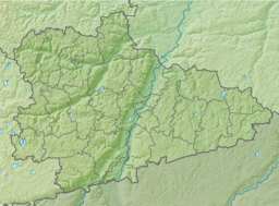
Filatovo (Russian: Филатово) is a body of water in Makushinsky District, Kurgan Oblast, Russian Federation.[1]
The lake is located 46 kilometers (29 mi) to the south of Makushino and 57 kilometers (35 mi) to the southwest of Petukhovo.[2]
Geography
[edit]Filatovo is a salt lake of the Ishim Plain, the southern part of the West Siberian Plain. The lake is roughly drop shaped and the western shore has a landspit projecting eastwards. The Kazakhstan–Russia border fringes the southern end of the lake.[1]
The area where Filatovo is located is dotted with smaller lakes. Larger lake Medvezhye lies 67 kilometers (42 mi) to the northeast and lake Menkeser 60 kilometers (37 mi) to the southeast, beyond the Kazakhstan-Russia border.[2]
This article or section is in a state of significant expansion or restructuring. You are welcome to assist in its construction by editing it as well. If this article or section has not been edited in several days, please remove this template. If you are the editor who added this template and you are actively editing, please be sure to replace this template with {{in use}} during the active editing session. Click on the link for template parameters to use.
This article was last edited by Xufanc (talk | contribs) 3 seconds ago. (Update timer) |
See also
[edit]References
[edit]- ^ a b Google Earth
- ^ a b "N-42 Topographic Chart (in Russian)". Retrieved 14 August 2024.


