
File:Southern England c.840.pdf

Size of this JPG preview of this PDF file: 424 × 600 pixels. Other resolutions: 170 × 240 pixels | 339 × 480 pixels | 543 × 768 pixels | 1,239 × 1,752 pixels.
Original file (1,239 × 1,752 pixels, file size: 1.17 MB, MIME type: application/pdf)
| This is a file from the Wikimedia Commons. Information from its description page there is shown below. Commons is a freely licensed media file repository. You can help. |
Summary
| Description |
English: This is based on a map created by Ikonact. I have amended to shown places mentioned in the article on King Æthelwulf of Wessex so that I can request help of the Graphics workshop |
| Date | |
| Source | File:British Isles 10th century.svg adapted for early 9C |
| Author | Ikonact and Dudley Miles |
Licensing
I, the copyright holder of this work, hereby publish it under the following license:
| This file is made available under the Creative Commons CC0 1.0 Universal Public Domain Dedication. | |
| The person who associated a work with this deed has dedicated the work to the public domain by waiving all of their rights to the work worldwide under copyright law, including all related and neighboring rights, to the extent allowed by law. You can copy, modify, distribute and perform the work, even for commercial purposes, all without asking permission.
|
File history
Click on a date/time to view the file as it appeared at that time.
| Date/Time | Thumbnail | Dimensions | User | Comment | |
|---|---|---|---|---|---|
| current | 21:31, 6 July 2015 | 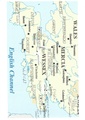 | 1,239 × 1,752 (1.17 MB) | Dudley Miles | {{Information |Description ={{en|1=This is based on a map created by Ikonact. I have amended to shown places mentioned in the article on King Æthelwulf of Wessex so that I can request help of the Graphics workshop}} |Source =File:British Is... |
File usage
The following pages on the English Wikipedia use this file (pages on other projects are not listed):