Gamboma Airport
Appearance
Gamboma Airport | |||||||||||
|---|---|---|---|---|---|---|---|---|---|---|---|
| Summary | |||||||||||
| Airport type | Public | ||||||||||
| Serves | Gamboma, Republic of the Congo | ||||||||||
| Elevation AMSL | 1,509 ft / 460 m | ||||||||||
| Coordinates | 1°49′50″S 15°53′00″E / 1.83056°S 15.88333°E | ||||||||||
| Map | |||||||||||
 | |||||||||||
| Runways | |||||||||||
| |||||||||||
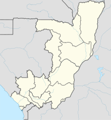
Gamboma Airport (IATA: GMM, ICAO: FCOG) is an airport serving the city of Gamboma in the Plateaux Department of Republic of the Congo. The runway is 5 kilometres (3.1 mi) north of town.
See also
[edit] Republic of the Congo portal
 Aviation portal
- List of airports in the Republic of the Congo
- Transport in the Republic of the Congo
References
[edit]- ^ Airport information for Gamboma Airport at Great Circle Mapper.
- ^ Google Maps - Gamboma
External links
[edit]

