Grand-Santi
Grand-Santi | |
|---|---|
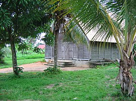
 Church of Grand-Santi | |
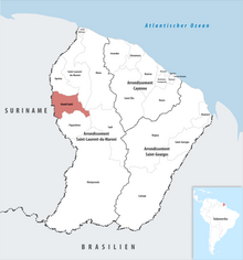
 Location of the commune (in red) within French Guiana | |
| Coordinates: 4°16′26″N 54°22′58″W / 4.2739°N 54.3828°W | |
| Country | France |
| Overseas region and department | French Guiana |
| Arrondissement | Saint-Laurent-du-Maroni |
| Intercommunality | Ouest Guyanais |
| Government | |
| • Mayor (2020–2026) | Felix Dada[1] |
Area 1 | 2,112 km2 (815 sq mi) |
| Population (2022)[2] | 9,390 |
| • Density | 4.4/km2 (12/sq mi) |
| Time zone | UTC−03:00 |
| INSEE/Postal code | 97357 /97340 |
| 1 French Land Register data, which excludes lakes, ponds, glaciers > 1 km2 (0.386 sq mi or 247 acres) and river estuaries. | |
Grand-Santi (French pronunciation: [ɡʁɑ̃ sɑ̃ti]; French Guianese Creole: Gransanti) is a commune of French Guiana, an overseas region and department of France located in South America. Most of the inhabitants are Ndyuka Maroons and Surinamese immigrants.[3]
History
[edit]The commune was originally called Grand-Santi-Papaichton and included the now independent communes of Apatou and Papaichton. On 12 November 1976 Apatou was detached from Grand-Santi-Papaichton and became an independent commune. On 1 January 1993 Papaichton was also detached from Grand-Saint-Papaichton and became an independent commune.[4] On that occasion, the name of the commune was shortened into Grand-Santi.[3] The commune mainly lives from small-scale agriculture and fishing.[5] The commune also contains other villages like Belikampoe.[6]
Population
[edit]| Year | Pop. | ±% p.a. |
|---|---|---|
| 1967 | 723 | — |
| 1974 | 1,041 | +5.35% |
| 1982 | 754 | −3.95% |
| 1990 | 1,786 | +11.38% |
| 1999 | 2,862 | +5.38% |
| 2007 | 3,427 | +2.28% |
| 2012 | 6,029 | +11.96% |
| 2017 | 7,918 | +5.60% |
| 2021 | 9,120 | +3.60% |
| Source: INSEE[7] | ||
Transport
[edit]
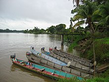
The commune can only be reached by boat or airplane.[3] The Grand-Santi Airport is located 1 km (0.54 NM) northeast of Grand-Santi.[8]
See also
[edit]References
[edit]- ^ "Répertoire national des élus: les maires" (in French). data.gouv.fr, Plateforme ouverte des données publiques françaises. 4 May 2022.
- ^ "Populations de référence 2022" (in French). The National Institute of Statistics and Economic Studies. 19 December 2024.
- ^ a b c "Grand-Santi". Petit Futé (in French). Retrieved 8 June 2020.
- ^ "Parcours La Source". Parc-Amazonien-Guyane (in French). Archived from the original on 31 December 2022. Retrieved 8 June 2020.
- ^ "Grand-Santi: visite de Grand-Santi". Americas-fr (in French). Retrieved 8 June 2020.
- ^ "Carbets de Belikampoe". Guyane Amazonie (in French). Retrieved 26 June 2022.
- ^ Population en historique depuis 1968, INSEE
- ^ SOGS – GRAND SANTI. AIP from French Service d'information aéronautique, effective 23 January 2025.
External links
[edit]- Official site (in French)

